Seasons and Shadows –
http://www.planetary.org/explore/topics/earth/spacecraft.html. Seasons and Shadows – Understanding the tilt, rotation and orbit of the Earth; uneven heating of the atmosphere, effects on seasons, Sun angle and shadows on Earth . Seasons and Shadows –


Seasons and Shadows –
E N D
Presentation Transcript
http://www.planetary.org/explore/topics/earth/spacecraft.htmlhttp://www.planetary.org/explore/topics/earth/spacecraft.html Seasons and Shadows – Understanding the tilt, rotation and orbit of the Earth; uneven heating of the atmosphere, effects on seasons, Sun angle and shadows on Earth
Seasons and Shadows – Understanding the tilt, rotation and orbit of the Earth; uneven heating of the atmosphere, effects on seasons, Sun angle and shadows on Earth Larry Braile, Dept. of Earth and Atmospheric Sciences Jenny Daugherty, Dept. of Technology, Leadership and Innovation Helen McNally, Dept. of Electrical and Computer Engineering Technology Inez Hua, Dept. of Civil Engineering JennifferDickensheets, 5th Grade Teacher, Sunnyside Middle School Pam Stamm, 5th Grade Teacher, Taylor IntermediateSchool Melissa Colonis, 7th Grade Math Teacher, Tecumseh Junior High School
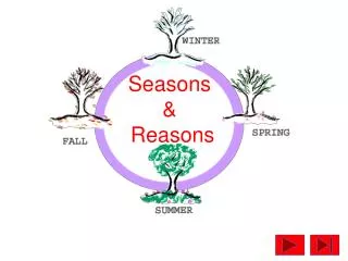
Seasons and Shadows – • Standards Addressed: • Indiana Science Standards: Content specific • 6.2.5 Demonstrate that the seasons in both hemispheres are the result of the inclination of the earth on its axis, which causes changes in sunlight intensity and length of day. • 5.2.2 Observe and use pictures to record how the sun appears to move across the sky in the same general way every day but rises and sets in different places as the seasons change. • K-8 Science Process Standard: The Design Process • As citizens of the constructed world, students will participate in the design process. Students will learn to use materials and tools safely and employ the basic principles of the engineering design process in order to find solutions to problems. • Identify a need or problem to be solved. Brainstorm potential solutions. Select a solution to the need or problem. Create the solution through a prototype. • .
Seasons and Shadows – • Standards Addressed: • Also, Math standards and graphing skills • Lesson Objectives: • Students will be able to: • Explain the tilt, orbit, shape, and motions of the Earth (rotation and revolution) and their relationship to the reasons for the seasons and variable heating of the Earth. • Describe the variations in the length of day throughout the year by graphing the length of day (from sunset to sunrise) for different latitudes. • Design a prototype awning to maximize shade and light throughout the year given a scale diagram and specific dimensions.
Design Activity 1 Seasons and Shadows – Shading a Picnic Table Design Activity 2 Seasons and Shadows – Shade My Space
Science Background – Design a tabletop physical model of the Earth-Sun system to effectively illustrate the tilt of the Earth relative to the plane of the ecliptic, the movements of the Earth (rotation and revolution), and develop an understanding of the effects of these movements on variable heating of the Earth and its atmosphere, length of day, and the reasons for seasons*. * This topic has been well documented to be difficult for students and involves strongly-held misconceptions (http://learner.org/resources/series28.htmlPrivate Universe video).
Learning Objectives/Challenges: Understanding motions of the Earth. Demonstrate that Earth’s axis of rotation (northern pole) currently points to the star Polaris. Illustrate effects of tilt, orbit and spherical shape of Earth on variable heating with latitude and time of year (seasons) and length of day. Address 3-D visualization challenges (very common in most students and with figures in books and on screens) with a 3-D physical model. Engage students by having them manipulate the model.
The Anasazi Indians of the southwestern U.S. (mostly in New Mexico and Colorado) used passive solar concepts about a thousand years ago to design their dwellings.
Introductory Activity: Demonstrate that the Earth’s rotational axis is tilted relative to the plane of the ecliptic and that the axis of rotation (northern pole) currently points to the star Polaris. This fact allows one to determine their latitude in the northern hemisphere from the angle of Polaris above the horizon. Time-lapse animation from Earth (northern hemisphere) showing position of Polaris (“the North star”) and other stars that appear to circle Polaris (actually due to Earth’s rotation) (http://en.wikipedia.org/wiki/Circumpolar_star)
Earth’s axis with its 23 degree tilt (relative to the plane of the ecliptic), the North directed axis points towards Polaris (the North Star in the constellation Ursa Minor), and angle relationships for a location at 40o North latitude and nighttime (~midnight) in the northern hemisphere summer solstice (June 21). The geometry of the Earth’s tilt and the rotational axis pointing to Polaris What would be the angle of Polaris above the horizon if you were standing at the Equator? At the North Pole? In Australia?
Additional illustrations of Earth’s axis of rotation (northern pole) pointing to Polaris. Polaris http://www.flickr.com/photos/juniorvelo/312672130/ Time-lapse (about one hour) photograph from Earth (northern hemisphere) showing position of Polaris (“the North star”) and other stars that appear to circle Polaris (actually due to Earth’s rotation)
Time-lapse (several hours) photograph from Earth (northern hemisphere) showing position of Polaris (“the North star”) and other stars that appear to circle Polaris (actually due to Earth’s rotation) Polaris http://www.wainscoat.com/astronomy/
An effective working model of the Sun-Earth system for “Seasons and Shadows”
Northern hemisphere summer Northern hemisphere winter
Close-up of Earth model – can rotate on its axis (23 degrees tilt) and be positioned at any place inits orbit around the Sun. The latitude lines and map help with orientation, etc.
Illustrating different heating of Earth with variation with latitude (angle of the Sun’s rays)
Design Activity 1 Seasons and Shadows – Shading a Picnic Table Design Activity 2 Seasons and Shadows – Shade My Space
Length of Day data (Sunrise and Sunset times – 24 hr format) (http://aa.usno.navy.mil/data/docs/RS_OneYear.php) and graphing (need to subtract sunrise time from sunset time, then convert to Hours and Decimal Hours to graph): 40 Degrees N, 21st Day of Month (Format = hhmm): Jan: 0805 1754 Feb: 0734 1830 Mar: 0649 1902 Apr: 0601 1933 May: 0527 2002 Jun: 0519 2020 Jul: 0537 2011 Aug: 0606 1935 Sep: 0635 1846 Oct: 0705 1759 Nov: 0741 1727 Dec: 0807 1726 60 Degrees N, 21st Day of Month (Format = hhmm): Jan: 0928 1631 Feb: 0813 1751 Mar: 0648 1904 Apr: 0515 2020 May: 0358 2133 Jun: 0324 2216 Jul: 0403 2144 Aug: 0516 2025 Sep: 0629 1852 Oct: 0741 1723 Nov: 0900 1607 Dec: 0950 1542
Average Monthly Temperature data (http://weatherbase.com/) and graphing: Lafayette, IN, 40 Degrees N, Month (Format = Degrees C): Jan: -4 Feb: -2 Mar: 2 Apr: 9 May: 16 Jun: 20 Jul: 21 Aug: 21 Sep: 18 Oct: 12 Nov: 5 Dec: -2 Anchorage, AK, 60 Degrees N, Month (Format = Degrees C): Jan: -13.9 Feb: -7.9 Mar: 1.6 Apr: 7.2 May: 12.0 Jun: 14.4 Jul: 12.9 Aug: 9.1 Sep: 0.9 Oct: -5.4 Nov: -10.5 Dec: -10.0
Quiz: Length of Day for Earth With No Tilt (Which One?) B A 40o N 40o N Hours 0 12 24 Hours 0 12 24 40o S 40o S Equator Equator 1 2 3 4 5 6 7 8 9 10 11 12 Month 1 2 3 4 5 6 7 8 9 10 11 12 Month C D 40o N 40o S Hours 0 12 24 Hours 0 12 24 40o N 40o S Equator Equator 1 2 3 4 5 6 7 8 9 10 11 12 Month 1 2 3 4 5 6 7 8 9 10 11 12 Month
Quiz: Ave. Monthly Temp. for Earth With No Tilt (Which One?) B A Equator Equator 40o N 40o N Temperature Low High Temperature Low High 40o S 40o S 1 2 3 4 5 6 7 8 9 10 11 12 Month 1 2 3 4 5 6 7 8 9 10 11 12 Month C D 40o N Equator 40o S Temperature Low High Temperature Low High 40o N Equator 40o S 1 2 3 4 5 6 7 8 9 10 11 12 Month 1 2 3 4 5 6 7 8 9 10 11 12 Month
0o Latitude 45o Latitude 60o Latitude