Download
1 / 70
1.14k likes | 2.51k Views
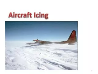
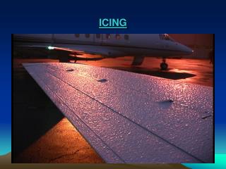
Understanding Aircraft Icing. Nick Czernkovich. Ground Icing. In-Flight Icing. “Aircraft Icing”. Aircraft icing can be broken down into 2 categories: Induction System Icing Structural Icing. Structural Icing. Some General Statistics. 10.8 % of all weather accidents result from icing

E N D
Understanding Aircraft Icing Nick Czernkovich
Ground Icing In-Flight Icing “Aircraft Icing” • Aircraft icing can be broken down into 2 categories: • Induction System Icing • Structural Icing Structural Icing
Some General Statistics • 10.8 % of all weather accidents result from icing • 3 leading factors: • 51.2 % - Carburetor icing • 41.4 % - In-Flight icing • 7.7 % - Ground Icing • PIC average flight time: 1,964 hrs • Average time on type: 306 hrs • Percent Instrument Rated: 71 %
In-Flight Icing Statistics • Cause of approximately 30 fatalities and 14 injuries per year in U.S. • Result of US $96 million per year in personal injury and damage • Between 1978 and 1989, contributed to 298 fatalities in Canada • In 57% of icing accidents pilots had received an icing forecast
Pilot Awareness About Icing • One study concluded the following: • “…pilots do not understand the combined meteorological and aircraft conditions that cause structural ice…” • “[Pilots] have a poor understanding of the concept of collection efficiency that causes smaller parts of the airplane…to collect more ice than larger parts.” • “All of the pilots surveyed have a very poor understanding of the specific effects ice has on the aerodynamics of the aircraft.” (COMET Baseline Needs Assessment)
OUTLINE • Past Studies and Current Research • Physics of Icing Environments • Icing Certification and SLD • Dynamics of Icing • Flight Planning • In-Flight Strategies • NASA Icing Video (Control Anomalies)
Recent Motivation • October 1994 crash of an ATR-72 near Roselawn, Indiana • 1995, 1996/1997, 1997/1998, 1999/2000 – CFDE I/II/III and AIRS (respectively) • AIRS – • Improve ability to remotely sense icing regions • Better characterize icing environments • Improve ability to forecast icing conditions • Obtain measurements of aircraft performance in icing conditions
McGill Vertically Pointing Radar The VPR VPR Data output: Reflectivity in dBZ Velocity in m/s
Physical States (Phases) • Three physical states: • Solid • Liquid • Vapour • Water can exist in the atmosphere in all three phases • Transition between phases takes place all the time, results in “Weather” • Phase changes consume/release latent heat
Phase Changes • Condensation • Evaporation • Freezing • Melting • Sublimation • Deposition
Two Points to Remember • Ice will always melt at 0 C, but liquid water will not necessarily freeze at 0 C • Evaporation, sublimation and deposition need not occur at any specific temperature
Formation of Clouds • Clouds are visible moisture • Can be composed of liquid droplets or ice crystals • Generally form as a result of air being lifted and cooled
A Note on Humidity • Relative Humidity = % saturation • Temperature – Dew Point spread is a measure of RH • Smaller T-Td spread = Higher RH Ok so far? Airmass #1 has T=20C and Td=5C Airmass #2 has T=8C and Td=5C Which has a higher RH? Which contains more water vapour?
A Note on Humidity • Airmass #2 has a higher RH because the T-Td spread is smaller • They both hold the same amount of water vapour • Temperature puts a cap on dew point because T >= Td, ALWAYS • Td is a measure of water vapour available, not T
Warm Cloud Process • Definition: Entire depth of cloud is above 0 C • Expect to find only liquid droplets • Often forms due to: • Frontal lifting • Orographic Lifting • Buoyancy • Convergence • Turbulence
Water begins to condense Phase change Vapour Liquid Lifting Condensation Level RH = 100% Amount of Moisture in parcel remains constant Warm Cloud Process Rising air expands and cools
Warm Cloud Process:Formation of Cloud Droplets • Homogeneous Nucleation not observed Typical cloud droplet size ~10 to 20 microns 1 micron = 1/1000 mm • Heterogeneous Nucleation • Vapour condenses onto tiny particles called CCN • CCN are always abundant in the atmosphere
Warm Cloud Process:Cloud Droplets to Rain • Drops grow by condensation up to 20 microns • After 20 microns collision-coalescence dominates
Warm Cloud Process:Summary • Clouds develop as air is lifted to saturation • CCN become activated • Cloud droplets grow by condensation up to about 20 microns • After 20 microns collision-coalescence dominates • When fall speeds of drops exceed updraft speed in cloud Precipitation
Cold Clouds • Definition: Some or all of the cloud is at or below 0 C • Formed through the same process as warm clouds • Possibility of forming ice particles • Ice particles must form onto aerosols called Freezing Nuclei (FN)
Cold CloudsReality of Freezing Nuclei • Liquid drops being carried above the freezing level Drops must contact an FN to freeze • Direct deposition (vapourice) requires presence of FN • If no FN present liquid droplets form on CCN
Cold CloudsSome points… • FN are functions of temperature • FN become more important as T< -15C • CCT < -15C can glaciate cloud from top down (BUT DON’T EXPECT THIS) • Ice and Liquid can co-exist in equilibrium • Liquid water is possible down to –40C
Inferring Icing Conditions From Precipitation Observations • Snow (SN) • Graupel/Snow Pellets (GS) • Freezing Rain (FZRA) • Ice Pellets (PL) • Freezing Drizzle (FZDZ)
Inferring Icing ConditionsSnow: What you can infer • Likelihood of icing in lowest layer reduced • Liquid Cloud layers above the ice are unlikely • BUT…Rimed snow suggests SLW aloft
Inferring Icing ConditionsSnow: What you CANNOT infer • Only ice exists aloft • No SLW exists aloft • Small amount of SLW exist
Inferring Icing ConditionsGraupel: What you can infer • Formed when snowflakes become heavily rimed • Significant SLW exists aloft
Inferring Icing ConditionsFreezing Rain: What you can infer • Could be formed by classical or non-classical mechanism • Freezing rain exists from the surface up to some level • Dangerous icing conditions likely exist
Inferring Icing ConditionsFreezing Rain: What you CANNOT infer • A warm layer exists aloft • Freezing rain layer is relatively shallow
Inferring Icing ConditionsIce Pellets: What you can infer • A layer of freezing rain or drizzle exists at some level aloft • If a melting layer exists it is likely to be shallow • SLW formed through collision-coalescence can also exist
Inferring Icing ConditionsIce Pellets: What you CANNOT infer • A warm layer exists aloft • Freezing rain/drizzle layer is relatively shallow
Inferring Icing ConditionsFreezing Drizzle: What you can infer • Could be formed by classical or non-classical mechanism • Freezing drizzle exists from the surface up to some level • Collision-coalescence more likely
Observed Properties of CloudsCumulus • Less likely in winter than in summer (but are still observed) • LWC ~ 0.1to3.0 g/m3 • Droplets tend to be larger than in stratus • Vertical extent ~ several km • Horizontal extent ~ 5 kmto10 km • Average lifecycle ~ 30 minto1 hr
Observed Properties of CloudsStratus • More common than cumulus in winter • LWC ~ 0.1 to 0.8 g/m3 • Droplet sizes tend to be smaller than cumulus (NOT ALWAYS THOUGH!) • Vertical extent usually 3000 ft or less • Horizontal extent ~ several hundred km • Highest LWC and largest drops usually at cloud top
Icing in Cloud: Probability • 40 % chance of encountering icing in cloud below 0 C • 14 % chance of encountering icing in cloud below –20 C
Icing in Cloud: What to Expect • 90 % of layered clouds have vertical extents of 3000 ft or less • 90 % of icing encounters last 50 sm or less
17.4 nm 2.6 nm Certification Into Known Icing • Meteorological Conditions Specified in • Canada : CAR 523/525 Appendix C • United States: FAR 23/25 Appendix C
Icing Certification: The Reality • Drop sizes much larger than 50 microns have been found to exist • These are called Supercooled Large Droplets (SLD)
Total Air Temperature vs Static Air Temperature • TAT = SAT + Kinetic Effects • Temperature at stagnation point will be higher than SAT due to local pressure increase • Temperature can vary across wing surface • One Example: • Standard Airfoil • 150 kts TAS • 1.9 C drop across airfoil THE POINT Icing can occur even when temperatures are above 0 C! (Up to ~ +4 C)
Types of Icing • Clear (Glaze) • Rime • Mixed
Types of Icing: Clear Ice • Temperatures (rule of thumb) 0 C to –10 C • Often the result of larger droplets • Droplet impinging on airfoil does not freeze instantly • Latent Heat release + Kinetic Temperature cause part of the droplet to runback • Accumulations can form protrusions that can dramaticallyreduce lift + increase drag • Can be difficult to detect (especially at night)
Types of Icing: Rime Ice • Temperatures • Possibility 0 C to –40 C • Rule of Thumb –15 C to –40 C • Droplets usually smaller • Droplets freeze on impact • Air becomes trapped between frozen droplets • Milky white in appearance • Generally conforms to leading edge
Types of Icing: Mixed • Temperatures (rule of thumb) –10 C to –15 C • Encompasses a continuum between Rime and Clear • Can form protrusions like Clear Ice but more white in colour • Should be treated with the same level of caution
Icing TypesSummary • General Observations: • Clear 0 C to –10 C • Mixed –10 to –15 C • Rime –15 C to –20 C • Typically: • Rime – Stratiform • Clear – Cumuliform • Temperature + Drop SizeIcing Type • LWC + Drop Size Accretion Rate • Airspeed also a factor (Kinetic Heating)
Dynamics of IcingCollection Efficiency of an object • Droplet Size • Object Shape • Airspeed