Download
1 / 17
170 likes | 285 Views
This evaluation explores targeted walking promotion policies in Geneva and their role in enhancing mobility in public spaces. Highlighting the shift from walking as a necessity to a choice, it discusses the integration of walking into daily agendas and the importance of planning effective walking routes. By addressing challenges such as representations and accessibility, the initiative aims to create inviting pedestrian environments. Lessons learned emphasize the need for community involvement in route design, promoting safety, attractivity, and sociability in urban settings.

E N D
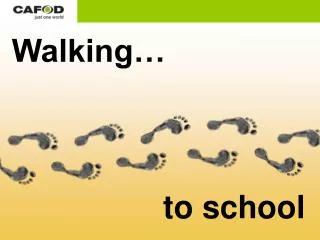
Evaluating walking promotion policies With regard to mobility representations, appropriations and practices in public space Sonia Lavadinho Observatory of Mobility mobile 076 582 62 62 sonia.lavadinho@geo.unige.ch www.unige.ch/ses/geo/oum
Why are we talking instead of just walking ? • Today we walk out of choice, not out of necessity • Mobility for all means mobility for none • Targeted promotion policies can only work if walking is made to fit in complex daily agendas • Planning walking routes can be an effective tool to promote walking practices, provided some challenges are met regarding walking representations • How do we know it’s working ? People actually walk there !
challenges Representations Practices accessibility continuity attractivity daily needs proximity multifonctionnality land mix sociability belonging identity Appropriations
Aims Demand-oriented evaluation Give • elements for a targeted promotion policy in adequacy with user profile Find out • walkers’ motives and practices • how walking gets inserted in daily agendas • which walking routes work and why some don’t • how walking promotion campaigns are perceived • where to disseminate information on walking
The pedestrian masterplan Started in 1995, adopted by the Grand Council of Geneva in 2001 and the State Council of Geneva in 2004 Legal framework • Law on the application of the federal law on routes for pedestrians and routes for hiking, L 1 60 (1998) Sustainable development framework • Rio Conference (1992) • Aalborg Charter (1994) • Local Agenda 21 (1995)
Ch. 1 Encouraging walking lay out walking routes promote a network connected to the suburbs
Ch. 2Enhancing places within districts extend pedestrian facilities at the foot of the old city and on the right bank lay out emblematic squares and playgrounds in existing districts and in new areas enhance other areas by connecting small public areas currently used for other purposes (pocket gardens)
Ch. 3Facilitating pedestrian movements redefine priorities at crossroads highlight shopping streets create safe routes for children and the elderly highlight parks entrances
Ch. 4Eliminating obstacles to pedestrians remove localised obstacles (function, topography or real estate) create a dense, continuous pedestrian mesh
Ch. 5Moderating traffic within districts • within districts, use the whole range of moderation measures (30 km zone, residential street, one-way streets, etc.) • on the main network, reinforce safety on heavy traffic roads, namely crossings
The walking routes • From estate to estate • From site to museum • From quay to runway • From city to city • Walking downstream • From here and afar • From body to heart • From history to modernity • From cedar to cedar
Station 4 – Budé Station 3 – Pl. du Petit-Saconnex Station 2 – Promenade des Crêts Station 1 – Parc des Franchises From history to modernity
Station 8 - BFM Station 7 – CFF St-Jean Station 6 – Pointe de la Jonction Station 5 – Bois de la Bâtie Walking downstream
Station 12 – Gare des Eaux-Vives Station11 – Parc des Contamines Station 10 – Plateau de Champel Station 9 – Pont de la Fontenette / Parc Noie-tes-Puces From city to city
The ideal walking route • homogeneous (structure & texture) • accessible (entry & exit points) • continuous (mental & physical, in time as much as in space) • connected (PT interfaces, distance from center) • readable (anchoring, landmarks, orientation, history) • attractive (equipments & urban furniture)
The real walking route Within districts • Peripherical location • Organised around secondary poles • Daily places & activities • Ordinary landscapes • Implicit heritage landmarks
Lessons learned • Requalifying nature, water, land & urbanscapes FACILITATES the emerging of new walking representations and practices • Offering additional room for other activities and furnishing public spaces ENHANCES attractivity, security and accessibility • Sharing stories HELPS togethering in public space • Walkers PLAY an important part in producing walking routes Before we start building walk-friendly routes, we should start learning how to design walk-friendly minds