Download
1 / 23
240 likes | 417 Views
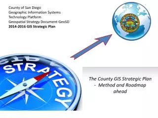
County of San Diego Geographic Information Systems Technology Platform Geospatial Strategy Document- GeoSD 2014-2016 GIS Strategic Plan. The County GIS Strategic Plan - Method and Roadmap ahead. COSD GIS Strategic Plan Methods. Background Justification and how we did it. Why we did it.

E N D
County of San Diego Geographic Information Systems Technology Platform Geospatial Strategy Document-GeoSD 2014-2016 GIS Strategic Plan The County GIS Strategic Plan - Method and Roadmap ahead
COSD GIS Strategic Plan Methods Background Justification and how we did it
Why we did it • Geospatial technologies are growing rapidly - amazing and dramatic changes in applications are now possible in government services • “The where” of things now matters at an enterprise scale • Strategic planning is necessary for effective management Information Technologies (IT) implementation
What we wanted • To review our current and future Geospatial technology use and develop a roadmap for our enterprise GIS platform and people • Build it as a reusable tool for San Diego County’s GIS Vision, Mission, and Goals • Realign the County GIS functions and SanGIS Land base to better support service delivery
COSD GIS Strategic Plan Methods Vision Highlight - What Was Before
COSD GIS Strategic Plan Methods Vision Highlight – The Strategic Planning Cascade After
Detailed Summary This is a living document Who was involved? A group of County executives formed the Executive Committee. A group of GIS Users and Experts wrote the plan as the Steering Committee. Which and how many staff were involved? The effort employed staff from HP and a professional facilitator. Approximately 12 people. What did we produce? A usable planning document that will evaluate the current major GIS projects in the County and the Current resources available to accomplish them.
More Facts What is the immediate benefit? Current projects that will require GIS resources and coordination will be considered on a whole in relation to the County’s overall needs. Gaps will be bridged. How long did it take? About 3.5 months were planned for the entire process – October was our deadline from County leadership to have the draft Funding needs? The effort was funded by the LUEG Exec office and the plan will be maintained long term by COSD GIS Manager.
Committee Participants and Jobs • Executive Committee ( alphabetic order ) • Sarah Aghassi • Ernest Dronenburg • Mikel Haas • Ashish Kakkad • Ron Lane • Nick Macchione Steering Committee • Regional Entities/Pro groups • SANDAG • SanGIS Was required to collect and vet content and process it into the strategic plan • SDRGC • ESRI • Operational Users • GIS Subject Matter Experts Were required to research concepts and ideas of current and future operational uses of GIS Were required to research the potential concepts and strategies using specific GIS technology
COSD GIS Strategic Plan MethodsPLANApproach How did we do this? • Collaborative, Concentrated, Strategic Workshops • A Facilitator • Simplicity • Vision, Mission - Objectives Driven focused on GIS as a strategic platform – We created a simple and useable document • NOW?, WHERE?, HOW? method
Here we are today Now what? 1-7-36
Summary of Plan • Help the County accomplish its strategic goals • Make it easier • Save money
One Vision • GIS is a strategic platform around which County staff support the County’s three strategic initiatives: Safe Communities * Sustainable Environments * Healthy Families To support these initiatives, we must: Guide the increase, effectiveness, innovation, reliability, accuracy, and value of geospatial information and tools; while lowering costs for the organization as a whole.
Many Missions From the County’s vision, it has built a list of mutually desired guiding principles, or design maxims. Here it seeks to: • Develop mutually accepted standards, policies, and business practices; and to make them self-referential, easily understood, and supported. • Communicate the value of GIS to County departments and agencies. When good things happen, tell people and popularize the success stories and allow others to leverage the knowledge. • Encourage collaborative GIS efforts among County, external government, and related organizations. Collaboration is one of the things that makes the County of San Diego great. • Ensure that GIS resources are available for day-to-day operations: look for high availability IT design approaches that are both robust and flexible; and to focus on the core business practice of GIS - not fixing the GIS as the core practice. • Maximize the cost-effectiveness of GIS investments. Use functional threading and economies of scale to build partnerships within region. • Cultivate the advanced use of GIS. County staff must not only stay current, they must also remain well-read and agile. Not all technological avenues produce fruit forever. • Pursue the innovative use of GIS and related technologies. Look for research on practical applications and use pilot studies with the technology. Move technology quickly into practical tests. • Integrate GIS technologies into County business operations. Where it is appropriate and timely, use it! Don’t fear change; look for obvious returns on investments. • Support emergency and disaster planning, response, and recovery. If there is one thing that must be done right, it is to help people when they need it most.
Seven Goals • Create, collect, maintain, and distribute high quality, up-to-date, and complete geospatial data • Ensure that the County’s GIS systems and data are available for day-to-day County/regional purposes • Share the County’s GIS data and services as widely as possible • Cultivate the advanced analytical use of GIS • Raise the awareness of GIS • Assist agencies to integrate spatial technology into their business processes and applications. • Support emergency planning, response, and recovery
Thirty Six Objectives (By goals) • 2-6 (creating self-service mapping infrastructure) or 3-2 (online web mapping & query) • 4-2 (or 4-6) access to internal expert or outside training at various levels of expertise • 6-3 (core GIS support staff to support GIS services)
The 36 - Continued • Medium - Adopt a County of San Diego address standard and document the address correction life-cycle (Goal 1) • Short - Develop a plan for resuming the previous user group meetings on a regular basis • Long - Take ownership and the responsibility of day forward updates of the parcel layer (which currently resides with SanGIS) (Goal 2 and 6).
Maintain a 2 year discipline clock Year 2 Year 0 Year 1
“We have a strategic plan…. It’s called doing things.”-Herb KelleherDone Done and DoneThank you