Download
1 / 21
210 likes | 542 Views
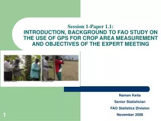
Session 1-Paper 1.1: INTRODUCTION, BACKGROUND TO FAO STUDY ON THE USE OF GPS FOR CROP AREA MEASUREMENT AND OBJECTIVES OF THE EXPERT MEETING. Naman Keita Senior Statistician FAO Statistics Division November 2008. PRESENTATION OUTLINE. INTRODUCTION

E N D
Session 1-Paper 1.1: INTRODUCTION, BACKGROUND TO FAO STUDY ON THE USE OF GPS FOR CROP AREA MEASUREMENT AND OBJECTIVES OF THE EXPERT MEETING Naman Keita Senior Statistician FAO Statistics Division November 2008
PRESENTATION OUTLINE • INTRODUCTION • BACKGROUND AND BRIEF OVERVIEW OF CROP AREA ESTIMATION METHODS • NEED FOR A STUDY ON THE USE OF GPS FOR CROP AREA MEASUREMENT • PURPOSE AND OUTCOME EXPECTED FROM THE CURRENT MEETING • WAY FORWARD • ANNEXES
INTRODUCTION • Reliable estimates of crop area, yield and production are an important requirement of any country agricultural statistics system • They are among any minimum set of key indicators for planning, monitoring and evaluation of agricultural and rural development programmes • These data are used for a variety of policy issues, including: • The determination of cultivation plans at national level (crop diversification) • The elaboration and implementation of import and export policies of agricultural commodities and international trade negotiations • The formulation of price policies (subsidies and incentives) • The zoning or regionalisation of crop production according to the nature of the soil, the level of the yield etc.. • The establishment of a system for equitable distribution of crop production over different regions of the country • The estimation of the contribution of agriculture to the gross domestic product and measuring the level of agriculture productivity • The establishment of food balance sheet and other food security indicators
INTRODUCTION • Crop production is usually derived from its two components; area harvested and yields per unit area. • In situations where the crop is entirely marketed or where the cultivation is limited to limited number of large estates, reliable estimates may be obtained through marketing channels or directly from producers. • In the context of small subsistence farming however, with crops grown by millions of farmers in scattered holdings, it is almost impossible a complete enumeration of their annual production. • A practical approach to measurement of production “P’ of such crops is to consider the two components of total production of a crop, namely the area “A” under the crop and the yield “Y” per unit area and estimate separately each of them. • The product of the two estimates then gives the total output of the crop: P = A x Y
BACKGROUND AND OVERVIEW OF CROP AREA ESTIMATION METHODS • Regarding estimation of crop area, FAO publication (1982) Estimation of crop areas and yields in agricultural statistics provides a detailed review of various sources that are being used by countries: • Reporting system (locality-wise or holding-wise) • Enumeration by interview (complete or sample) • Measurements • Regarding the measurement of crop area, the following methods are reviewed: • Methods based on mapping material: area sampling, grid/point sampling, remote sensing • Land surveying methods: measuring parcels and fields,
BACKGROUND AND OVERVIEW OF CROP AREA ESTIMATION METHODS Crop area determination on the basis of land measurement • The assessment of the surveying instruments and methods in the 80’s classified them in two categories: • Measuring distances: pacing, standardised cords, surveyor’s chain, and others (Trumeter, Smith Wheel, Optical Range finder etc..) • Measuring angles: pantometer, compasses, clisimeter or clinometer in presence of slopes.
BACKGROUND AND OVERVIEW OF CROP AREA ESTIMATION METHODS Crop area determination on the basis of land measurement Two groups of methods were used: • Group 1: the primary data (distance and angle) is used to produce a sketch of the plot at a given scale, the area of which is measured or calculated and converted to actual crop area. Several techniques were used: Planimeter, Topochaix, others such as triangulation, weighting, etc • Group 2: the primary data are used directly to produce plot area. This second group became a standard with the technological breakthrough of the apparition of handheld/pocket programmable calculators and their low cost. They allowed the calculation of crop area in the field by inputting directly the distances and angles.
BACKGROUND AND OVERVIEW OF CROP AREA ESTIMATION METHODS Crop area determination on the basis of land measurement • For Group 2 method, FAO has developed several programmes for different models of programmable calculators which, in addition to the estimates of area, also provide an estimate of closing error. • This standard method of crop area measurement (compass, tapes and calculator) still widely used in most African countries was a considerable advance in the mid 80’s in agricultural surveys using land surveying methods. • Currently, with the new technological advances, it appears important for FAO to revisit past methods and prepare a review of the state of the art in terms of crop area measurement and reference document on the use of the new devices.
BACKGROUND AND OVERVIEW OF CROP AREA ESTIMATION METHODS Crop area determination on the basis of map based methods (area frame, aerial photos, satellite images etc..) • It should be noted that an increasing number of countries are interested or using the methods based on mapping material since the resolution of images is becoming higher with substantial reduction in their cost and with also availability of powerful computer systems which can assist in the map based methods. • FAO has produced in the mid-90’s two complementary publications on the area frame sampling which can be used as reference for this technique: Multiple frame agricultural surveys Volume 1 and Volume 2. • Regarding the use of satellite images for estimation of crop area, substantial advances are being made and this is a domain which needs a consolidated technical documentation on the state of the art and guidelines for practical application in countries
NEED FOR A STUDY ON USE OF GPS IN AGRICULTURAL SURVEYS • Most African countries still use land surveying methods in their agricultural surveys for crop area measurement and the typical instrument is the compass, tape and calculator. • The Global Positioning System (GPS) provides directly the crop area without a need of cumbersome distance and angle measurement. • Agricultural statisticians in Africa through the biennial meetings of the African Commission on Agricultural Statistics requested to FAO to conduct a study on the use of this instrument as an alternative to the traditional compass method. • The 19th Session of AFCAS in 2005 in Maputo, Mozambique recommended that FAO: • undertake a study on the use of GPS in agricultural surveys for crop area measurement • organise an international technical meeting to review and validate the results of the study • prepare on the basis of the study and the expert meeting a technical reference document on the use of GPS in agricultural statistics
NEED FOR A STUDY ON USE OF GPS IN AGRICULTURAL SURVEYS • Following AFCAS meeting and with funding provided by project GCP/INT/903/FRA, FAO implemented these recommendations in the following steps: • Document review of GPS technology, experiences in its use for crop area measurement • Design and implementation of a comparative field study in four countries: Cameroon, Madagascar, Niger and Senegal. The studies compared the use of various types of GPS to the traditional method using compasses, tapes and calculators in various conditions and for various parameters • Compilation and preliminary analysis of the results (two analysis were conducted respectively by FAO consultants and staff) • A consolidated report including additional analysis was prepared by another FAO. This report summarises the main findings from FAO studies • Organisation of this expert meeting to compare findings validate some conclusions and discuss way forward for preparation of the technical document (handbook/manual, etc) on the use of GPS in agricultural surveys
PURPOSE AND OUTCOME EXPECTED FROM THE CURRENT MEETING • The ultimate goal of the meeting is to come up with expert agreement on conclusions and recommendations as a basis for FAO, in partnership with other institutions, to prepare a handbook/manual on the use of GPS in agricultural surveys/censuses. • It is expected that the technical presentations and discussions on the findings from various studies will provide responses to some of the following questions: • Q1: How precise can be the measure of crop area given by GPS receiver as compared to the true area? • Q2: Does the type of GPS have an impact on the accuracy? • Q3: How stable is the measurement of area with GPS? does the repetition of measurements improve the accuracy? • Q4: Is there a link between accuracy of measurement with GPS and plot size? Is there a cut-off point? • Q5: How faster is it to measure crop area with GPS? • Q6: What other uses can be made of the GPS to improve agricultural surveys?
WAY FORWARD It is also expected that this expert meeting will produce a preliminary outline of the handbook/manual on the use of GPS in agricultural surveys, including: • coverage • content • roadmap for its preparation: • What? • How (technical inter-institutional working group)? • When by October 2008 (for 21st AFCAS in Arusha, Tanzania or Benin)?
PROPOSALS FOR DISCUSSION(TWO ALTENATIVE PROPOSAL FOR A PRELIMINARY OUTLINE OF PUBLICATION) Title 1: USE OF GPS IN AGRICULTURAL CENSUSES AND SURVEYS • Foreword • Acknowledgements • CHAPTER 1: Introduction • CHAPTER 2: Review of various methods of crop area measurement • CHAPTER 3: Use of GPS for cop area measurement in the context of land survey methods • CHAPTER 4: Use of GPS for geo-referencing data collection units • CHAPTER 5: Linkages with spatial information and GIS • APPENDIXES • Detailed technical instructions for use of various types of GPS for crop area measurement • Case studies/comparative studies in the use of GPS for crop area measurement • Case studies in the use of GPS for geo-referencing data collection units • Case studies for linkages with spatial information and GIS
PROPOSALS FOR DISCUSSION(TWO ALTENATIVE PROPOSAL FOR A PRELIMINARY OUTLINE OF PUBLICATION) Title 2: ADVANCED DATA COLLECTION METHODS IN AGRICULTURAL CENSUSES AND SURVEYS- Use of GPS and PDAs in agricultural censuses and surveys • Foreword • Acknowledgements • CHAPTER 1: Introduction • CHAPTER 2: Review of various methods of crop area measurement • CHAPTER 3: Use of GPS for cop area measurement in the context of land survey methods • CHAPTER 4: Use of GPS for geo-referencing data collection units • CHAPTER 5: Linkages with spatial information and GIS • CHAPTER 6: use of PDAs in agricultural statistics • APPENDIXES • Detailed technical instructions for use of various types of GPS for crop area measurement • Detailed technical instructions for use of PDAs for data collection • Case studies/comparative studies in the use of GPS for crop area measurement • Case studies in the use of GPS for geo-referencing data collection units • Case studies for linkages with spatial information and GIS • Case studies for use of PDAs