Download
1 / 9
90 likes | 217 Views
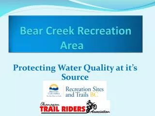
Bear Creek Recreation Site Information and Resources. Bear Creek Water Advisory Committee Meeting District of West Kelowna April 21, 2010. Information and Materials for Bear Creek Recreation Site. Context

E N D
Bear Creek Recreation Site Information and Resources Bear Creek Water Advisory Committee Meeting District of West Kelowna April 21, 2010
Information and Materials for Bear Creek Recreation Site Context • Unmanaged and dispersed motorized use is a predominant and pressing issue throughout British Columbia • Comprehensive management of ORV’ s is a new step in BC although it is more than 20 years old in the U.S. • Planning and implementation information must be effective and efficient for operationalization by MTCA. • Information should be compiled to meet the needs of agencies (IHA, MOE etc.) and stakeholders as well as serve the needs of MTCA. • Spending on Bear Creek since 2007 exceeds the total annual field operations budget for MTCA Recreation Sites and Trails (1339 recreation sites and 8000 km of trails).
Bear Creek Planning Model Process, Practice and Results • Success at Bear Creek will depend on planning and implementation that follows an established process based on: • Best Management Practices; • Established and accepted guidelines for the Bear Creek Recreation Site; • Industry/ practice standards; • Existing legislation, regulations, policy; • Agency planning frameworks (RMCP); and • Evaluated results • MTCA’s Operating Plan, Concept Mapping, Resource Mapping, numerous assessments, reports and reliance on professionals provides a process and practice based approach with the greatest chance of success.
Information Overview • GIS Mapping • Bear Creek Zone Map • Bear Creek OHV Concept Map • Terrain Sediment Delivery Map • Terrain Slope Stability Map • Water Crossings Map • Other Resource Layer Maps (ESA’s, Wildlife, Fish, Range, Timber) • Monitoring Plan • Inspection and monitoring frequency, method, responsibility and reporting • Operating Plan • OHV Program Management • Road Management Objectives • Trail Management Objectives and Actions • Trail Location and Design • Facility Management Objectives and Actions • Signage • Barriers • Rehabilitation • Trail Patrol Handbook • Outlines requirements, expectations, standards and procedures for volunteer trail patrols. • 2010 Program of Work • Outlines proposed work program including trail construction and rehabilitation for 2010 field season. • Reports, Assessments and Other Information • Sediment Source Survey - GeoStream Environmental Consulting • Sediment Monitoring Plan - GeoStream Environmental Consulting • Bald Range Creek Water Quality Analysis – Summit Environmental • 2009 Bear Creek Recreation Site Annual Report – RecConnect • Bald Range Creek Crossing Riparian Mitigation Plan – ForFish Consulting • Bear Creek Recreation Site 2009 OHV Trail System Map -MTCA
GIS Mapping* • Zone Plan • Classification of recreation site into areas of trail and infrastructure intensity. • Staging areas; high density trail areas; no trail and corridor access only. • Concept Plan • Watershed boundaries, contours, proposed trails, staging areas, constructed fencing, trails to be deactivated, water courses • Terrain Sediment • Risk of sedimentation; proposed trails, trails to be deactivated • Terrain Stability • Risk of terrain stability; proposed trails, trails to be deactivated • Water Crossings • Water courses, proposed trails, trails to be deactivated • Other Resource Mapping • ESA’s, Fish, Wildlife, Range, Tenure • IHA- Clarification – July 22, 2009 • Community watershed outlines • Land Contours • Elevations • Available information on existing trails • Staging areas • Proposed trails • Planned structures including culverts and Bridges • Existing roads • Streams and riparian areas • Surface drainage patterns • Terrain stability * All maps continue to be available on publicly accessible ftp site.
Operating Plan Provides guidance for the planning, development and implementation of a sustainable motorized trail system in the Bear Creek Recreation Site IHA- Clarification* – July 22, 2009 • Plans for trail construction where network crosses slopes with high risk of sediment delivery • Plans for trail construction where trails intersect streams or other water bodies • Rider education materials • Rider dispersion strategies • Spill containment and notification • Enforcement Strategies • Trail closure strategies for unapproved trails • Rehabilitation plans for riparian / stream or slope damage *(Concept and Operating Plan) • Implementation • Private Lands, ROW, & Utilities • OHV Program Management • Road Management Objectives and Actions • Trail Management Objectives and Actions* • Trail Location and Design* • Facility Management Objectives and Actions* • Signing • Barriers • Rehabilitation • Appendices • Sample Trail Management Objective • Design Guidelines • Safety and Education Plan • LRMP Direction • Advisory Committee Terms of Reference • List of Interests/Concerns • Reference Index by Resource • Responses to Comments * Note revisions to trail and facility sections providing clarification for MTCA procedures related to areas with high stability risk or sediment delivery potential including MOE review and consensus planning.
Monitoring Plan Specifies category, frequency, method, responsibility, and reporting structure for 35 categories • Social • Level of use, • conflict, • sanitation etc. • Management • Designated/ closed trail compliance, • hill climbing, • noise restriction compliance etc. • Physical • Trail maintenance/ condition, • facility maintenance, • bridge / fence/ structure maintenance etc. • Biological • Impacts to water quality, • invasive/noxious weeds, • wildlife encounters etc. • IHA- Clarification – July 22, 2009 • Frequency of physical trail inspections • Mapping of trails monitored • Inspection of creek crossings, fencing and signage • Reporting Structure for non-approved trails • Inspection Methods: • Trail Patrol • Website Feedback • User Survey • Citations • Direct Feedback • Interagency / Interest Holder Communications
Reports Assessments and Other Information Reliance on Professional Expertise • Sediment Source Review - GeoStream Environmental Consulting • Review of sediment sources in lower Bald Range Creek and proposed bridge crossing location. • Proposed sediment monitoring plan considerations • Sediment Monitoring Plan Proposal - GeoStream Environmental Consulting • Proposed Bald Range Creek sediment monitoring plan to quantify the amount of sediment generated from old trails and newly constructed trails, particularly in the vicinity of the old “sand hill” trail and upper pits mass wasting area. • Bald Range Creek 2009 Water Quality Analysis Report – Summit Environmental • Expand understanding of water quality conditions in BRC and linkages to recreation activities. • Review previous water quality reports. • Obtain and analyze water samples for f. coliform bacteria, E. coli, suspended sediments, nutrients and routine water quality variables.
Reports Assessments and Other Information • Bald Range Creek Crossing Riparian Mitigation Plan – ForFish Consulting • Focused mitigation strategies for planning and construction of Bald Range Creek Bridge Crossing and approach trails. • Bear Creek Recreation Site Trail Ranger Handbook – RecConnect Consulting • Outlines requirements, expectations, standards and procedures for volunteer trail patrols. • 2009 Bear Creek Recreation Site Annual Report – RecConnect Consulting • Summary of works completed at Bear Creek Recreation Site in 2009 • Identification of priorities for MTCA and OTRA for 2010 • Bear Creek Recreation Site 2009 OHV Trail System Map –MTCA • Map indicating designated trails and routes in Bear Creek Recreation Site • Extensive rider etiquette, area information, expectations of users, resource education and information, sign explanations and overall management awareness.