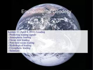
Environmental Geodesy
Environmental Geodesy. Lecture 3 (February 1, 2011): Earth's Shape - Earth's mean shape - Endogenic processes and Earth's shape - Exogenic processes and Earth's shape - Oceans, hydrosphere and cryosphere and Earth's shape. Earth's Mean Shape.

Environmental Geodesy
E N D
Presentation Transcript
Environmental Geodesy Lecture 3 (February 1, 2011): Earth's Shape - Earth's mean shape - Endogenic processes and Earth's shape - Exogenic processes and Earth's shape - Oceans, hydrosphere and cryosphere and Earth's shape
Earth's Mean Shape The meaning of the terms "figure of the Earth" and "shape of the Earth" depends on context, e.g. (1) topography of the solid Earth; (2) surface of solid Earth including oceans, terrestrial hydrosphere and cryosphere. ETOPO1 Global Relief Model ETOPO1 includes ocean bottom topography and ice mass surfaces, i.e., it is in between (1) and (2).
Earth's Mean Shape The meaning of the terms "figure of the Earth" and "shape of the Earth" depends on context, e.g. (1) topography of the solid Earth; (2) surface of solid Earth including oceans, terrestrial hydrosphere and cryosphere. (2) is the surface on which most geodetic in situ measurements are carried out (2) is too complex for mathematical descriptions of characteristics of the solid Earth or the Earth system Soffel (1989) describes four different phases related to the view of the Earth's shape and dynamics and the main target of research (see Lecture 1).
Earth's Mean Shape Four different phases of geodesy related to the view of the Earth's shape and dynamics and the main targets of research. A: From 200 BC up to the middle of the 17th century: the radius of a spherical Earth; simple geometrical form. B: From the middle of the 17th century to the middle of the 19th century: the oblateness of a rotational ellipsoid; geometrical form resulting from rotational dynamics. C: From the middle of the 19th century to the middle of the 20th century: the geoid; gravitational field in addition to a purely geometrical form. D: Since the middle of the 20th century: dynamics of the Earth's surface and relativistic models of the Earth system; changes in the shape instead of mean shape; dynamical instead of static view.
Earth's Mean Shape B: From the middle of the 17th century to the middle of the 19th century: the oblateness of a rotational ellipsoid; geometrical form resulting from rotational dynamics. Rotational ellipsoid is uniquely defined by two numbers: - two dimensions (i.e., two axes), - one dimension (axis0 and a number representing the difference between the two dimensions.
Earth's Mean Shape B: From the middle of the 17th century to the middle of the 19th century: the oblateness of a rotational ellipsoid; geometrical form resulting from rotational dynamics. Rotational ellipsoid is uniquely defined by two numbers: - two dimensions (i.e., two axes), - one dimension (axis0 and a number representing the difference between the two dimensions. Geodesists, by convention, use the semimajor axis and flattening: - Size of ellipsoid: radius a at the equator; i.e. semimajor axis of the cross-sectional ellipse - Shape of the ellipsoid: flattening f, which indicates how much the ellipsoid departs from spherical. Long sequence of attempts to determine accurate values for a and f.
Earth's Mean Shape A key open question relates to rotational ellipsoid: - Is the rotational figure of the Earth in hydrostatic equilibrium? Rotation of the Earth is decreasing (LOD increasing) over time (due to tidal friction): LLR: +2.3 ms/cy (cy=century) Historical record of eclipses: +1.70 ± 0.05 ms/cy This indicates a quadratic term: +31 s/cy² As a result, oblateness should be decreasing, depending on the viscoelastic response of the Earth to the changing gravitational potential . SLR: Question relates to the "Love Number" k2 (will be explained later), which is relevant for many secular geodynamic problems
Earth's Mean Shape Topography deviates from reference ellipsoid by +8848 m and -10,911 m - deviations are small (only 0.17% of the radius) - deviations are relevant for many practical applications Sea level - adjusts to gravitation field, not geometry; - it follows a equipotential surface of the gravitational potential, if undisturbed by tides, winds, currents, ... Geoid is a equipotential surface of Earth's gravitational potential (including both gravitational and centrifugal forces). Geoid deviates from reference ellipsoid by about -110 m and +85 m.
Earth's Mean Shape Geoid deviates from reference ellipsoid by about -110 m and +85 m.
Earth's Mean Shape Reigber et al. (2005). Improvement of the Earth’s gravity field models. From top left to bottom right: GRIM-5S1: SLR data only (best gravity field model before CHAMP and GRACE); EIGEN-CHAMP03S: Gravity field from CHAMP; EIGEN-GRACE03S: Gravity field from GRACE; EIGEN-CG03C: Gravity field from GRACE combined with terrestrial data.
Earth's Mean Shape After removing tides, waves, atmospheric forcing (including surges), sea level can deviate up to 2 m from the geoid. "Mean" dynamic sea surface topography due to influences of ocean circulation, ocean temperature, salinity. Accurate "static' geoid required for determination of mean dynamic sea surface topography, which is required for ocean circulation and climate models. Currently, most accurate static geoid from the Gravity Recovery and Climate Experiment (GRACE). GRACE is particularly strong in measuring geoid variations at sub-monthly time scales and down to 300 km spatial scales (see Lecture 4). Significant improvements of static geoid expected from the Gravity field and steady-state Ocean Circulation Explorer (GOCE) .
Earth's Mean Shape Significant improvements expected from the Gravity field and steady-state Ocean Circulation Explorer (GOCE). Launched on 17 March 2009.
Earth's Mean Shape 1. Ocean 2. Ellipsoid 3. Local plumb 4. Continent 5. Geoid Relation of the various surfaces used in geodesy
Endogenic Processes Endogenic processes change the Earth shape on time scales from seconds to million of years
Endogenic Processes Earthquakes cause significant 3-d deformations within seconds to minutes
Endogenic Processes A 2.3 m coseismic displacement has distorted the railroad track near the railway station Tepetarla in the region between Sapanca Lake and Izmir Gulf, Turkey (www.geopages.co.uk/news/rev002.html).
Endogenic Processes Earthquakes cause significant "static"/permanent 3-d deformations within seconds to minutes. Predicted coseismic displacement field of the Sumatra-Andaman 2004 earthquake.
Endogenic Processes GPS observes the static, co-seismic offset Large tsunamis are associated with loading signals on the order of 10 mm Observed coseismic displacement field of the Sumatra-Andaman 2004 earthquake.
Endogenic Processes April 4, 2010 Mayor-Cucapah M 7.2 earthquake Seismic waves have amplitudes of several > 100 mm in large distances from the epicenter
Endogenic Processes Displacement field of Hector Mine earthquake observed with InSAR G. Peltzer, UCLA
Endogenic Processes More on earthquakes; goal to give an impression of the changes in earth shape ...
Endogenic Processes Seismic Free Oscillations of the Earth deform the earth with periods from 53 minutes down to seconds and can last for several days. Theoretical representation through spherical harmonics. http://icb.u-bourgogne.fr/Nano/MANAPI/saviot/terre/index.en.html
Endogenic Processes Seismic Free Oscillations of the Earth deform the earth with periods from 53 minutes down to seconds Theoretical representation through spherical harmonics. http://icb.u-bourgogne.fr/Nano/MANAPI/saviot/terre/index.en.html
Endogenic Processes More on post-seismic deformations
Endogenic Processes Subsurface processes associated with volcanoes and magma transport induce local to regional changes in shape. InSAR (ERS) has revealed that four Andean volcanoes thought to be inactive, are now known to be rapidly deforming. Each color cycle corresponds to 5 cm of deformation. The top three volcanoes are inflating and Robledo is deflating (Pritchard & Simons, 2002).
Endogenic Processes Plate tectonics induce secular changes in shape on the order of 10 cm/yr horizontally
Endogenic Processes Secular changes
Endogenic Processes Secular strain rates caused by plate tectonics and plate boundary processes Kreemer et al. (2003)
Exogenic Processes Exogenic variations in Earth's shape include: - Tides of the solid Earth caused by the tidal potential of moon, sun, and planets (see Lecture 4); - Rotational perturbations caused by exchange of momentum between core and mantle, angular momentum exchange with atmosphere and ocean, external torque caused by tidal forces, ... (see Lecture 5); - surface loading due to mass relocation on the Earth's surface.
Exogenic Processes Surface loading due to mass relocation on the Earth's surface include: - mass redistribution in atmosphere: low/high pressure areas; - mass relocation in the ocean: tsunamis, tides, storm surges, wind-driven circulation, other circulation; - redistribution of water stored on land; - mass changes in land-based glaciers, ice caps and ice sheets; - mass exchange between any of these reservoirs in the global water cycle; - sediment transport and deposition; - anthropogenic mass relocation (coal mining, oil mining, groundwater mining, ...) Loading - deforms the solid Earth, - changes the gravity field (both due to the surface mass relocation and the deformation of the solid Earth) and - impacts Earth rotation.
Exogenic Processes Response of solid Earth has an elastic (instantaneous) and viscous (delayed) contribution. Elastic response dominate for loading at sub-seasonal to interannual time scales (e.g., tides, seasonal cycle); Viscous contribution important for interannual to secular time scales (e.g. coal mining, postglacial rebound). Elastic deformations range from up to 20 mm for atmospheric loading, 50 mm associated with ocean loading (tides and surges); Visco-elastic deformations range from sub-mm/yr for hydrologic changes (droughts), 1 mm/yr in coal mining areas, several mm/yr for recent ice load changes, more than 50 mm/yr during major deglaciation periods. Post-mass relocation deformations are triggered by surface loads but then dominated by endogenic processes. More details on this during subsequent lectures.
Oceans, Cryosphere, and Terrestrial Hydrosphere Oceans: - Time-variable surface, both as spatial average and locally - global sea level variations caused by mass exchange with other reservoirs and changes in heat contents, - variability on a wide range of spatial and temporal scales Ice surfaces: - Time-variable surface height and extent; - large variations in mass balance; - seasonal, interannual, decadal time scales; - ice ages on time scales of 100 kyrs. Land water storage: - Time-variable surface water storage (e.g., floods, droughts), also including significant anthropogenic changes; - Time-variable subsurface water storage (includes also significant anthropogenic changes)
Oceans, Cryosphere, and Terrestrial Hydrosphere More details in subsequent lectures.