Download
1 / 13
130 likes | 230 Views
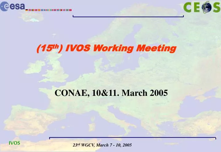
(15 th ) IVOS Working Meeting. CONAE, 10&11. March 2005. IVOS (working) meeting 10.3 pm. and, 11.3 am. Agenda: 1. Updates on country reports since June/Oct.’04 - done 2. F uture In-situ comparison activities (NIST) - done 3. Recommendations of the IVOS workshop October 2004

E N D
(15th) IVOS Working Meeting CONAE, 10&11. March 2005
IVOS (working) meeting 10.3 pm. and, 11.3 am • Agenda: • 1. Updates on country reports since June/Oct.’04 - done • 2. Future In-situ comparison activities (NIST) - done • 3. Recommendations of the IVOS workshop October 2004 • 4. Short term-actions for IVOS • 5. ESA's current activites in this context IVOS Recommendations: • - Web interfaces for Instrument Characteristics • - Web interfaces for Diagnostic data (incl. WTF) • - Documentation of inter-comparison methodologies • 6. IVOS in the context of GEO and GMES
Round Table Issues • What is the current performance of satellites in orbit in terms of radiance / reflectance cross calibration. • What is the required level of radiance / reflectance cross calibration performance for level 2 data products merging(This depends on operational services and products) • Is there the need for a web-site containing links to: • Instrument description (including performance documentation) • Calibration methods • L0 and L1 processing document (algorithms) • Library / links to software tools (radiative transfer tools, data readingroutines…) • Library of publications on vicarious calibration and intercomparisons • Is there a need for a centralised access to data over a set of diagnostic data sites, which space borne instruments data would be available and over which sites? • Many different radiativetransfer codes (RTCs) exist, is there the need for links to RTC source and documentation as well as an RTC inter-comparison exercise? • Is there a need for a campaign dedicated to large scale vicarious calibration(2006/7)
In order to establish reference datasets to support the understanding of climate change and quality assure operational services by E.O. satellites, data from different sensors and the resulting synergistic data products require a high level of accuracy which can only be obtained through continuous traceable calibration and validation activities. • In this context, IVOS recommends to initiate an activity to : • document a reference methodology to predict TOA radiance for which currently flying and planned wide swath sensors can be inter-compared, i.e., define a standard for traceability. • create and maintain a fully accessible web page containing, on an instrument basis, links to all instrument characteristics needed for inter-comparisons as specified above, ideally in a common format. • create and maintain a database (e.g.: SADE) of instrument data for specific vicarious calibration sites in a common format delivered by agencies responsible for their instruments. This database should also include site characteristics. • This activity should be supported for an active (implementation) period of 2 years and a maintenance period over 2 subsequent years. An amount of 500 K-euro/$ is estimated to be required for this activity. • Agencies are asked to support this activity by providing appropriate information and data in a timely manner. Workshop Recommendations (1)
Systems elements 1 – Methodologies and Procedures • document a reference methodology to predict TOA radiance for which currently flying and planned wide swath sensors can be inter-compared, i.e., define a standard for traceability. • System element 1 includes RTC procedures and all error propagation models and methods to establish QA characteristics. • Use: • common methodology for uncertainty components in the in-flight calibration • operational processor (by all) • use common data format • ensure common methodology check (-frequency) • ensure coherent data merging/combination methods incl. common grid registration and use of spatial, spectral and radiometric response characterizations. Qualification for the above: Best Effort basis for GEOSS operational needs for the next 10 years
Systems element 2- satellite and in-situ data • create and maintain a database (e.g.: SADE) of instrument data for specific vicarious calibration sites in a common format delivered by agencies responsible for their instruments. This database should also include site characteristics. • Diagnostic Data • Satellite: • Ensure: • Agreement on a fixed set of diagnostic sites over land, ocean plus possibly atmospheric targets by all • regular data acquisition and provision over those sites by all • common data formats and tools for satellite imagery and metadata analysis • in-situ: • Ensure: • Common use of ancillary data from facilities such as AERONET • standardization of site characteristics in common format • common measurement practices and protocols and related documentation • provision of all in-situ data on timely and regular basis and in common/standard format • inclusion of in-situ networks such as Fluxnet, Modland, Valerie, Globcarbon etc. • consistency of cal. measurements between sites
Systems Element 3 – Sensor information • create and maintain a fully accessible web page containing, on an instrument basis, links to all instrument characteristics needed for inter-comparisons as specified above, ideally in a common format. • Ensure: • common Instrument functionality and operational performance description (identical format for all sensors and agencies). Detailed entries to be defined within ESA study • The use of common terminology (refer to ISPRS Task Force Report) and the identification of methods used to evaluate these characteristics • A common instrument characteristics check and update frequency
Interoperability • Interoperability: • The task of interoperability becomes feasible by the successful implementation of the three basic system elements. Building upon this, the following requirements for interoperability of information from different systems elements and their maintenance over the lifetime of missions relevant to GEOSS has to be satisfied. • Ensure that the satellite instrument, diagnostic site- and methodology entries/data can be used for the synergistic combination and merging of data from different optical sensors/sources, allowing the harmonization of (operational) data products and the establishment of higher level information products such as global maps and time series (from different sensor outputs) to meet the operational service requirements to be fulfilled in the framework of the GEOSS Themes. • Differences in information products are known to exist owing to different observation techniques or system characteristics and different observing conditions (e.g. atmospheric influence). It will have to be ensured that these differences are understood and documented. Therefore the availability of means/procedures (including normalization) to combine/merge co-related information products from different systems has to be ensured.
Testcase Testcase1 Global Sea Surface Temperature map during El Nino from Envisat-AATSR and MODIS-Aqua SE1: Provide the RT procedures (ocean to satellite) for SST modeling and retrieval for both AATSR and MODIS-Aqua SE2: Provide radiance (and temperature) values from diagnostic sites at the time of AATSR and MODIS-Aqua acquisition together with satellite data and ancillary information (metadata) SE3:Provide AATSR and MODIS-Aqua system performances and characteristics an sensor calibration data SE 4: Compare the radiance data and provide means/procedures for harmonization based on reference data sets (underpinned by Miami IR inter-comparison campaign) enabling the “normalization” across the temporal and observation condition differences of acquisition and difference in observing system characteristics
WEB GMES CAL/VAL Methodology guideline, synthesis Diagnostic Data (Satellite and in-situ) • Instrument characteristics • radiometry • Spectral • geometry H ARMONISATION H ARMONISATION CalibrationMetric Diagnostic sites, land and sea AERONET Sade Nilu type interoperability Other Agencies Methodology Catalogue and data access Instrument data ESA’s current actions following the IVOS Workshop recommendations Links to different Agencies • includes RTC procedures and • all error propag. models and methods • to establish QA characteristics. Use: • operational processor(by all) • use common data format Box 3 Box 2 Box 1 for data combination and merging Level - 1 Level – 1 & 2 Box 4
IVOS (working) meeting ctd. At the level of IVOS, we need is a generic list of items (for all optical sensors) needed for the CEOS instrument characteristics pages that would be the starting point for any inter-comparison (or in our table: inter-operability) between sensors, and any good ideas (for methods already proven) on inter-calibrating sensors, i.e. the two side activities in the concept diagram
Future actions for IVOS related to Workshop Recommendation (1) Create and distribute an orbit propagator tool for large scale optical sensor inter-comparison planning purposes (ESA) Specify a data format to be used for a database for sensor inter-comparison purposes such as SADE (ESA/CNES) Contact instrument teams to adhere to the previous recommendation, i.e., to provide instrument descriptions and inter-comparison data in a common format (IVOS to establish white paper containing rationale and defining benefit and intended use) Encourage the use of diagnostic sites as established by international cal/val teams (IVOS in coop. with WTF) Establish a Workplan for the coming (3?) years for IVOS Decide if we should repeat a Workshop of this kind (possibly with a wider framework) in the future
Planning of a potential field experiment for 2006/2007 based on a pilot experiment in March 2005 in Argentina (prior to next WGCV meeting) aiming at: • Bringing international teams together to develop best practice and agreed protocol for future vicarious calibration activities and evaluating the potential of this technique as a means of improving calibration and validation. • Comparing all field radiometers against the same source before the field experiment. • Comparing radiative transfer models in the context of the experiment. Future actions for IVOS related to Workshop Recommendations (2) The proposed dedicated inter-comparison campaign (Large-scale Optical Sensor Inter-comparison -LOSI )including multi-sensor in-situ deployment over one uniform vicarious target was not recommended for the 2005/6 timeframe