Download
1 / 36
410 likes | 765 Views
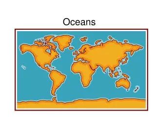
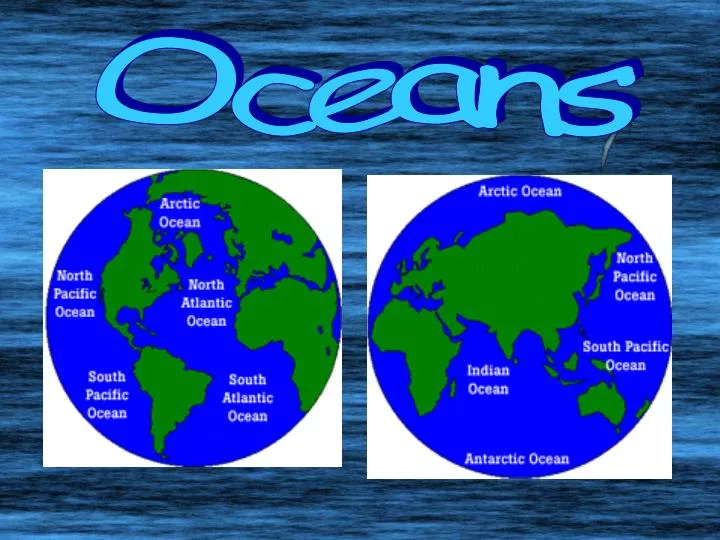
Oceans. What percent of the earth is covered in water or land?. What percent of the earth’s water is salty or fresh?. Ocean Salinity. Area (1,000,000 km²). Volume (1,000,000 km³). Average Depth (m). Maximum Depth (m). Atlantic Ocean. 82.4. 323.6. 3926. 9200. Pacific Ocean. 165.2.

E N D
Area(1,000,000 km²) Volume(1,000,000 km³) Average Depth(m) Maximum Depth(m) Atlantic Ocean 82.4 323.6 3926 9200 Pacific Ocean 165.2 707.6 4282 11,022 Indian Ocean 73.4 291.0 3963 7460 Arctic Ocean 14.1 17.0 1205 4300 World Ocean Facts – which ocean is the biggest?
HW: What makes the ocean salty? • Think about why the highest salinity is found near equator.
Lab Inquiry: • How does temperature and salinity affect the density of ocean water?
Oceanic Circulation Aim: Why causes the currents in the ocean?
Vocabulary • Salinity • Density • Upwelling • Gyre • Currents • Thermal Expansion • Coriolis • Global Winds
Why is Ocean Circulation Important? a. Transport ~ 20% of latitudinal heat between Equator and poles b. Transport nutrients and organisms c. Influences weather and climate d. Influences commerce e. Pollution is transported
2 kinds of circulation: • Surface driven currents are wind-driven and occur in the uppermost 100 m or less of ocean • Deep ocean currents are caused by density changes due to salinity and temperature differences. These currents produce very slow flows in deeper waters. • Other forces affecting currents: Corioliseffect, friction, gravity, thermal expansion, geologic shape of ocean basin and landmasses
How fast? A few miles/hr (Gulf Stream off of Miami = 4.5 mph) How much? Total water in ocean surface circulation = about 100 Amazon Rivers (20 million m3/s).
N. Pacific Gyre • N. Atlantic Gyre • S. Atlantic Gyre • S. Pacific Gyre • Indian Ocean Gyre • Antarctic Circumpolar Current
Current Gyres • Gyres are large circular-moving loops of water Five main gyres (one in each ocean basin): • North Pacific • South Pacific • North Atlantic • South Atlantic • Indian • Generally 4 currents in each gyre • Centered about 30o north or south latitude
ESRT Surface Ocean Currents pg. 4 • Color the war currents red and the cool currents blue http://www.youtube.com/watch?v=PAQos8COqYI&feature=player_embedded
Surface Currents are created by: • 1. Global Winds • 2. Coriolis Effect • 3. Solar Heating (temperature, density)
Global Winds pg. 14 ESRT Surface currents of ocean generally mirror atmospheric circulation (wind) patterns
North Pole Buffalo moves 783 mph Quito moves 1036 mph Buffalo 15o N equator Quito Buffalo equator 79oW Quito South Pole
The Coriolis effect on Earth • As Earth rotates, different latitudes travel at different speeds • The change in speed with latitude causes the Coriolis effect
Coriolis Effect • The rotation of Earth causes a deflection (curve) of the winds and waters of the Earth. • In Northern Hemisphere, curvature is to right - clockwise • In Southern Hemisphere, curvature is to left – counterclockwise b. Effect lessens at equator and increases at poles • Visualization of the Coriolis effect: • http://www.classzone.com/books/earth_science/terc/content/visualizations/es1904/es1904page01.cfm?chapter_no=visualization • Wind: • http://www.classzone.com/books/earth_science/terc/content/visualizations/es1905/es1905page01.cfm?chapter_no=visualization
Idealized winds generated by air pressure differences and Coriolis Force. • Actual wind patterns affected by land mass distribution..
Thermal expansion • Solar radiation heats the water at equator more than the poles • Warm water expands and cool water contracts, creating a water bulge at the equator • Gravity pulls warmer water “downhill” toward cooler water
Ocean Salinity Increased evaporation near the equator makes the water saltier.
Thermohaline Circulation Global ocean circulation that is driven by differences in the density of the sea water which is controlled by temperature and salinity.
LINKS: • http://www.youtube.com/watch?v=w_8mw-1HYFg • http://www.youtube.com/watch?v=nAq9LXLXISk • http://www.youtube.com/watch?v=rR5TFWNLtOc&feature=related • http://www.youtube.com/watch?v=boiFoSRq1BM&feature=related
What do Nike shoes, rubber ducks, and hockey gloves have to do with currents?
2004-2007 Barber’s Point
North Pacific Subtropical Gyre • “Great Pacific Garbage Patch” • Estimate: 46,000 pieces of floating garbage/mi2.
North Pacific Subtropical Gyre 135° to 155°W and 35° to 42°N
North Pacific Subtropical Gyre Great Pacific Garbage Patch- Good Morning America 2010 http://www.youtube.com/watch?v=uLrVCI4N67M&feature=player_embedded http://www.youtube.com/watch?v=FrAShtolieg&feature=related http://marinedebris.noaa.gov/info/patch.html#6