
Snowmelt and River Dynamics in Alaskan Watershed
E N D
Presentation Transcript
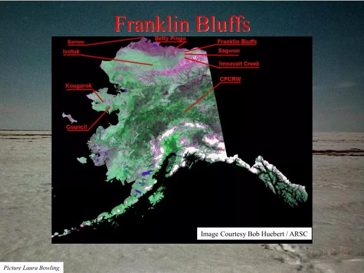
Franklin Bluffs Image Courtesy Bob Huebert / ARSC Picture Laura Bowling
Franklin Bluffs, Alaska Picture Laura Bowling
Franklin Bluffs Picture Laura Bowling
Franklin Bluffs Picture Laura Bowling
Year 2000 Snowmelt on the Putuliguyak Watershed, North Slope, Alaska. Jeremiah Drage and Laura Bowling. The Putuliguyak River watershed is located on the North Slope of Alaska. The 471 km2 watershed drains north into the Arctic Ocean via Prudhoe Bay. The river channel freezes solid during the winter months. During snowmelt the river channel begins to fill, storing a fair amount of water before the channel opens up to drain freely, this is due to the very shallow gradient of the river channel and the large amount of snow that drifts into the channel. The Putuliguyak River does not begin to really flow until most all snow in the watershed melts. During snowmelt, snow survey and river discharge data were collected daily. Three snow survey sites existed for the Putuliguyak River watershed; Betty Pingo, West Dock and Franklin Bluffs. Franklin Bluffs is near the headwaters of the watershed while the Betty Pingo and West Dock sites are near the mouth. At each snow survey site 50 depths and 5 densities were collected. An Adirondack snow tube was used for collecting densities. The density samples were weighed using a digital scale. The Putuliguyak River was gaged using two different methods. Before high flows it was possible to wade the channel using a top setting rod and cup type current meter. During high flows gaging was completed from pipeline bridge crossings with a bridge crane setup.
Initially, periodic snow surveys began on the 19th of May. Daily snow surveys began on the 4th of June. The vast majority of the snowpack melted by the 14th of June. Measurable discharge began on the 8th of June. The Putuliguyak River discharge peaked on the 15th of June with about 5920 cfs. The peak discharge in 2000 was greater than previously recorded discharges on the river. The USGS recorded a peak discharge of 5800 cfs in 1980 on the 12th of June.
Franklin Bluffs is located on the Sagavanirktok River, south of Prudhoe Bay. The Putuliguyak River which drains to Prudhoe Bay Franklin Bluffs and Sagwon Sagwon is located south of Franklin Bluffs.
Snowpack ablation during spring, 2000 displays remarkable variability among the many sites where snowmelt processes were monitored.
Funding for this research was provided by the National Science Foundation Arctic Systems Science Program (Grant No. OPP-9814984). Laura Bowling, University Of Washington Jeremiah Drage, Water and Environmental Research Center University of Alaska