Download
1 / 17
170 likes | 298 Views
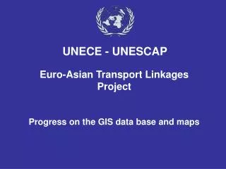
Euro-Asian Transport Linkages Project Progress on the GIS data base and maps. UNECE - UNESCAP. GIS Status. Entities Rail Line Sections Road Line Sections Nodes (cities rail/ road/ railway stations/ BCP) Inland Waterways Projects (ongoing and planned) Sea and inland ports

E N D
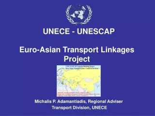
Euro-Asian Transport LinkagesProjectProgress on the GIS data base and maps UNECE - UNESCAP
GIS Status Entities • Rail Line Sections • Road Line Sections • Nodes (cities rail/ road/ railway stations/ BCP) • Inland Waterways • Projects (ongoing and planned) • Sea and inland ports • Border crossing points
Layers GIS (Predefined) • Border Shapes • Rivers and Lakes • Cities (Capitals, Small Cities, Populated places, Build up areas) • Railway Lines – all • Railway Stations • Road by categories
Layers GIS(EATL Specific ) • Nodes (cities rail/ road/ railway stations/ BCP) • EATL Rail Routes • EATL Road Routes • EATL Rail Line Sections with associated data • EATL Road Line Sections with associated data • Projects (ongoing and planned) • Sea and inland ports • Border crossing points
Available GIS System Software • MapInfo GIS version 7.5 • MapInfo Viewer version 7.0 • ADC WorldMap Europe Version 4.0 • ADC WorldMap Middle East Version 4.0 • ADC WorldMap Asia Version 4.0
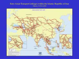
Euro-Asian Transport Links Rail and Road RoutesGIS Status Example of result get from EATL GIS
Euro-Asian Transport Links Rail Routes Draft UNECE – UNESCAP
Euro-Asian Transport Links Rail Routes Draft UNECE – UNESCAP
Euro-Asian Transport Links Rail Routes Draft UNECE – UNESCAP
Euro-Asian Transport Links Rail Routes Draft UNECE – UNESCAP
Euro-Asian Transport Links Rail Routes Draft UNECE – UNESCAP
Euro-Asian Transport Links Rail Routes Draft UNECE – UNESCAP
Euro-Asian Transport Links Rail Routes Draft UNECE – UNESCAP
Euro-Asian Transport Links Rail Routes Draft UNECE – UNESCAP
Euro-Asian Transport Links Rail Routes Draft UNECE – UNESCAP
Euro-Asian Transport Links Road Routes Draft Same maps can be obtained for: - roads, projects, etc.; - overlapped layer of rail, roads, ports, projects, etc. UNECE – UNESCAP