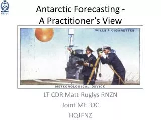
Antarctic Forecasting - A Practitioner’s View
310 likes | 460 Views
Antarctic Forecasting - A Practitioner’s View. LT CDR Matt Ruglys RNZN Joint METOC HQJFNZ. My background. Joined the Royal Navy in 1981 METOC training 1990 METOC, HMS ENDURANCE 1991-1993 Two deployments to the Antarctic Peninsula MetService NZ 2007-2010

Antarctic Forecasting - A Practitioner’s View
E N D
Presentation Transcript
Antarctic Forecasting -A Practitioner’s View LT CDR Matt Ruglys RNZN Joint METOC HQJFNZ
My background • Joined the Royal Navy in 1981 • METOC training 1990 • METOC, HMS ENDURANCE 1991-1993 • Two deployments to the Antarctic Peninsula • MetService NZ 2007-2010 • Joined Royal New Zealand Navy 2010 • METOC in HMNZS OTAGO Nov 2013-Jan 2014 • Deployment to the Ross Sea
A tale of two ships • HMS ENDURANCE • Ice class 1A1 (DNV) • Displacement 6100t • LOA 91m • Beam 17.9m • Draught 8.5m • HMNZS OTAGO • Ice class 1C (Lloyds) • Displacement 1900t • LOA 85m • Beam 14m • Draught 3.6m
Challenges • Sparsityof surface observations • Even greater sparsityof upper air observations • Hence the determination of current weather conditions and the spatial distribution of weather elements (fronts, air masses and so on) is difficult
Satellite Imagery • Satellite imagery is essential to fill in the gaps in observations • Geostationary satellites do not cover polar regions • Polar orbiting satellites have better resolution than geostationary satellites • Generating a time sequence is not really possible
Data & Communications • Internet via satellite • Slow, thus file size is important • Chose NAVGEM over GFS or AMPS • AMPS D3 (Ross Sea) • MSLP and 10m u and v winds – 46MB • NAVGEM Global (Ross Sea) • MSLP and 10m u and v winds – 1.8MB
Orography • Orography has a powerful modifying effect on the airflow • Trans-Antarctic mountains and high ground to the west of the Ross Sea • Barrier winds
Orography Contours in metres. From: Parish, TR; Cassano, JJ; Seefeldt, MW; Characteristics of the Ross Ice Shelf air stream as depicted in Antarctic Mesoscale Prediction System simulations; J Geophys Res III D12109, doi:10.1029/2005JD006185
Katabatic winds • Boundary layer very strong temperate inversions • Katabatic winds can be very extreme, reaching storm force or greater at times • Develop at very short notice • Strongly channelled by local topography • Local weather conditions can change dramatically over very short space and time scales • Katabatic flows can be associated with very turbulent conditions, rapid temperature changes, and often very poor visibility in blowing snow
IR image showing katabatic drainage (dark signature & yellow arrows). Red areas show polynyas (ice-free areas) formed where strong offshore winds blow
Advection Fog • Relatively straightforward • Air temperature • Dewpoint • Sea surface temperature
Boundary Layer • The boundary layer can be difficult for both man and machine
Human Forecasters • Because of the • topography • land surface • lower atmospheric flows • relative lack of good surface weather observations • The meteorologist is an even more important component of the forecasting system than s/he would be in other locations • But even they will get caught out