Download
1 / 31
320 likes | 536 Views
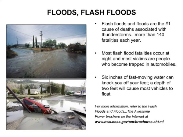
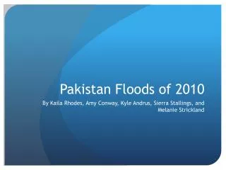
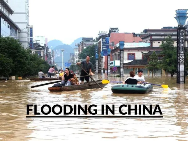
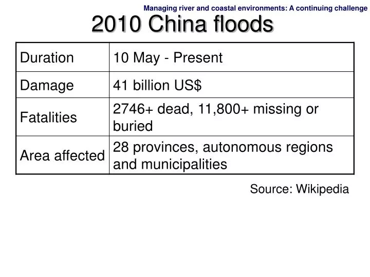
2010 China floods. Source: Wikipedia. Why?. Heavy downpour in summer Summer monsoon Onshore winds Low pressure centre over Asia Mudflow / landslide Overflow of rivers. 2 Managing river and coastal environments: A continuing challenge.

E N D
2010 China floods Source: Wikipedia
Why? • Heavy downpour in summer • Summer monsoon • Onshore winds • Low pressure centre over Asia • Mudflow / landslide • Overflow of rivers
2 Managing river and coastal environments: A continuing challenge
crack A narrow ridge of sand in Greece A large crack along the coast at Cheung Chau (Credit: Corbis) (Credit: Liang Wing Hang Yanchap) (Credit: The Government of Hong Kong Special Administrative Region) Cheung Chau Islands A lake in New Zealand (Credit: NSIL)
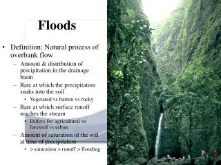
Do you know what agents shape these landscape? Let’s study some basic knowledge about river and coast before we learn how rivers and waves shape the land. They are shaped by rivers and waves.
How does water move on our earth? Water moves among the storage areas on the earth. The main storages are: Main storages of water Atmosphere Land Ocean Soil and rocks Rivers and lakes Vegetation cover Ice caps
atmosphere precipitation evaporation precipitation transpiration soil and rocks evaporation evapotranspiration vegetation cover rivers and lakes surface run-off infiltration ocean subsurface run-off How does water move on our earth? condensation
How does water move on our earth? Vegetation cover transpiration precipitation evaporation interception stem flow drip flow
How does water move on our earth? Surface run-off precipitation evaporation overland flow surface run-off channel flow
How does water move on our earth? Water movement underground evaporation absorption surface storage unsaturated rock and soil infiltration soil moisture storage water table percolation throughflow subsurface run-off saturated rock base flow ground water storage impermeable rock
Test yourself! If there is deforestation … Interception will ( increase / decrease ); surface run-off will ( increase / decrease ); infiltration will ( increase / decrease ). If trees are cut down, how will the water cycle change? Some map skills about rivers
The running water of the Jinsha Jiang (Credit: Tsui Chung Pong David) How does a river shape the land? • Rivers can • split rocks and cut into land; • carry stones and sand along; • drop the carrying stones and sand in places where their energy drops. • Rivers are a significant agent that shape the landscape. Erosion Transportation Deposition
An isolated mass of rock near Jeju Island, Republic of Korea (Credit: Liang Wing Hang Yanchap) How does seawater shape our coast? Tides and waves are also agents that shape the coast. Waves can be either erode the land or deposit sediment there. Tides have significant impact on the formation of coastal landform.
How does seawater shape our coast? There are two high tides and low tides every day. Hightide – Low tide = Tidal range The larger the tidal range, the larger the zone of active wave action. Active zone of wave action Tidal range
How does seawater shape our coast? Zone of wave attack Highest water level where storm waves can reach Lowest water level
How does seawater shape our coast? High tide level Lowest water level Foreshore Shore
How does seawater shape our coast? Highest water level High tide level Lowest water level Backshore Offshore Foreshore Shore
1 Defining the area of a drainage basin Can you identify the watershed of River basin A on the map? First, identify the ridge that separates the basin from adjacent ones. Second, use a curved line to join the ridge and the highest parts down the spurs. Cut every contour line at right angle on its way. River basin A Last, close the watershed at the mouth of the river.
Drainage basin Channels = 21 cm 100,000 = 2,100,000 cm 2 Drainage density of a river Drainage density of the river Total length of the channels in a drainage basin = ___________________________ Total area of the drainage basin Total length of the channels = 21 km Scale: 1:100,000
0.5cm 0.5cm 2 Drainage density of a river 1 2 Drainage density of the river 3 4 5 6 7 8 9 10 11 12 13 Total length of the channels in a drainage basin 14 15 16 17 18 19 20 = ___________________________ 21 22 23 24 25 26 27 Total area of the drainage basin 28 29 30 31 32 33 34 35 36 37 38 39 40 41 Complete squares 42 43 44 45 46 47 55 squares = 48 49 59 51 52 53 54 55 Scale: 1:100,000
2 Drainage density of a river 35 34 33 1 2 3 32 31 Incomplete squares 5 4 30 = 35 0.5 7 6 29 = 17.5 squares 8 28 55 9 27 Complete squares +Incomplete squares 10 26 11 25 = 55 + 17.5 12 24 = 72.5 13 22 23 14 20 21 15 16 17 18 19 Scale: 1:100,000
2 Drainage density of a river On the map, 1 cm = 100,000 cm (1 km) in actual; 0.5 cm = 50,000 cm (0.5 km) in actual The actual area of each square = 0.5 km 0.5 km = 0.25 km2 The total area of the drainage basin = 0.25 km2 72.5 complete squares = 18.125 km2
2 Drainage density of a river Drainage density of the river Total length of the channels in a drainage basin = Total area of the drainage basin 21 km = 18.125 km2 = 1.16 km/km2 The higher the drainage density, the more ( active / inactive ) the erosional force in the basin. Discussion : How will deforestation affect drainage density?
3 Identifying different features of a river River source Tributaries River A Confluence point Main river
1 1 1 2 1 2 1 1 3 1 1 2 3 2 1 1 4 4 4 Finding out the stream order Stream order = stream hierachy River A 1 First order streams 2 Second order streams 3 Third order streams 4 Fourth order streams 3 This is a fourth order basin. Discussion: What is the difference in stream order between a river basin in TRF and a river basin in desert?
Identifying the ridges on a contour map A ridge is an elongated area of relatively high ground. 500 700 600 800 A ridge
100 200 300 B A Identifying the spurs on a contour map Is this a spur? Height (m) 300 200 100 The cross-section of AB B A