Download
1 / 19
190 likes | 395 Views
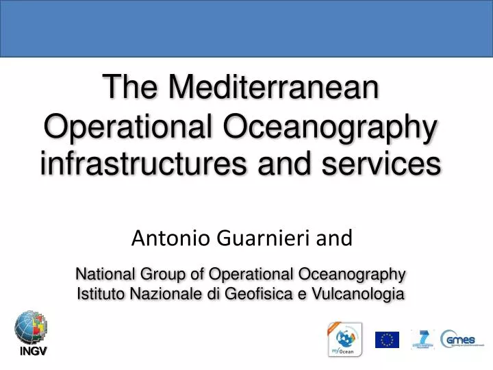
The Mediterranean Operational Oceanography infrastructures and services National Group of Operational Oceanography Istituto Nazionale di Geofisica e Vulcanologia. Antonio Guarnieri and. INGV. INGV. OUTLINE.

E N D
The MediterraneanOperationalOceanographyinfrastructures and services National Group ofOperationalOceanographyIstituto Nazionale di Geofisica e Vulcanologia Antonio Guarnieri and INGV INGV
OUTLINE • The Mediterranean Operational Oceanography Network (MOON) and the GMES European Marine Service: system design and implementation • Specific products of INGV • The regional experience of ADRICOSM, and the Adriatic Observing System • Conclusions
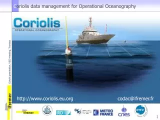
Operational oceanography in the Mediterranean Sea:1995-today Real Time Observing System from satellites and in situ platforms Numerical models of hydrodynamics and biochemistry at basin scale Numerical models for shelf and coastal areas End-User applications Downstream services MOON: Mediterranean Operational Oceanography Network 16 nations involved, 36 institutions http://www.moon-oceanforecasting.eu
The design principles LARGE SCALE SHELF SCALE • REPEATED MULTIPARAMETRIC SECTIONS • SATELLITE AND AERIAL SURVEYS • COASTAL RADARS • AUTONOMOUS UNDERWATER • VEHICLES • CABLED MULTIPARAMETRIC STATIONS • RIVER RUNOFF AND LOADING • MONITORING • SEDIMENT/WQ MONITORING • MOORED BUOY ARRAYS • SOOP EXPANDABLE AND ONDULATING INSTRUMENTS • SATELLITE SENSING: • SEA LEVEL, • SEA SURFACE TEMPERATURE, • SEA SURFACE SALINITY, • COLOR, WINDS • DRIFTING BUOYS • (SURFACE AND SUBSURFACE) • GLIDERS OBSERVING SYSTEM • MODEL PHYSICS • Non-Hydrostatic (<1- 5 KM) • TURBULENCE AND LIGHT • SUBMODELS MODEL PHYSICS PRIMITIVE EQUATION (> 1-5 KM) TURBULENCE CLOSURE SUBMODELS DATA ASSIMILATION KALMAN FILTERS ADJOINT MODELS • DATA ASSIMILATION • OPTIMAL INTERPOLATION • 3-DVAR, KALMAN FILTER BIOCHEMICAL MODELS PELAGIC COMPARTMENT BENTHIC CLOSURE BIOCHEMICAL MODELS PELAGIC COMPARTMENT BENTHIC-PELAGIC COUPLING SEDIMENT DYNAMICS MODELING SYSTEM • ATMOSPHERIC FORCING • OPERATIONAL ANALYSES AND FORECASTS FROM LARGE SCALE MODELS • ATMOSPHERIC FORCING • OPERATIONAL ANALYSES AND FORECASTS FROM LIMITED AREA MODELS
Click click XBT VOS/SOOP high resolution (12 nm along track and full profile transmission, few hours delay) 20 ARGO floats deployed from VOS (few hours delay) ENVISAT JASON GFO ERS Multiparametric buoys in: Ligurian Sea, Adriatic Sea and Cretan Sea (few hours delay) T/¨P Daily satellite SST interpolated in RT on model grid (one day delay) JASON-1, GFO, ENVISAT, T/P Sea Level Anomalies (few days delay) click Scatterometer DAILY winds analysis, 1/2x1/2 (one week delay) Open ocean monitoring by gliders (few hours delay) MOON data collection system:Basin scale and real time
MyOcean: The European GMESMarine Core Service functions Satellite and in situ data Geoportal For Data Access The Marine Core Service delivers regular and systematic reference information on the state of the oceans and regional seas of known quality and accuracy
A catalogue of « common denominator » data • Currents, • Temperature, • Salinity • Sea Level, • Sea Ice, • Surface winds • Biogeochemistry • 239 products DISCOVER VIEW DOWNLOAD Open & Free Slide taken from MyOcean Coordinator
The Marine Core Service for users: 4 areas of benefit MARINE AND COASTAL ENVIRONMENT • GMES service delivers a service to: • European agencies (EEA, EMSA, EDA, ...) • Member State Users: National / Regional Service Providers (public or private) • Intergovernmental bodies (OSPAR, UNEP-MAP, HELCOM, ICES, ...) • Private businesses MARINE RESOURCES MARINE SAFETY WEATHER, CLIMATE & SEASONAL FORECASTING
MyOcean catalogue www.myocean.eu • SeaSurfaceHeight • Temperature • Salinity • Currents daily: 10-day forecast weekly: 15-day analysis once: reanalysis • Stokesdriftcurrents • Wavenumber ✔ Med-MFC-currents • Chlorophyll • Nutrients ✔ bi-weekly: 10-day forecast once: analysis • DissolvedOxygenconc. • Primary production • Phytoplanktonbiomass ✔ ✔ ✔ ✔ ✔ Med-MFC-biogeochemistry
A regional experience: ADRICOSM • The Italian Ministry of Environment and Territory started an ADRICOSM Pilot Project in October 2001 to develop the monitoring and modelling of the Adriatic currents and ecosystem in order to detect changes and mitigate impacts • Other Projects will start in 2004 that will continue the ADRICOSM developments • The last ended of these projects is ADRICOSM-STAR: ADRICOSM INTEGRATED RIVER BASIN AND COASTAL ZONE MANAGEMENT SYSTEM: MONTENEGRO COASTAL AREA AND BOJANA RIVER CATCHMENT • The last on-going project is Adricosm-Intermediate
ADRICOSM APPROACH Coastalwater cycleintegratedstrategy Numerical models of the atmosphere, marine and river hydrodynamcs, underground waters coupled to water quality and sediment transport Multidisciplinary Multi-platform Observing system (satellites, atmospheric and oceanographic stations, river, urban and underground water monitoring) Climate change scenario simulations coupled to regional/local models Production of generic high quality data for environmental managers and policy makers
Enhancement and continuationof the monitoring system • Daily Ocean Color derived parameters have been produced for the study area since 1998 based on SeaWiFS data (CNR-ISAC): • Total Suspended Matter (TSM) • Colored Dissolved Organic Matter (CDOM) • Attenuation coefficient (K_490) • Chlorophyll (Chl_a) March 4th 2004
Enhancement and continuationof the monitoring system Meteo domain Wind Measurements and Data Statistics (OGS) B A A B XBT domain Continuation of VOS Program (OGS) along the Trieste – Durres – Bari Track (XBTs)
New monitoringstations in Montenegro Kotor • water quality Fraskanjel • water level Port of Bar • flow Renewal of several hydromet stations • water level
FTP, HTTP Data Servers The Adricosm Geoportal Project and External Users Homogeneous Metadata Catalog, Information System, Access Center Connect and Use Download and use Search Catalog and Find Data providers control access to their data ADRICOSM-STARGEOPORTAL Map Servers Publish data and services ADRI-SIS WEB PORTAL Data Data Data
THEMES CENTERS NETWORK DISCOVERY SERVICE The Adricosm Geoportal
The Adriatic Observing System (Italian side) Multiparametric Buoys/Stations MAMBO (OGS) PALOMA (OGS) Acqua Alta (CNR) S1 (CNR-ISMAR) E1 (CNR-ISMAR) E2M3A (OGS) ITALY Surface drifters HF Radars Several Baros/Batos Installations on ferries and research vessels Lagrangian profilers
CONCLUSIONS • Within the last 20 years Operational Oceanography has developed a thick network of modelling and observing data and products • At a regional scale (Mediterranean) the “base” products are freely available through MyOcean • At sub-regional (Adriatic) an effort was done to start to create a semi-centralized GeoPortal to access the data • All these products proved and keep proving everyday to be fundamental instruments for end users such as European and local Agencies ad Services, Member states, policy and decision makers Thank You