Download
1 / 23
230 likes | 387 Views
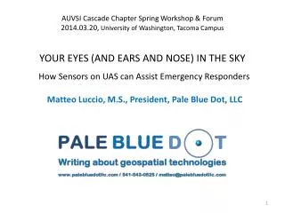
AUVSI Cascade Chapter Spring Workshop & Forum 2014.03.20, University of Washington, Tacoma Campus YOUR EYES (AND EARS AND NOSE) IN THE SKY How Sensors on UAS can Assist Emergency Responders. Matteo Luccio , M.S., President, Pale Blue Dot, LLC. Acknowledgments.

E N D
AUVSI Cascade Chapter Spring Workshop & Forum2014.03.20, University of Washington, Tacoma CampusYOUR EYES (AND EARS AND NOSE) IN THE SKYHow Sensors on UAS can Assist Emergency Responders MatteoLuccio, M.S., President, Pale Blue Dot, LLC
Acknowledgments This presentation is based in part on interviews with • Dave Dobler, Director, Emergency Services Programs, PARADIGM isr • Wolfgang Juchman, Ph.D., Director of Sales & Marketing, Velodyne LiDAR • Kevin Lauscher, Police / Industrial Sales & Training Manager, Draganfly Innovations Inc. • Ron Manginell, Ph.D., Researcher, Sandia National Laboratory
Introduction I mostly write articles on geospatial technologies for trade magazines, including Professional Surveyor Apogeo Spatial Sensors & Systems I also write white papers and case studies. I am currently writing a book on precision agriculture. I have written a few articles on UAS, including a recent one on how they can be used for precision agriculture. DISCLAIMERS • I am not an expert on emergency response. • I am not being compensated for this presentation and any company or product I mention is only an example. • I am not an expert with PowerPoint…
Structure of this presentation • My goal today is to help you identify the ways in which UAS can help you accomplish your mission. • I will focus on small UAS (SUAS) – i.e. those weighing under 55 lbs. • Out of about 48,000 fire and police departments in the United States, currently probably fewer than 25 operate UAS. • I will focus mostly on lidar scanners and chemical sensors.
Factors to consider when shopping for a SUAS for emergency response • Size • Time aloft • Range • from the controller • from take-off to landing • Maximum payload • Ability to quickly change sensors • GPS receiver accuracy • Does it have an inertial measurement unit (IMU)? • Does it have a data downlink? How fast is it? What is its range? • Does the controller have a display? • What software comes with it? • Reliability • Ease of use • Price • Technical support
Some potential uses for UASin emergency response situationswhere manned aircraft are not available or cannot be deployed in time • Find victims • Find and pursue suspects • Verify that all innocents have been evacuated • Identify points of entry and exit • Analyze situations, gain tactical advantage • Identify hazards • Guide responders • Gather evidence at accidents, disasters, and crime scenes • Monitor forest fires, floods, crowds, etc. • Find things in post-flight analysis that were not evident from the real-time video feed
Types of sensors • There are hundreds of different types of sensors and new ones are created all the time. • Sensors on satellites and aerial platforms, whether manned or unmanned, are used for remote sensing.
Remote Sensing “Collecting and interpreting information about the environment and the surface of Earth from a distance, primarily by sensing radiation that is naturally emitted or reflected by Earth’s surface or from the atmosphere, or by sensing signals transmitted from a device and reflected back to it.” Source: Tasha Wade and Shelly Sommer, eds., A to Z GIS: An illustrated dictionary of geographic information systems (Redlands, CA: Esri Press, 2006).
Electro-optical (EO) sensors Passive:sense reflected or naturally emitted energy • Visible • Panchromatic (i.e., grayscale) • Color (i.e. red, green, blue) • Infrared thermal • Multispectral: capture image data at specific frequencies across the electromagnetic spectrum • Hyperspectral: employs hundreds of contiguous bands to detect and identify a variety of natural and man-made materials Active:emit energy and sense the energy returned • Radar: uses radio waves to determine the range, altitude, direction, or speed of objects • Lidar: measures distance by illuminating a target with a laser and analyzing the reflected light This is what digital cameras and cell phone cameras use.
Other sensors that are relevantto first responders • Chemical • Biological • Radiological • Acoustic
Source: Google Earth Nadir Oblique Source: Pictometry
Lidar • How it works • You can use it to • measure distances • measure ground elevation • measure the depth of water • create 3D models of buildings • image a scene in 3D in the dark The 3D building models that you see in Google Earth are based on lidar data.
more on lidar • real-time 3D point clouds make it easier to see the 3D aspect of complex shapes, landscapes, or features • you can use rulers within the real-time data to measure distances • in some cases, a couple of hours after the flight a complete 3D model of the captured scenery can be available
Some uses of lidarfor emergency response • Preemptively, to create 3D models • In the dark, to visualize an area or a structure • After a disaster, to quickly model and measure an area or a structure
Velodyne’s HDL-32E laser scanner • measures 5.7" high x 3.4" in diameter weighs a little more than 4 lbs. • has up to 32 lasers across a 40° vertical field of view, aligned from +10° to -30° • has a rotating head that delivers a 360° horizontal field of view natively • generates a point cloud of 700,000 points per second • has a range of 70 meters and typical accuracy of +/- 2cm. https://www.youtube.com/watch?v=rfUfMi19Utk&feature=youtu.be http://www.youtube.com/watch?v=aIxYt7DkK5A&feature=youtu.be
Ron Manginell, Ph.D., Researcher, Sandia National Laboratory and one of the detectors his team developed
Ear-plug-sized samplers, with silvery microvalves and solder connectors, developed at Sandia National Laboratory
The radiation sensor (smaller pod) and Harvester sampling pods developed at Sandia National Laboratory ready for a UAV test flight
A few more examples of the use of UAS for emergency response • Hazmat situation • Multiagency coordination • Finding a person ejected from a rolled-over vehicle
Conclusions • A lidar can help you before, during, and after an emergency or disaster. • UAS with chemical sensors can fly into plumes after an explosion and detect dangerous chemical compounds. • Tiny sensors on tiny aircraft can be your eyes, ears, and nose in the sky.
Questions? ?????????????????