Download
1 / 22
230 likes | 357 Views
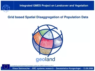
Integrated GMES Project on Landcover and Vegetation. Grid based Spatial Disaggregation of Population Data. geo land. Co-funded by the European Commission within the GMES initiative in FP-6. Klaus Steinnocher – ARC systems research – Geostatistics Kongsvinger – 13.09.2006. Background.

E N D
Integrated GMES Project on Landcover and Vegetation Grid based Spatial Disaggregation of Population Data geoland Co-funded by the European Commission within the GMES initiative in FP-6 Klaus Steinnocher – ARC systems research – Geostatistics Kongsvinger – 13.09.2006
Background Integrated project geoland Observatory Spatial Planning geoland • funded within the 6th framework programme of the EC • represents a network of more than 50 research organisations, public administrations and service providers • aims to provide and establish geo-information products and services to support the European Global Monitoring for Environment and Security (GMES) programme • utilises available Earth Observation resources, and integrates them with existing models into pre-operational end-user applications Klaus Steinnocher ARC systems research 13.09.2006
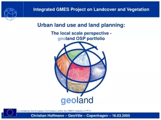
Background Observatory Spatial Planning Observatory Spatial Planning geoland • Introducing innovative EO based services and products into the domain of spatial planning • Building upon a representative user group representing European, national and regional policy requirements • DG Regio, ESPON • Environmental agencies • Regional governments • Serving user needs by integrating EO-derived land cover and use information with existing socio-economic data • Spatial Planning on European level focuses to a very high degree on socio-economic data alone • Land cover and use information can substantially improve statistical data Klaus Steinnocher ARC systems research 13.09.2006
Linking people and pixels Spatial disaggregation Share of artificial surface areas Population density per artificial surface areas Observatory Spatial Planning geoland + = NUTS3 population density Klaus Steinnocher ARC systems research 13.09.2006
Spatial disaggregation Population density Observatory Spatial Planning geoland • Parameters • Total population – global parameter on administrative units level • Housing density – local parameter from Earth observation • Spatial Disaggregation • Distributes population according to housing densities • Results in local distribution of population • Assumptions • Population density is proportional to housing density, • no population occurs outside housing areas, and • relationship between population and housing density is constant within a region, but might differ between regions. • Question • Is the assumption valid? • How accurate are the resulting data? Klaus Steinnocher ARC systems research 13.09.2006
European case study Transnational test site Observatory Spatial Planning geoland • Region • Central Europe • 7 countries • Data base • Residential areas from CLC (class 1.1 urban fabric) • Population per NUTS 3 area (Eurostat) • Reference data (Austria) • Population grid (250m) –Statistik Austria • Population per district / municipality (census) Klaus Steinnocher ARC systems research 13.09.2006
European case study CORINE land cover 2000 CORINE land cover level 1 Artificial surfaces Agricultural areas Forest and semi-natural areas Wetlands Waterbodies Observatory Spatial Planning geoland Kassel Erfurt Chemnitz Praha Nürnberg Stuttgart Wien Bratislava München Source: CLC 2000 Milano Venezia Klaus Steinnocher ARC systems research 13.09.2006
European case study Proportion of urban fabric 2000 per 3x3km grid cell Proportion of urban fabric [%] no urban fabric below 2.5 2.5 to 5 5 to 10 10 to 20 20 to 25 25 to 30 30 to 40 40 to 50 50 to 60 60 to 75 75 to 100 Observatory Spatial Planning geoland Source: CLC 2000 Klaus Steinnocher ARC systems research 13.09.2006
European case study Population density 2000 per NUTS 3 area Population density [pop/km2] below 50 50 to 100 100 to 150 150 to 200 200 to 300 300 to 500 500 to 1.000 1.000 to 2.000 above 2.000 Observatory Spatial Planning geoland Source: Eurostat Regio Data Base Klaus Steinnocher ARC systems research 13.09.2006
European case study Population density 2000 on urban fabric per 3x3km grid cell Population density [pop/km2] no population below 10 10 to 100 100 to 250 250 to 500 500 to 1.000 1.000 to 2.000 2.000 to 5.000 above 5.000 Observatory Spatial Planning geoland Source: CLC 2000 Eurostat Regio Data Base Klaus Steinnocher ARC systems research 13.09.2006
European case study Population density 2000 on urban fabric per 3x3km grid cell Population density [pop/grid cell] no population below 100 100 to 500 500 to 1.000 1.000 to 1.500 1.500 to 2.500 2.500 to 10.000 10.000 to 20.000 above 20.000 Observatory Spatial Planning geoland Source: CLC 2000 Eurostat Klaus Steinnocher ARC systems research 13.09.2006
European case study Population density 2000 from census per 3x3km grid cell Population density [pop/grid cell] no population below 100 100 to 500 500 to 1.000 1.000 to 1.500 1.500 to 2.500 2.500 to 10.000 10.000 to 20.000 20.000 to 75.000 above 75.000 Observatory Spatial Planning geoland Source: Statistik Austria Klaus Steinnocher ARC systems research 13.09.2006
European case study Comparison of census and disaggregation results District level all districts urban districts excluded average error 21,4% (14.505) 13,8% (8.278) Observatory Spatial Planning geoland • Total cells 9.774 • Populated cells: • Statistik Austria census grid 7.739 • NUTS 3 / CLC 1.1 disaggregation 4.009 • Disaggregation covers only • 51,8 % of cells, BUT • 91,3 % of total population Klaus Steinnocher ARC systems research 13.09.2006
European case study Comparison on district level Relative population difference [%] below -70 -70 to -40 -40 to -20 -20 to 20 20 to 40 above 40 Observatory Spatial Planning geoland Source: CLC 2000 Eurostat / Statistik Austria Klaus Steinnocher ARC systems research 13.09.2006
Regional case study Vorarlberg Observatory Spatial Planning geoland • Region • State of Vorarlberg • 5 districts, 93 municipalities • Data sets • Housing density 1:25.000 – 3 density classes (250m grid) • Residential areas 1:100.000 – 1 class (from CLC) • Population – total for entire region • Validation data • Population density raster (250m) – from Statistik Austria • Population totals for districts / municipalities Klaus Steinnocher ARC systems research 13.09.2006
Regional case study Comparison of housing and population density (250m grid) Observatory Spatial Planning geoland Klaus Steinnocher ARC systems research 13.09.2006
Regional case study Comparison of population densities (250m grid) Observatory Spatial Planning geoland Satellite image Disaggregation results Reference data (census) Klaus Steinnocher ARC systems research 13.09.2006
Regional case study Comparison of population densities (250m grid) Observatory Spatial Planning geoland Disaggregation results Reference data (census) Difference to reference Klaus Steinnocher ARC systems research 13.09.2006
Regional case study Comparison of population on district level Observatory Spatial Planning geoland housing densities residential proportional relative average error 8,4% (5.904) 12,7% (8.874) 94,7% (66.325) Klaus Steinnocher ARC systems research 13.09.2006
Regional case study Comparison of population on district level Observatory Spatial Planning geoland Absolute deviations from reference per municipality housing densities residential proportional relative average error 12,8% (467) 26,9% (981) 113,3% (4.136) Klaus Steinnocher ARC systems research 13.09.2006
Conclusions Observatory Spatial Planning geoland • Spatial disaggregation of population leads to reliable results • Accuracies • improving with level of detail of land cover data (housing densities) • depending on spatial reference unit (districts, municipalities, etc.) • smaller units lead to lower relative but higher absolute accuracies • urban centers are underestimated, due to missing information on building heights • sparsely populated areas are underestimated, due to minimum mapping unit • For disaggregation of population housing density classes are required • Large cities should be treated separately Klaus Steinnocher ARC systems research 13.09.2006
geoland coordinators: Infoterra GmbH Medias-France Integrated GMES Project on Landcover and Vegetation Thank you for your attention! www.gmes-geoland.info Contact: ARC systems research GmbH Klaus Steinnocher +43–(0)50550–3876 klaus.steinnocher@arcs.ac.at geoland Co-funded by the European Commission within the GMES initiative in FP-6