Download
1 / 49
490 likes | 646 Views
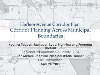
Elk Run Inter-regional Corridor Planning and Reality. MPO Summer Workshop August 11, 2008 Phil Wheeler, AICP, Executive Director ROCOG. A Case Study of the Land Use/ Transportation Planning System. Background on the North 52 Study and Plan Pine Island’s Land Use Plans

E N D
Elk RunInter-regional Corridor Planning and Reality MPO Summer Workshop August 11, 2008 Phil Wheeler, AICP, Executive Director ROCOG
A Case Study of the Land Use/ Transportation Planning System • Background on the North 52 Study and Plan • Pine Island’s Land Use Plans • The Elk Run Development Proposal • The draft AUAR • Mn/DOT’s, DEED’s, Olmsted County’s, & ROCOG’s Responses • The final AUAR and its responses • Current Status
TH. 52 Pine Island / Oronoco SUBAREA Study Vision 52 IRC Plan
Sub-Area Corridor Study • 2000 – consultant selection and contract • April 2001 – public review of preliminary concepts • July 2001 – refined concepts presented, preferred concept identified • August 2003 - Environmental Analysis complete • December 2003 – Open houses on official map
Highway 52 Oronoco to Pine Island Sub-Area Study • Goal: To implement the Highway 52 freeway vision between 85th Street in Oronoco Township and 500th Street in Pine Island by choosing new interchange locations and new or improved connecting roads.
Preferred Study Alternative • Developed through a combination of technical study and local input • Vision is to provide interchange access, serve properties, and maintain connectivity • Other local and regional system connections identified and may be studied further as locals develop long-range plans
Design Elements • Conversion to 4-lane freeway (10.2 miles) • 3 freeway interchanges (CSAH 12/CR 112, CSAH 12/CSAH 5, Main Street) • Closure of all at-grade access • 9.2 miles of new Olmsted County Roads • 2.7 miles of new Goodhue County Roads • 12.3 miles of new frontage/supporting roads
Coming Phases • Phase 2 – Engineering Design and Environmental Assessment • Will begin on October 1, 2001 and should last approximately 12 months • Phase 3 – Right-of-Way Preservation and Official Mapping • Will conclude by January 2003
Next Steps • Jurisdictional Review Period (September 4 – October 15) seeking formal endorsement of Preferred Study Alternative • Phase 2 of Study begins October 1, 2001 • Preliminary Design and Environmental Assessment
Pine Island Council Resolution supporting preferred alternative
Pine Island Council Resolution supporting preferred alternative
Major Milestones • TH 52 Inter-Regional Corridor Study • Sub-Area Corridor Plan & Environmental Assessment 2000 - 03 • Official Map of Preferred Alternative 2003 - 2004
Public Involvement • 47 public meetings on the corridor study or official map • 24 meetings in the City of Pine Island • 18 public open house meetings on study; 12 in Pine Island
What is an Official Map? • A map which establishes anticipated acquisition lines for future streets or sites needed for public facilities • Prepared by licensed land surveyor • Adopted by ordinance by local jurisdictions such as counties and in some cases cities and townships • Authorized in City & County Planning Legislation (Chapters 394 and 462 of statute)
Typical Approach to Developing an Official Map • Establish the need for the project • Long Range Transportation Plan or a Corridor or Subarea Study • Complete a Preliminary Layout and/or Right-of-Way Needs Study • Complete Environmental Review (For projects anticipated to be funded with state or federal $$) • Review and Adopt Official Map
What an Official Map Shows An Official Map document is similar to a Subdivision Plat without any lots – it shows: • A surveyed centerline of the proposed road corridor with right of way limits dimensioned off the centerline OR surveyed right-of-way limits • Anticipated access control for future limited-access roadways typically highlighted
Responsibility of Jurisdictions • Willingness of jurisdiction with zoning authority to administer zoning consistently with the County’s official map • Responsibility on the part of the road authority to negotiate in good faith with affected landowners • Acknowledgement on the part of the public that if resources are not available building construction may proceed
Proposed Official Map Approach • Rely on county and state staff and financial resources to acquire land for needed right of way • Coordinate the review of permit applications between Cities/Towns and the County for lands in the Official Map area • Agree on the roles of cities, towns, county & state in administering Official Maps
Outline of Agreement • Counties will adopt Official Maps • An advisory committee will be created to address issues in administering Official Maps • Towns and Municipalities agree to administer the Official Maps on behalf of the Counties • Counties and MNDOT agree to review permits in a timely manner and to conduct negotiations with landowners
Result • Two Official Maps: one for each County • Each County Official Map goes to County Recorder’s Office • Towns and Municipalities have their own copy of map for use in planning and zoning work • All local jurisdictions entered into the proposed official map agreement
Comparison of Split Interchange to current Off. Map
Elk Run AUAR Olmsted/Goodhue County Line 18 Traffic Impact Study 52 Oronoco City Limits
AUAR Study Area AUAR Study Area Proposed Land Use Pine Island 52 18 Douglas Trail 5 31 12 3 Oronoco 18 52 1.5 mi 5 31 3 5.5 mi
Land Use Scenario Total Land Use Housing: 6,275 Units Est Population: 15,000 Retail: 2.6 million sqft Biobusiness: 1.8 million sqft Industrial: 1.7 million sqft Business Park: 420k sqft The Falls / Assisted Living Traffic Generated Estimated 210,000 trips TH 52 North: 40-45,000 TH 52 South: 60-70,000
Core Area Land Uses in Acres 5 acre non-profit bio-science center * * At a floor area ratio of .2, this would be a commercial area larger in floor area than the gross leasable floor area of the Mall of America
Projected 2025 Traffic Typical Freeway Capacities Typical Arterial Capacities
AUAR Recommended Improvements for 2012 A: Build Interchange on TH 52 B: Construct connection to 59th Ave C: Pave 59th Ave D: Pave 520th St (County Line road) E / G: Convert 52 access to right-in, right out F: Improvements at existing CSAH 11 interchange
2025 Recommendations • 2025 Recommendations • Replace 2012 Diamond Interchange with a Cloverleaf or Split Diamond • 4-6 lanes + multiple turn lanes across interchange from 59th Ave to 80th Ave NW • All frontage or backage roads 3 or 4 lanes
AUAR Plan Staff Concerns 2012 RecommendationsInterchange Construction 31 AUAR suggests connecting only 59th Ave (east leg). West leg should be built to CSAH 31 All right-in, right –out access (E /G) should be closed if interchange is built & frontage roads built AUAR does not address expected public assistance to build improvements Approved 52 Plan 31
Staff Concerns 2012 RecommendationsLocal Streets & Access 31 • AUAR finds that 400,000 sq ft of development could occur without interchange & access to TH 52 limited to right-in, right-out • Under this scenario, drivers will need to travel to Pine Island interchange and Oronoco overpass to make left turns onto highway • AUAR recommends paving 59th Ave from point B northward; paving should extend on 59th Ave south all the way to Oronoco given likely scenario that interchange may not be built for some time / Who pays? • Lack of any local street connections back to Pine Island will force local traffic to use TH 52
TH 52 Impact / 2025 Scenario • AUAR Guidelines state “the geographical extent of the analysis must extend outward as far as the traffic to be generated would have a significant impact on the roadway system… “ • 107,000 vehicles per day projected on 52 at full development • 6 lane freeway needed south to 75th St • Likely right of way, bridge widening impacts in Oronoco in addition to added through lanes needed / issues with noise impacts • Could require curb & gutter with storm sewer instead of runoff managed in ditches • AUAR DOES NOT (but should) ADDRESS POTENTIAL IMPACTS of this change, including especially noise and air and water quality
Other impacts outside of AUAR area not discussed • 29,000 ADT on 59th Ave extending into Oronoco in full build-out scenario • AUAR does not discuss impact or improvement need this would create on East Frontage Rd and in vicinity of overpass in Oronoco (4 lane + turn lanes needed) • 12,000 ADT on CSAH 31 extending south towards CSAH 12 (3 or 4 lane needed) • 7,100 ADT on CSAH 3 south of AUAR Area (turn lanes & bypass lanes, paved shoulders needed) • Ash Rd between 59th Ave and CSAH 18 eliminated (how is service replaced to lands outside of Elk Run?)
Recommended right of way preservation needs in AUAR report. Staff ConcernsLocal Network 2025 AUAR Major Street Network Plan is less extensive than Comp Plan Network though development assumed is more intense AUAR does not mention issue of need for additional River Crossing to facilitate local circulation – results in forcing heavy volumes on 125th St, Main Street, Center St (all County Roads) AUAR does not discuss how many miles of new road may be needed / what costs might be Recommended Future Street Network for south side of Pine Island in Comp Plan River Crossing
River Crossing • Pine Island Comprehensive Plan states • “A new river crossing corridor should be considered somewhere east of the Main Street bridge” • “from a local circulation perspective (it may) be advantageous to plan for another Highway 52 overpass that would functionally link the northeast section of the City with the southern section (via the potential new river crossing)” • Staff concurs with the Comp Plan language • AUAR should discuss this issue (it makes no mention of river crossing issue) • Development in AUAR area will need improved local street network connectivity
Current Footprint 125th St Corridor • Projected traffic of 40,000 to 65,000 • Highest volume non-freeway in Rochester / 30,000 at Wal-Mart South on 63 • General Level of Service guidelines suggest 6 to 8 lanes from 59th Ave to 80th Ave NW • AUAR recommends mixing of expressway and arterial street design to provide adequate capacity • Staff Concerns • High arterial volumes suggest insufficient density of arterial & collector streets • Do not think “expressway” design will be effective • - High capacity interchange which will require larger footprint / more access control / obviously more $$$ - what is impact on Elk Run?
How does AUAR address 2025 Street Network Issues? • Recommends that MNDOT & Counties re-do the TH 52 Environmental Assessment by 2012 • Address interchange needed, additional overpasses, changes to frontage road system, river crossing as part of new EA • Conversely, what could the AUAR have included? • At a minimum an additional analysis scenario evaluating how much development could be supported with an urban diamond interchange that would fit within the right of way officially mapped.
Revised AUAR • Mn/DOT, Olmsted County, and ROCOG registered objections to the notion that comments should be restricted to the2013 phase but should acknowledge the 2025 phase. • Strongly worded objection to AUAR by Mn/DOT.
Outcome • Strong support for Elk Run Bioscience element by Senator Murphy, Governor Pawlenty, and DEED. • Mn/DOT AUAR objection withdrawn. • DEED grant for infrastructure approved. • Groundbreaking for utility extension 8/22/2008. • Pine Island adherence to official map in plat approval conditions.