Download

1 / 22
220 likes | 538 Views
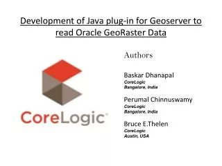
Development of Java plug-in for Geoserver to read Oracle GeoRaster Data. Authors Baskar Dhanapal CoreLogic Bangalore, India Perumal Chinnuswamy CoreLogic Bangalore, India Bruce E.Thelen CoreLogic Austin, USA. Agenda. About CoreLogic Need and Scope Technology and tools used

E N D
Development of Java plug-in for Geoserver to read Oracle GeoRaster Data Authors Baskar Dhanapal CoreLogic Bangalore, India Perumal Chinnuswamy CoreLogic Bangalore, India Bruce E.Thelen CoreLogic Austin, USA
Agenda • About CoreLogic • Need and Scope • Technology and tools used • Architecture • Existing Approach • Plug-in Development • Benefits of this plug-in • Screen shots • Conclusion
About CoreLogic • Launched from The First American Corporation, CoreLogic is a leading provider of consumer, financial and property information, analytics and services to business and government. • We have more than one million users who rely on our data. • We have most comprehensive repository of public, contributory and proprietary data in the United States like mortgage information, parcel and geospatial data; motor vehicle records, criminal background records; national coverage eviction information, payday lending records, credit information, and tax records. • Working with over 40,000 clients in the public and private sectors has given us a vast storehouse of real-world experience to draw upon in helping you create effective solutions that target your unique needs
Need and Scope of this plug-in • Geoserver reads and supports all featureType data like shapefile, point, polygon etc. from local file system as well as from oracle spatial database. It also reads and support raster images from local file system only. It does not support to read GeoRaster data from oracle spatial. This plug-in helps Geoserver to read GeoRaster data from database. • To create separate standalone plug-in for Geoserver to read Oracle GeoRaster data • To include all basic functionalities like zoom-in, zoom-out and panning to GeoRaster data • It should follow all the rules that GeoTools community described to create plug-in for GeoServer.
Technology and Tools used • Windows environment • Java 1.5 • GeoTools API version 2.7-SNAPSHOT • Oracle Spatial Queries • Maven • GeoServer
Architecture • Client application can be any web client which has capability to send http request. • Client application can query Geoserver using WMS request to get required GeoRaster data. • GeoServer in turn query GeoRaster data which is stored in Oracle spatial database using the GeoRaster plug-in deployed in GeoServer. • User can view GeoRaster data in Openlayers window and also in any format like GIF,JPEG,PNG.
Oracle GeoRaster • The core of Oracle Spatial GeoRaster is the physical schema designed to facilitate storing and managing raster or grid-based data inside the database • A GeoRaster table is any user-defined table, which has at least one data column of type SDO_GEORASTER • SDO_GEORASTER objects include metadata and information about how to retrieve GeoRaster cell data which is stored in another user-defined table called a Raster Data Table, which is an object table of type SDO_RASTER. • The SDO_RASTER type includes a BLOB column called RASTERBLOCK, which stores the real raster blocks • Other information associated with the GeoRaster objects can be stored in separate columns or tables, such as a Value Attribute Table (VAT). • The relationship between a GeoRaster object and its raster data table is automatically managed by GeoRaster itself internally using a database dictionary
Geoserver • The GeoServer application is comprised of a series of modules • At runtime, a module can make use of Spring to obtain classes providing services from other modules. This ability to "plug-in" additional functionality forms the basis for GeoServers extension mechanism • Web Map Service (WMS) provides a simple HTTP interface for requesting geo-registered map images from one or more distributed geospatial databases • A WMS request defines the geographic layer(s) and area of interest to be processed. The response to the request is one or more geo-registered map images (returned as JPEG, PNG, etc)
GeoTools • GeoTools is a free software GIS toolkit for developing standards compliant solutions. It provides an implementation of Open Geospatial Consortium (OGC) specifications as they are developed • It is written in Java and currently is under active development. It is used by GeoServer and UDig projects • GeoTools library includes lots of plug-ins to support different data formats with different coordinate reference system
Existing GeoRaster Support • Recently, GeoRaster support has been added in GeoTools 2.6.4 version. It is developed as an extension of “ImageMosaic-JDBC” plug-in • This plug-in takes one xml config file as input that contains all information needed to query GeoRaster data Flaws of Existing approach • It does not mosaic georaster data if the GeoRaster table has ‘n’ number of rows. This feature supports to retrieve only one row of data at a time. • It does not work with other layers. • It is not separate standalone plug-in. It is an extension of “ImageMosaic-JDBC” plug-in. • User has to mention the co-ordinate reference systems (i.e EPSG) in the config file • User has to know “GEORASTER” field name in GeoRaster table and name of the “RASTER DATA TABLE”. All these things have to be mention in config file
Plug-in Development • First we need to store the GeoRaster data in Oracle spatial database • we need to find the way how we can make Geoserver to recognize our code as a plug-in. • To do this we need GeoTools support. Geoserver internally depends on GeoTools library for all data manipulation. GeoTools provides few interfaces and class that needs to be implemented and extended to develop new plug-in. • Geoserver handles two types of data i.e Vector and Raster data. GeoTools has separate hierarchy structure of class to handle these types of data. • Since GeoRaster is raster type of data, we concern about the classes required to handle raster data. Following are the interfaces and classes that needs to be implemented and extended to create new plug-in. 1. org.geotools.coverage.grid.io.GridFormatFactorySpi (interface) 2. org.opengis.coverage.grid.Format (interaface) 3. org.geotools.coverage.grid.io.AbstractGridFormat (class)
Plug-in Development cont., • We build the source code using Maven, a build tool and created jar file. Finally, we placed the resultant jar in lib directory of Geoserver. • Next time, whenever Geoserver starts, it recognizes the jar as a plug-in and it list GeoRaster as valid data source option in Geoserver • This plug-in does not depend on any licensed version jars. • Input Configuration file format <datastore > <coverage>coverage_Name</ coverage > <rastertable>Georaster_Table_Name</rastertable> <server>DB Server IP</server> <dbname>DB NAME</dbname> <port>port</port> <username>username</username> <password>password</password> </datastore>
Plug-in Development cont., • <datastore> Denotes the start of GeoRaster configuration details. • <coverage> User defined name for layer • <rastertable> Name of Georaster table which holds tiles of GeoRaster data • <server> Database server address • <port> Database port • <username> login id • <password> password The configuration files has very few limited information needed to process GeoRaster data.
Benefits of this plug-in • It’s a separate plug-in developed to read GeoRaster data based on “ImageMosaic-JDBC” plug-in. • It mosaic “n” number of GeoRaster data from a table. • It works with other layers. • It needs few information about GeoRaster table in configuration file.
Screenshots cont., • Coordinate Reference systems and Bounding boxes are calculated automatically by the plug-in.
Conclusion • This plug-in helps people who works with GeoRaster data. • Need to check-in the code public repository. • Getting support from various developer around the world by giving the code to them directly. • Contact : dbaskar@corelogic.com for more information.
Thank you…. Questions if any……………..?