Download
1 / 56
560 likes | 716 Views
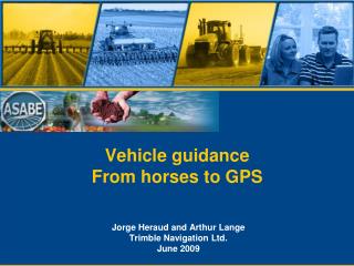
Vehicle guidance From horses to GPS. Jorge Heraud and Arthur Lange Trimble Navigation Ltd. June 2009. The greatest challenge. This generation of engineers and scientists will need to solve the toughest of problems ever encountered

E N D
Vehicle guidanceFrom horses to GPS Jorge Heraud and Arthur Lange Trimble Navigation Ltd. June 2009
The greatest challenge • This generation of engineers and scientists will need to solve the toughest of problems ever encountered • Energy shortage, Food shortage, Fresh water shortage, Global Warming • “Today more than ever before, Science holds the key to our survival as a planet and our security and prosperity as a Nation” Barack Obama, Dec 20, 2008 • I will show you, how previous generations rose to tough technical challenges
For today • History of automatic steering • Modern automatic steering • Why GPS guidance so widely used
1953 – Cabled double row marker1963 – Cabled folding row marker
1921 – Looking through the tractor1951 – Front mounted visual aid
1951 – Double hood mounted visual aid1990 – Windshield and hood visual aid
1987 – Paper tissue marking system Tissue paper roll goes here
1996 – Rocking sensors boundary detection 1998 – Ultrasonic sensor boundary detection
GPS based systems are now the norm for automatic steering • Manual GPS started around 1995 • Automatic GPS started in 1997 • Hydraulic, steer-by-wire, CAN, electric motor
GPS guidance doesn’t accumulate errors Re-start Skips Overlaps Fixed pass guidance GPS, strings when planting orchards Prior pass guidance Visual aides, row markers, foam markers
Convenient embodied technology with a quick payback • Savings of 10%+ on skips and overlaps • Just drive to get the savings • Operate at faster speeds, at night • Reduced fatigue, convenience • All field patterns • All terrains • Facilitates / enables new practices • Strip till, band spraying, drip tape, strip- intercropping • Reduces need for additional on farm labor • Performance not skill dependent • “Grandpa is planting again”
Overlap cut down by 75% Overlap eliminated Automatic 3 section shutoff Automatic shutoff row level Automatic section control Automatic section control minimizes overlap and slow down Reaction time Headland Overlap area Manual shutoff
Automatic section control Field NOT Using Air clutches Field Using Air Clutches
Value Proposition Automated Guidance Implement Guidance Variable Rate Overlap Switching Data Transfer 12.0% 3.0% 7.3% 4.6% ? Total Savings >26.9% 15.0% 22.3% 26.9% 12.0% Engineers working on Automatic Guidance and Precision Agriculture have increased productivity by 26.9% in the last 14 years The Ag Engineering community is ready for the next challenge
GPS Each SV transmits signals and data that are received by the rover (user equipment). This allows the rover to measure the distance to each SV. These are the ‘Pseudoranges’ In 3-=dimensions, it takes 4 Pseudoranges to calculate the position since time at the rover is also a variable. A GPS receiver measures Position, Time, and Velocity. The velocity measurement is independent of the position measurement and is based on the Doppler. 1. Atomic standards in satellites (4 needed) 2. Satellites transmit ranging signals & orbit info 3. Position, velocity, & time computed from range measurements and data message
Increasing GPS accuracy Four or more satellites viewed by two receivers Base station - a high performance GPS receiver placed in a fixed location whose position is accurately known. The GPS measured position is compared sec by sec against the known position, and an error calculated. This error is assumed to be the same error at the rover, and is sent to the rover as a ‘differential correction’. Rover adds error to its measured position to obtain the corrected position Error data is sent to rover with radio Autonomous GPS = 2 meters Differential GPS = 0.5 meters RTK (5 SVs) = 0.02 meters
GPS Operational GPS Satellites • Current Satellites: • 25 IIA/IIRs: • 10 Final Clock* • 2 will be decommissioned Spring 09 • 6 IIR-Ms: (L2C) • Launch planned Mar 09, Aug 09 (with L5 enabled) • Future Satellites • GPS Block IIF (L5) • IIF-1 launch Oct 2009 • GPS III • Launch 2014 • 24 satellites by ~2021
GPS Modernization Benefits • GPS IIR-M L2C (1227 MHz) • Improved L2 signal measurement – slight improvement to IONO measurements • GPS IIF L5 (1185 MHz) • Improved RTK Acquisition • Improved DGPS accuracy • Higher chipping (10^7) • Better ionosphere modeling • Increased Power Level • Improved operation under canopy • Better SNRs • GPS III • L1C designed for interoperability with other systems (Galileo, for example)
Global Navigation Satellite System (GNSS) • GPS • Space Based Augmentation Systems (SBAS) • WAAS, EGNOS, MSAS, GAGAN, GRAS, CDGPS • OmniSTAR, Starfire • GLONASS (Russia) • QZSS (Japan) • Compass (China) • Galileo (EU)
Augmentation Systems for increased accuracy • Space Based Augmentation Systems (SBAS) • WAAS - Wide Area Augmentation System (US) • EGNOS - European Geo Stationary Navigation Overlay System (EU) • MSAS - MTSAT Satellite-Based Augmentation System (Japan) • GAGAN (GPS Aided GEO Augmented Navigation) India • GRAS (Ground Regional Augmentation) AUS • Canadian DGPS • OmniSTAR XP/HP • StarFire
Augmentation Systems for increased accuracy • Ground Based Augmentation Systems • NDGPS MF Beacons (sub-meter) • HA-NDGPS MF Beacons (4 sites are now transmitting) 10-20 cm service (similar to OmniSTAR XP/HP) • RTK Base Stations – local radio transmitters • RTK VRS Networks – internet and cell phones • Trimble Terrasat • CORS (Continuously Operating Reference Station)
U.S. GPS Augmentation Update • Wide Area Augmentation System (WAAS) • Expanding monitor stations into Canada and Mexico • Two SVs at 135 and 138 for North America • WAAS satellites provide L1 and L5 ranging • WAAS provides DGPS corrections including IONO modeling • Nationwide Differential GPS (NDGPS) • DOT’s Research and Innovative Technology Administration, funding of NDGPS is still a concern
European Geostationary Navigation Overlay Service (EGNOS) • Status • AOR-E (120) and IOR-W (126) • Initial Operations • ARTEMIS (124) • Testing • Recommended reading • EGNOS for Professionals web site WWW.ESA.INT