Download
1 / 23
230 likes | 369 Views
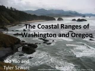
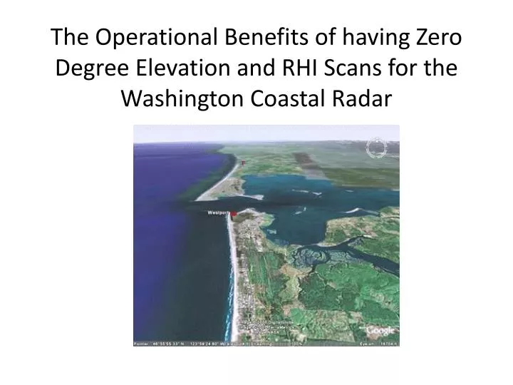
The Operational Benefits of having Zero Degree Elevation and RHI Scans for the Washington Coastal Radar. The need to optimize the radar for a coastal region with terrain.

E N D
The Operational Benefits of having Zero Degree Elevation and RHI Scans for the Washington Coastal Radar
The need to optimize the radar for a coastal region with terrain • Although a “one-size fits all” approach to radar acquisition and use has certain administrative advantages, to do so for the new Washington coast radar would fail to best meet the forecast challenges of the region: • An area ravaged by intense and rapidly evolving cyclones (as they approach and interact with the coast and mountains). These storms approach from the data sparse Pacific Ocean and bring deadly hurricane force winds, heavy precipitation, and devastating floods. • Critical storm structures (coastal jets, low-level jets, frontal-waves, etc.) are typically in the lowest levels with many of them occurring below 10kft. • Critical precipitation production levels and structures are also typically below 10kft. Rare severe convection is also low-topped. • Much of the winter is spent with the melting level between 2 and 5 kft and highly variable in space and time. Determining its height and evolution is critical to precipitation type and flood forecasting. A shift up or down of a 1 kft can make the difference between no flooding and major flooding.
To meet these special regional challenges it is critical that the radar include: • a zero degree elevation angle scan as part of the scanning strategy: • to extend the useable data coverage as far offshore as possible; • to provide the longest possible warning time of approaching storms and information regarding internal low-level structures and features; • to get detailed low-level information regarding precipitation structures and flow over/around the coastal terrain. • the ability to complete RHI scans (interleafed between required PPI scans) along key azimuths: • to accurately place the rain/snow level in the areas of complex terrain; • to get detailed vertical cross sections of precipitation structures and flow over the terrain and to show the structure of approaching weather systems; • To accurately define the bright band/melting level height for input into the storm and river forecast processes; • To view low-level convective storm structure for areas of rotation, wind and heavy precipitation. The typical, albeit rare, severe thunderstorm in the PNW is very shallow and rarely sampled by more than one or two PPI scans with most beams overshooting the cells.
Zero Degree Scan Strategy • A zero degree scan angle allows far greater horizontal range, in this case allowing the radar to view the lower atmosphere much farther offshore. • Concerns about sea clutter were not found to be serious when zero-degree scans were used at Westport during the IMPROVE-1 project, using a radar very similar to the proposed (S-band, dual-polarization).
Zero Degree Scans Proved Effective and Useful During the IMPROVE Experiment • During Improve 1 (Jan-Feb 2001), the zero degree angle scan provided valuable information far out over the Pacific Ocean.
Distance-Height Diagram for Zero Degree and Standard 88-D Elevation Angles VCP 21 example Beamwidth = 0.93 deg The legend indicates the elevation angles Solid (dashed) lines indicate the center (edges) of the beam No coverage at .5 degree Note the absence of low-level coverage of the standard .5 degree elevation angle at greater distances (more than 100 km out). The zero degree angle provides a major improvement in coverage at long ranges in the critical lower atmosphere.
Most of the proposed sites have a good view seaward at zero degrees Example: Saddle Hill
A 0 degree scan allows viewing of significant precipitation features earlier (farther offshore) and can show shallow features overshot by the 0.5 degree scansThis has substantial operational implications
An example of the substantial superiority of 0.0 degree elevation angle over 0.5 degree for seeing important features approaching from the Pacific(Following images are from the SPOL radar at Westport, WA, during the IMPROVE field experiment)
Zero Degree: Heavy Rain Band Obvious Offshore0.5 Degree: Not there.
Even close in: major differences0.5 can’t see heavy low level rain
Necessity of RHI scans • Provides far more vertical resolution because: • The radar continuously scans through elevation angles. • There is no need for interpolation steps from horizontal or conical planes to elevations in the cross section. • Does not have the problem of gaps between scanning levels that is inherent in synthetic PPI-based approaches.
There are a number of reasons why RHI scans are of great value in the western U.S. and why the new WA coastal radar should make use of them • The vertical resolution with which the bright band (BB) and other structures can be determined from PPIs (even with the use of dual polarization) is limited compared to true RHIs. • Determining the level of the bright band (BB)/melting level is critical for hydrologic diagnosis and prediction in the orographic west. • In this region of relatively low freezing levels, BB contamination is a problem for QPE. Detailed BB identification with the best possible resolution i.e., that provided by RHI scans, will facilitate improving the QPE quality.
RHI Scans Have Been Used to Great Advantage in Field Programs Such as IMPROVE and MAP to determine microphysical processes over terrain and bright band levels.
Synthetic RHIs do not allow forecasters to gain a clear picture of the vertical structures of important weather features over terrain and elsewhere
An Example of a Synthetic RHI scan Toward the Cascades using the Camano Island WSR-88D • Note the coarse, broken nature of the cross section, particularly aloft—and this is for a close-in section!
The Contrast with A True RHI is Substantial: More Structure and Detail, No Gaps Example from IMPROVE 1: SPOL at Westport looking to the NE.
More examples of True RHIs Example from IMPROVE 1: SPOL at Westport looking to the W Example from IMPROVE 1: SPOL at Westport looking to the E
A Future Hydrometeorological Testbed • There has been substantial discussion of the Olympic Mountains and western Washington serving as a future hydrometeorological testbed for the NWS and the research community. • A radar capable of operational RHI scans is required for such application. • The proposed new scanning approaches can be evaluated in Washington for use throughout the NWS Western Region.
In addition to the clear operational advantages, there are scientific benefits • Such capabilities will help provide the backbone of a hydrometeorological research testbed that could be centered on the Olympic Peninsula. • This testbed could play an important role in improving precipitation estimates and forecasts over the region. • The fine scale vertical structure of the precipitation field revealed by RHI scans will be essential for validating and calibrating high-resolution models that explicitly represent the microphysics.
Bottom Line • Zero degree scans allow forecasters to see considerably farther offshore and to view low-level structures missed by 0.5 degree scans. • RHI scans greatly enhance the ability of forecasts to diagnose precipitation over complex terrain…which is critical in this region, and to see detailed structures of incoming weather systems. • Both operations and operations-oriented research will greatly benefit from both capabilities.
Radar Specifications • It is essential that the specifications for the new coastal radar include both zero degree elevation scans and RHI as operational capabilities. I.e., the design metrics should allow for repeated stopping/starting PPI scans to complete interleaved RHI scans with acceptable wear. • A zero degree scanning strategy should be included from the beginning. • A hybrid PPI/RHI scanning strategy should be developed by a joint NWS/University team, using data from previous research experiments (IMPROVE) as a testbed. • This strategy can be perfected when the new radar is installed.