Download
1 / 10
100 likes | 129 Views
Learn about partnership models, crucial habitat assessment tools, umbrella species selection, and thoughts on mitigation programs for effective conservation efforts.

E N D
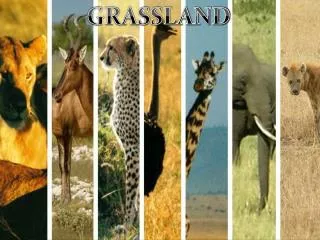
Options and Starting Points for Developing for Multi-Species ESA Conservation ProgramsSpecifically for Threats Resulting in Habitat Loss Sean Kyle WAFWA Industry Service Director Bill Van Pelt WAFWA Grassland Initiative Coordinator
Partnership Models to Address Threats WAFWA Range-wide Plan • Addresses industry-based threats on private lands • Industry mitigation to fund habitat restoration and management NRCS Working Lands for Wildlife (LPCI and SGI) • Addresses agriculture-based threats on private lands • Federal funding for restoration and management of private lands Other Federal Agreements and Initiatives • Addresses industry-based threats, invasives, natural disturbances, etc. • CCA agreements and targeted federal restoration programs (e.g New Mexico CCA & 4FRI)
Partnership Models to Address Threats Multispecies efforts may require combinations of approaches • Species ranges may cross state and federal or private and public land boundaries • Species may be experiencing multiple types of threats • In the case of the LPC, all three types of partnerships are being applied
Grouping Species into InitiativesWhat species do I want to conserve and how? 1) Group by ecotypes to define extent of the program • Grasslands, forests, riparian, aquatic, wetland, BCRs, etc. • Group by threat type groupings and land ownership to determine partnership types • Industry, agriculture, other • Federal, state, or private land
Developing Crucial Habitat Assessment ToolsDefining what is important on your landscape to support those species • Compile GIS habitat data resources for each species in the list • Range maps, ranked habitat quality, and threat layers (industry development, invasive species, agriculture) • Overlay data to identify multi-species focal areas and connectivity zones • Utilize biological information to develop population and habitat goals • Population goals and habitat conservation strategies must be connected • LPC plan used population goals and density estimates to determine how many acres of focal areas and connectivity zones were required. • Incorporate these layers into web-based decision support tools for conservation targeting, avoidance, minimization, and mitigation
Making It ManageableSelecting umbrella species and developing conservation strategies • Rank species groupings at the habitat type scale for: • Home range size • Relation to disturbance • Development avoidance • Identify umbrella species for small, medium and large scales • Select species ideally that are easier to sample and species that you have the most information for • Consider vulnerability analysis (NatureServe, or USFS) • Use home range size and disturbance information to develop guidelines for managing heterogeneity and patch size • Use soils or ESD information to refine and implement these goals • Where possible use NRCS practices to define management actions on private lands • Focus on the species with the largest development avoidance to define avoidance buffers • Defines the scale of impacts for mitigation
Thoughts on Mitigation Programs Some systems are better suited for mitigation than others • Can I restore habitat quickly, efficiently, and successfully? • If not consider higher mitigation ratios and/or focus on permanent habitat conservation How do I value habitat? • See the WAFWA Delivery Guide in the LPC RWP for example • Acres * Habitat Quality * CHAT Multiplier * Endowment Multiplier * Cost • Use a common system to develop unit costs • RWP used NRCS practice costs (restoration and maintenance) and easement costs weighted by how much we expected to use those practices • Where possible, categorize. • Develop a mitigation ratio by considering: • The duration of impacts • The time required to restore habitat • Habitat goals and recovery timelines • See CHAT multiplier in the LPC RWP
Thoughts on Mitigation Programs The money must be secure and long term • The money must be secure, and that usually means some sort of non-profit organization • Develop a business plan and include start-up funds • Include endowment funds for conservation in perpetuity and for admin Have a plan for how to deliver the conservation • Staffing for delivery, monitoring, databases, and reporting • Should you hire staff or use admin funds to support existing agency staff? • Confidentiality requirements may provide the answer to that question Try not to recreate the wheel • What can you cobble together from existing resources? • WAFWA has already has an existing program that may be adapted
Hotspot map of current SGCNs for the study area. Warm colors indicated hotspots and the numbers in legend indicate the number of SGCNs in each color category.