Ollivier & Company
210 likes | 361 Views
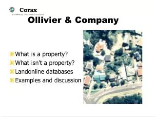
Ollivier & Company. What is a property? What isn’t a property? Landonline databases Examples and discussion. What is a property ?. Is it defined by:. Parcels? 2,308,194 Title? 3,352,999 Assessment? ~2.33 M Owner? 4,873,324 Address? 1,467,005 Property ID?.

Ollivier & Company
E N D
Presentation Transcript
Ollivier & Company • What is a property? • What isn’t a property? • Landonline databases • Examples and discussion
What is a property? Is it defined by: • Parcels? 2,308,194 • Title? 3,352,999 • Assessment? ~2.33 M • Owner? 4,873,324 • Address? 1,467,005 • Property ID?
What is not a property? • Vested roads • Statutory reserves • Crown land • Seabed, lake and riverbed • Unknown appellation • Untitled land
Parcel as a property key? • Original purpose… • Ambiguous appellation • Unit plans not mapped • Multiple parcels for large properties • Undivided shares • Parcels do not have an address
Title as a property key? • Rating Act unit (almost) • Not all parcels “titled” • Boundaries not mapped • Unit titles not locatable • Not in valuation roll • Properties can have multiple titles • Multi-title asssessments
Assessment as property key? • Spatially based rolls • Not all properties assessed • Part properties in different assessment • Unrateable properties ignored • No formal link to parcels 0089000200 LOT 1 DP 50683 LOT 1 DP 59262 LOTS 1 2 DP 74387 LOT 1 DP 102734 ALLOTS M61 S61 SM61 NE61 S62 77 78 97 PT ALLOTS M42 S42 AHUROA PSH ALLOT 134A PT ALLOTSM158 N158 164 165A 165B 266 268 E165 W165 415 MA HURANGI PSH ALLOTS SW30 85 128-134 KOURAWHERO PSH ALLOTS NE45 SW45 46-48 51-52 PT ALLOT 53 ALLOTS 1 45- 148 SO 53558 ALLOT 422 SO 53562 HOTEO PSH BLKS I II V VI X XI MAHURANGI SD BLK VII TAUHOA SD-TN A-ALLOTS 86 92 96 HOTEO PSH PT SUBJ TO OIL & GAS ESMT ONSO 57374 & SO 57375 ALLOT 93 HOTEO PSH ALLOT S E21 21A E22 W22 PT ALLOTS E20 W31 N32 KOURAWHERO PSH PT ALLOT 93 KOURAWHERO PSH-SUBJ TO WATER SUPP LY ESMT
Address as a property key? • Well known to owners • No property address (~10%) • Road names, numbers change • Alternate addresses occur • No defined format • Confused with postal • Addresses are reused • Only a linear reference • “Parcels do not have…”
Owner as a property key? • Customer focus (!) • Multiple owners • Owners own multiple properties (HCNZ) • Owners change but title/parcel does not • Corporate owners • Owner not Occupier
Property-ID as a property key? • Internal unique key • No external reference • Not a legal reference • Financial account bias • Manual maintenance of foreign keys • Inadequate data model for GIS
Ideal Property Architecture • Fully integrated with GIS • Spatial property model • Direct editing of property attributes with graphics • Integrated web access to attributes and maps
In practice councils have separate applicationsConstraints with dual databases • Version upgrades • Common business rules • Replication for performance and simplified security • Synchronisation issues & editing
GIS - LIS • Location of all properties • Boundary definitions • Relations for many-to-many • Support council activities • Consents are on parcels • A map-in-the-app • http server for accessibility
Landonline Simplified National Database Property Relationships Survey Stat Acts Appellation sap Parcel afp Plan Legality lgp Address Road Cl DVR Rates Maori, Other Title Estate ppr ct Relation Table Corax match ets Titles Valuation X Units Owners Property?
Landonlineis the survey database • CRS - digital cadastre • Replaces paper survey plans • High urban accuracy • Linked to Titles & Owners • Surveyors have online access • BDE - bulk supply for others • Coordinates in lat/long-160 • NZGD 2000 datum
LINZ Core Records System does not have : Incremental updates (yet) Links from parcels to road names or addresses Address ranges on centrelines Links to district valuation rolls Mailing addresses Occupier or ratepayer names
LINZ Core Records System does have : Authoritative title, survey and ownership • Survey plans and dates • Titles and dates • Address points • Road centreline names • Strata titles and Unit Plans • Title Owner names • Survey accuracy codes
Corax • Data supply - not an application or design • Supplied as cleaned topological features • Plus related tables to support better model • Source BDE is very large, 24 Gigabytes
Cadastral Parcels Everything is a Parcel
Coordinate upgrading 3,646,142 new end markers (emf) 1,206,211 NZGD2000 survey marks 2,308,194 parcels total 40% of parcels in NZ will be exact
Extra processing in Corax provides : • Label ready fields • Feature codes • EMF points • Separated parcel layers • Separated transport layers • Parcel polygons and lines • Geocoded titles and owners • Open format
Further information: • LINZ Introduction to bulk data v 7 (pdf) • LINZ data dictionary (pdf) • Corax_intro.htm on CDROM • Sample projects ArcView 3, ArcMap


![[Your Company Name]](https://cdn1.slideserve.com/3574980/your-company-name-dt.jpg)