Download
1 / 41
410 likes | 496 Views
Explore geographical impacts on HIV/AIDS response, with GIS role, community involvement, and multi-level governance models. Address mapping accuracy, strategy, and information flow.

E N D
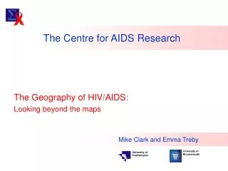
The Centre for AIDS Research The Geography of HIV/AIDS: Looking beyond the maps Mike Clark and Emma Treby University of Bournemouth University of Southampton
Looking beyond the maps • Geography as a driver of understanding versus Geography as a tool for intervention (behavioural or non-behavioural) • Geography as distributions of attributes (choropleth maps!) versus geography as synthesis and spatiality • The geography behind the maps: • Information, action, behaviour • Information and communication (governance) • Information and management The geography of HIV/AIDS: looking beyond the maps
Looking beyond the maps • A typology of HIV/AIDS mapping • Geography and governance: a role for GIS? • Issues of caution • Participation, adaptivity and AIDS response The geography of HIV/AIDS: looking beyond the maps
A typology of HIV/AIDS mapping • HIV, AIDS and response • A working typology of mapping • Policy-influencing (informing and attitudinal) • Strategic (targets and monitoring) • Operational (support and supervision) • Community participation The geography of HIV/AIDS: looking beyond the maps
Simplistic policy-influence concepts “If you do that, this is what will happen to you” “OK, in that case I won’t” The geography of HIV/AIDS: looking beyond the maps
(after The Theory of Reasoned Action: Ajzen & Fishbein, 1975) Adding realism to map influence The geography of HIV/AIDS: looking beyond the maps
2. Strategic (targets & monitoring) The geography of HIV/AIDS: looking beyond the maps
Mapping – The Valley Trust 3. Operational (support & supervision) The geography of HIV/AIDS: looking beyond the maps
P Johnstone & J Ranken (1994) 4. Community participation The geography of HIV/AIDS: looking beyond the maps
A typology of HIV/AIDS mapping ACCURACY • A working typology of mapping • Policy-influencing (informing and attitudinal) • Strategic (targets and monitoring) • Operational (support and supervision) • Community participation Focus on synthesis, aggregation & association Focus on location and sampling HOW DOES GIS RELATE TO ORGANISATIONS? PRECISION The geography of HIV/AIDS: looking beyond the maps
A model of regional governance The geography of HIV/AIDS: looking beyond the maps
A model of regional governance A role for GIS? The geography of HIV/AIDS: looking beyond the maps
A role for information The geography of HIV/AIDS: looking beyond the maps
A model of national governance National-level organisation Provincial-level organisation Flow of management targets District-level organisation Flow of operational information Local-level organisation The geography of HIV/AIDS: looking beyond the maps
A model of national governance National-level organisation Provincial-level organisation District-level organisation Flow of operational information Local-level organisation Flow of management syntheses / maps / models ? The geography of HIV/AIDS: looking beyond the maps
A model multi-level organisation Policy level Management strategy level Supervision level Flow of operational information Operational level Policy informing GIS Flow of management maps / models Operational feedback The geography of HIV/AIDS: looking beyond the maps
A model multi-level organisation Policy level Management strategy level Supervision level Operational level Synthesis, aggregation & association Location and sampling The geography of HIV/AIDS: looking beyond the maps
Provincial-level organisation District-level organisation Local-level organisation Spatial organisation in practice
Applying the model: CHW The geography of HIV/AIDS: looking beyond the maps
CHW information structure The geography of HIV/AIDS: looking beyond the maps
A spatial structure for CHWs The geography of HIV/AIDS: looking beyond the maps
KwaZulu Natal example Mapping – The Valley Trust The geography of HIV/AIDS: looking beyond the maps
The multi-facilitator model The geography of HIV/AIDS: looking beyond the maps
The multi-clinic model Applicable to mobile clinics or health posts The geography of HIV/AIDS: looking beyond the maps
ORGANISATIONAL STRUCTURE SPATIAL STRUCTURE Geography and governance Spatial and organisational structure are inherently and operationally linked Information drives the organisation through these structures The geography of HIV/AIDS: looking beyond the maps
Mapping, culture & élitism The geography of HIV/AIDS: looking beyond the maps
Technology is Power Power Corrupts Technology Corrupts Can we be sure, any more? Information Ethics? The geography of HIV/AIDS: looking beyond the maps
Maps of models of partial representations of subjective indicators of “our” world Can we be sure, any more? The geography of HIV/AIDS: looking beyond the maps
Efficiency Engagement Empowering Equity Elitism Exclusion The intellectual/moral contradiction The geography of HIV/AIDS: looking beyond the maps
Engagement Empowering Equity Elitism Exclusion The intellectual/moral challenge The geography of HIV/AIDS: looking beyond the maps
= GIS = Goal setting = Objective setting RISK ASSESSMENT Why might target be missed INDICATORS For monitoring target and performance of measures BASELINE Status & prediction Adaptive management MODELS/PROCEDURES Prediction/scenario/review TARGETS Where do we want to get MEASURES Needed to achieve target The geography of HIV/AIDS: looking beyond the maps
BASELINE MODELS/PROCEDURES GOALS OBJECTIVES RISK ASSESSMENT MONITOR INDICATORS STAKEHOLDER PARTICIPATION TOOLS ENABLINGTECHNOLOGIES DECISION SUPPORT TOOLS The geography of HIV/AIDS: looking beyond the maps
BASELINE Operational GIS MODELS/PROCEDURES GOALS OBJECTIVES RISK ASSESSMENT Policy GIS MONITOR INDICATORS Strategic GIS VISUALISATION SCENARIOS Options Appraisal NETWORKING ENABLEMENT SOLUT WEB ENABLEMENT SOLUTIONS IMPLEMENTATION PROCEDURES DECISION TREE ANALYSIS RULE-BASED / MULTICRITERIA STATISTICAL / GEOSTATISTICAL MATHEMATICAL MODELLING FUZZY MODELLING BAYESIAN MODELLING The geography of HIV/AIDS: looking beyond the maps
BASELINE MODELS/PROCEDURES GOALS OBJECTIVES RISK ASSESSMENT MONITOR INDICATORS Operational GIS VISUALISATION SCENARIOS Options Appraisal NETWORKING ENABLEMENT SOLUT WEB ENABLEMENT SOLUTIONS IONSIMPLEMENTATION OROCEDURES Policy GIS DECISION TREE ANALYSIS RULE-BASED / MULTICRITERIA STATISTICAL / GEOSTATISTICAL MATHEMATICAL MODELLING FUZZY MODELLING BAYESIAN MODELLING Strategic GIS The geography of HIV/AIDS: looking beyond the maps
Operational GIS VISUALISATION SCENARIOS Options Appraisal Policy GIS Strategic GIS The geography of HIV/AIDS: looking beyond the maps
Operational GIS Policy GIS Strategic GIS The geography of HIV/AIDS: looking beyond the maps
The Centre for AIDS Research The geography of HIV/AIDS: looking beyond the maps