Utah Geological Survey West Desert Ground-Water Monitoring Project
Summary of the Utah Geological Survey's ground-water monitoring project in West Desert, including well drilling program, water levels, and chemistry. Updates on project progress and future work. Dissemination of project information and uses of data.

Utah Geological Survey West Desert Ground-Water Monitoring Project
E N D
Presentation Transcript
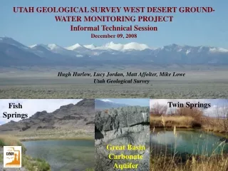
Title UTAH GEOLOGICAL SURVEY WEST DESERT GROUND- WATER MONITORING PROJECT Informal Technical Session December 09, 2008 Hugh Hurlow, Lucy Jordan, Matt Affolter, Mike Lowe Utah Geological Survey Twin Springs Fish Springs Great Basin Carbonate Aquifer
Program summary • Summary of Monitor-Well Drilling Program • ~$3.5M over 2 years (July 1, 2007 • to June 30, 2009) • Wells in basin-fill and carbonate • aquifers • Located near proposed SNWA well field; areas of suspected • interbasin & regional flow; agricultural areas; environmentally • sensitive springs & wetlands; saline water monitoring; • Characterize background water levels and chemistry; • understand regional flow in carbonate & basin-fill aquifer • systems & their connectivity; quantify future drawdown; • data for future ground-water flow models
Update UTAH GEOLOGIAL SURVEY WEST DESERT GROUND-WATER MONITORING PROJECT PROGRESS UPDATE • Three-fourths complete in work and budget as of • December 31, 2008 • 26 sites; 47 boreholes; 64 wells (piezometers)
chemistry1 Previous Data UGS Monitor Wells
Results Results ·Water quality is typically good (<500 ppm total-dissolved-solids concentrations) in the upper 1000 feet of both the basin-fill and bedrock aquifers. TDS increases markedly below 1000 feet. ·Water levels vary from 22 to 1426 feet below land surface. Water levels are shallowest in the Snake Valley basin center, and deepest in the Confusion Range east of Snake Valley. In our new monitor wells on the eastern and western margins of Snake Valley, water levels are similar in the basin-fill and bedrock aquifers, suggesting close connection of the two aquifers. These wells show a slight downward vertical gradient, suggesting recharge to the carbonate aquifer. Upward vertical gradients are observed in the Snake Valley basin center, indicating discharge from the basin-fill aquifer toward the land surface. ·Preliminary data suggest that most ground water in Snake Valley is a mixture of ” modern” (recharged <50 years ago) and “old” (recharged 2,000 to 22,000 years ago) waters. ·Our preliminary aquifer test of the carbonate aquifer yielded a fairly high transmissivity, consistent with results from SNWA’s test of the same aquifer in Spring Valley.
Future work UTAH GEOLOGIAL SURVEY WEST DESERT GROUND-WATER MONITORING PROJECT PROGRESS UPDATE • Work for 2009 • Aquifer tests (2 – Site 11 The Cove & Site 3 East of Garrison) • Boreholes (1 to 5 – Sand Pass, Gandy Salt Marsh South, Upper • Swazey Wash, other???) • Spring-Discharge Gauges (Miller Ranch, Foote Reservoir, Twin • Springs, ?Coyote Spring, ?Dearden Ranch • Saline-water monitoring wells • Re-sample selected wells
Results & benefits Uses and Implications ·This ground-water monitoring system will provide an “early warning” of future ground-water level changes in Snake Valley. ·Long-term, continuous water-level monitoring will help define trends under current conditions, better quantify available resources, and quantify changes if/when new pumping occurs. ·Aquifer-test data will help quantify the capacity of the bedrock (carbonate) aquifer to transmit and store ground water. ·Spatial distribution of sites will help understand regional-scale flow patterns including interbasin flow. ·We expect that our results will be will be incorporated into SNWA’s ground-water flow model for their pipeline EIS, and the model they will present to the Nevada State Engineer at the Snake Valley hearing in Fall of 2009.
dissemination UTAH GEOLOGIAL SURVEY WEST DESERT GROUND-WATER MONITORING PROJECT PROGRESS UPDATE • Dissemination • Project Description and Results available on • UGS web page: • http://www.ugs.state.ut.us/esp/snake_valley_project/index.htm • (updated quarterly) • Summary report at end of project • Uses of Data • Detect water-level changes early to allow mitigation • Calibration of new ground-water flow model • for US BLM EIS for SNWA pipeline • ?? Monitoring system as part of interstate and/or • stipulated agreement (neither currently in place)
Site types Basin-fill Aquifer Carbonate Aquifer Site Types Springs & Wetlands Agricultural areas
completion1 Basin Fill Single-Completion Well Diagram not to scale Carbonate Single-Completion Well Diagram not to scale 12 ¼” borehole diameter 10 ft 14 ¾” borehole diameter 10 ft 20 ft Concrete 6.5” borehole diameter ~10 ft 6 5/8” OD 250 wall steel casing ~20’ into bedrock 20 ft 2” sch 80 PVC bentonite grout ¼” time-release bentonite pellets, ~10 ft 6 1/8” borehole diameter Paired Carbonate-Basin Fill Monitor Well Design sand filter pack 20’ 2” sch 80 0.02”-slot PVC screen Well design by Lucy Jordan (UGS) & Steve Crawford (USGS) Paired well diagram
completion2 Dual-Completion Well Diagram - not to scale - Double-wall steel locking hole enclosure (minimum 2.5’ bgl) Well stick-up min 1.5’ agl w/ venting cap 10 ¾” OD 250 wall steel casing to 20 ft Concrete 12 ¾” borehole diameter 8 ¾” borehole diameter ¼” time-release bentonite pellets 20-40’ 2” sch 80 .02” slot PVC screen 2x12 mesh (#3 Monterey) sand pack 20’ abv & 10’ blw screen ¼” time-release bentonite pellets 30%-solids bentonite grout 2” sch 80 PVC pipe ¼” time-release bentonite pellets 20’ 2” sch 80 .02” slot PVC screen 2x12 mesh (#3 Monterey) sand pack 20’ abv & 10’ blw screen
Spring-Gradient Well Diagram - not to scale - completion3 completion2
Sensitive Species • On UT Division of Wildlife Resources • Sensitive Species List, Tier 1 (highest priority) • Occupy spring pools & riparian habitat in • Snake Valley, Tule Valley, & Fish Springs • Potential candidates for Federal listing as • threatened species Indigenous To Utah Info.from Chris Keleher, DNR Endangered Species Program
Conceptual flow From USGS SIR 2007-5261 (BARCAS final report)
hydrostratigraphy Basin-fill aquifer upper lower Hydrostratigraphy Upper Paleozoic carbonate aquifer Middle confining unit Lower Paleozoic carbonate aquifer Modified from Hintze and others (2000) Lower confining unit hydrostratigraphy Hydrostratigraphy
Basin fill 2 Data from Saltus and Jachens, 1995 Basin-FillAquifer Basin Fill