Download

1 / 19
190 likes | 408 Views
UAS for Remote Sensing Myths and Realities. 33rd International Symposium of Remote Sensing of the Environment Steve Wegener Bay Area Environmental Research Institute NASA Ames Research Center 6 May 2009. Outline. History of UAS as a Remote Sensing Platform

E N D
UAS for Remote SensingMyths and Realities 33rd International Symposium of Remote Sensing of the Environment Steve Wegener Bay Area Environmental Research Institute NASA Ames Research Center 6 May 2009
Outline • History of UAS as a Remote Sensing Platform • UAS Remote Sensing Mission Requirements • UAS as a Remote Sensing Platform • expectations, • institutional bias, • authority to operate, • command, control, and data communications, • reliability, • contingency management, • staffing costs • UAS as Airborne Science Platform Experience • Conclusions
Early Unmanned Aircraft The 1917 Kettering Bug was an aerial torpedo, the forerunner of what today is considered a UAV or a cruise missile. It was capable of striking ground targets up to 75 miles (120 km) from its launch point.
Ryan Firebee The Ryan Firebee was a series of target drones or unmanned aerial vehicles developed by the Ryan Aeronautical Company beginning in 1951. It was one of the first jet-propelled drones, and one of the most widely-used target drones ever built.
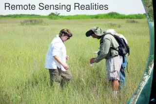
UAS as Remote Sensing Platform • Basic airborne imaging platform operational requirements for remote sensing include the following; • Stability enough to provide needed resolution and coverage; • Operational range / altitude sufficient to cover targets efficiently; • Payload capability sufficient to support imaging system and associated control-data-communications systems; • Operate safely; • Affordable- Cost effective
UAS as a Remote Sensing Platform • Expectations, • Institutional bias • Authority to operate, • Command, Control, and Data Communications, • Reliability, • Contingency Management, • Staffing costs
UAS as a Remote Sensing PlatformChallenges • Institutional bias • Authority to operate, • Command, Control, and Data Communications, • Reliability, • Contingency Management, • Staffing costs
UAS as a Remote Sensing PlatformChallenges • Institutional bias • Authority to operate, • Command, Control, and Data Communications, • Reliability, • Contingency Management, • Staffing costs
UAS as a Remote Sensing PlatformChallenges • Institutional bias • Authority to operate, • Command, Control, and Data Communications, • Reliability, • Contingency Management, • Staffing costs
Examples • Aerosonde • Vector P • Sierra • Ikhana • Global Hawk
Examples • Aerosonde • Vector P • Sierra • Ikhana • Global Hawk
Examples • Aerosonde • Vector P • Sierra • Ikhana • Global Hawk
Examples • Aerosonde • Vector P • Sierra • Ikhana • Global Hawk
Examples • Aerosonde • Vector P • Sierra • Ikhana • Global Hawk
UAS Issues and Challenges • Acceptance in Airspace • Cost • Reliability • RF Spectrum
CONCLUSIONS UAS are an emerging technology that holds great promise. While unmanned aircraft capabilities overlap with capabilities of manned platforms, the UAS niche will continue to be supporting needs that can’t be met by manned aircraft. This will continue until reliability and operational life cycle costs are comparable with manned aircraft.
NRC Decadal Survey The transition of airborne programs at NASA and NOAA from conventional aircraft to unpiloted aerial vehicles (UAVs) presents opportunities as well as risks. UAVs provide increased range and flight time and the ability to penetrate environments that might be too hazardous for piloted aircraft. However, issues of cost, reliability, software, and proximity to urban areas have limited the use of UAVs to demonstration missions. For now, conventional aircraft remain more reliable and more cost-effective for Earth sensing, and agencies need to ensure an appropriate balance between these two types of platforms.
UAS TodayUAS Types, Operating Altitude, Endurance and Payload Capabilities 70K Global Hawk U-2 HALE 60K Heron 2 Predator B 50K 40K Altitude 30K MALE Heron 1 Predator A 20K 10K Aerostar, Hermes, Sky Eye, Vigilante, Fire scout, Hunter, Shadow 200 10 MAV LALE 20 Endurance (hours) 30 LASE VTOL
Thank you Steve Wegener NASA Ames Research Center, MS 245-5 Moffett Field, CA 94025 650/604-6278 swegener@mail.arc.nasa.gov