Download
1 / 33
330 likes | 461 Views
Status of MERIS validation activities. at BOUSSOLE. MERIS, March 4, 2003. David ANTOINE. Laboratoire d’Oceanographie de Villefranche (L.O.V.), France. Outline. Some acknowledgement slides Reminder about - The project context and objectives, - The site where we are working

E N D
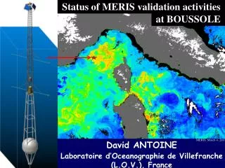
Status of MERIS validation activities at BOUSSOLE MERIS, March 4, 2003 David ANTOINE Laboratoire d’Oceanographie de Villefranche (L.O.V.), France
Outline • Some acknowledgement slides • Reminder about • - The project context and objectives, • - The site where we are working • - The data we are collecting • Why a new mooring type ? • Quantitative summary of data acquisition • MERIS matchups & comparison with SeaWiFS and Aqua-MODIS • Conclusions / recommendations
Funding Agencies / Supports European Space Agency Centre National d’Etudes Spatiales, France National Aeronautics and Space Administration of the USA Centre National de la Recherche Scientifique, France Institut National des Sciences de l’Univers, France Observatoire Océanologique de Villefranche sur mer, France
Acknowledgements In addition to our supporting/funding Agencies, We also express our appreciation & thanks to The crews and Captains of : the Castor-02 vessel from the Fosevel Marine company (buoy/mooring operations), the INSU R/V Téthys-II (regular monthly cruises), the GG-IX from the Samar company (buoy servicing) Pilots of the Valair and Commerçair helicopter companies, for their willingness in accomplishing for us unusual survey missions above the BOUSSOLE site. The French institute IFREMER and the Norvegian Marintek company are also thanked for their help and fairness in the engineering studies that were ordered to them after the major failure of the buoy in spring of 2002. The French weather forecast Agency, “Meteo France” (real time data that are of great help in the day-to-day management of the monthly cruises). The Brockmann Consult company (Germany) for data distribution The ACRI-in/Genimar (Sophia Antipolis, France) and Satlantic Inc. (Halifax, NS Canada) for the buoy & instrument system designs Emmanuel Bosc, Maria Vlachou, Guillaume Lecomte, Edouard Leymarie, Fanny Tièche, who are helping in data acquisition at sea.
People involved • RESEARCH STAFF (L.O.V., Villefranche sur mer) David ANTOINE, Chief Scientist Marcel BABIN, Natural phytoplankton fluorescence Annick BRICAUD, IOPs Malik CHAMI, Ocean colour vicarious calibration Hervé CLAUSTRE, IOPs, Biogeochemical proxies • Fabrizio d’Ortenzio Associate project manager (starting 2006) • André MOREL, AOPs • TECHNICAL STAFF (L.O.V., Villefranche sur mer) • Alec SCOTT, Responsible for monthly cruises, data processing (2003-2004) • Guislain BECU, idem (2004 - ongoing) Bernard GENTILI, Data processing codes Francis LOUIS, Servicing, electronics, design Joséphine RAS, HPLC and ap measurements Dominique TAILLIEZ , CTD + IOPs, monthly cruises David LUQUET, Diving TECHNICAL STAFF, partnership with companies Pierre GUEVEL, ACRI-st-Genimar, Buoy design, hydrodynamics calculations Jean-François DESTE, ACRI-st-Genimar, Engineering work (e.g., reduced scale model), testing • Philippe BARDEY, ACRI-st, Expertise • Ludovic BOURG, Grigor OBOLENSKY • Alpha CAMARA, “Avance Conceptuelle”, Buoy design, structure calculations • Cyril DEMPSEY Satlantic Inc. • Darrell ADAMS Satlantic Inc.
Motivations Establish a time series of inherent and apparent optical properties (IOPs and AOPs), with two parallel objectives : - Science objectives : short-term changes in IOPs and AOPs, relationships between both, role of CDOM, seasonal and inter-annual changes, bidirectionality of the ocean reflectance... - Operational objective : vicarious radiometric calibration of ocean color observations from space, and validation of the level-2 “geophysical products” (e.g., chlorophyll, normalized radiances).
Strategy Combination of 3 elements : - A deep sea mooring, collecting data on a “continuous” basis - Monthly cruises for collecting data that are not accessible to the mooring (vertical profiles, water sampling), as well as for servicing the mooring - A coastal AERONET station, providing the necessary information about the aerosol properties, which are a central element of the vicarious calibration process
Measurement suite, instrumentation - Buoy: Surface irradiance (Es), downwelling irradiance (Ed), upwelling irradiance (Eu) and upwelling radiance at nadir (Lu) at 4 and 9 meters (7 l’s Satlantic’ OCR-OCI 200 Series), attenuation coefficient (Wetlabs C-star), backscattering coefficient (2 l’s, Hobilabs’ Hydroscat), chlorophyll fluorescence (Chelsea MiniTracka). Temp., Pressure, Salinity at 9 meters (SeaBird’ SBE37), buoy tilt and compass. - Monthly cruises In-water profiles of Ed and Eu at 13 l’s (Satlantic’ SPMR/SMSR), above water determination of Lw, phytoplankton pigments (HPLC), phytoplankton absorption (filtered water), total absorption, scattering and attenuation coefficients at 9 l’s (Wetlabs’ AC9), backscattering profile (Wetlabs’ eco VSF) and CDOM fluorescence (Wetlabs’ CDOM WetStar). Aerosol optical thickness (CIMEL CE-317 or SIMBADA). - Coastal AERONET Station (CE-318 sun photometer) : aerosol optical thickness, sky radiances (aerosol types) and polarization
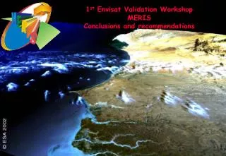
The site where we collect data : “BOUSSOLE” site & program “Buoy for the acquisition of a long-term (bio)optical series” Monthly cruises (started July 2001) + a new type of optical buoy (since Sept. 2003) Marine optics, Bio-optics, Ocean color calibration / validation program (MERIS, SeaWiFS, MODIS, PARASOL)
Site characteristics (oligotrophic to eutrophic) Winter, Maximum of the water mixing Chl ~0.2-0.5 mg m-3 mixed layer down to 1000 meters Summer, Maximum of the stratification. DCM is maximum, with surface Chl ~0.05-0.1 mg m-3 (up to 1 in the DCM) Spring, Bloom Chl up to ~ 3-5 mg m-3 End of fall, Erosion of the thermocline, the DCM progressively disappears Chl ~ 0.2-0.5 mg m-3
SeaWiFS chlorophyll 2001-2004 (in correspondence with our monthly cruises) Feb March Apr May Jun Jul Sept Oct Nov Dec 2001 2002 2003 2004 SeaWiFS/SIMBIOS « diagnostic data sets » (http://seawifs.gsfc.nasa.gov/cgi/seawifs_region_extracts.pl?TYP=ocean)
Why a new mooring type ? (1/2) • All our radiative transfer (and derived algorithms) : plane parallel assumption : horizontally-homogeneous ocean (horizontal gradient of irradiance E or radiance L is considered negligible) • Satellite pixel size is ~1km (at least several hundreds of meters) • “Sea truth” data are made of individual profiles (scale ~1 m) • In a homogeneous ocean (in terms of IOPs), this would not be a problem when the sea surface is perfectly flat • Irradiance profilers provide however highly noisy data near the surface because of the effect of capillary and gravity waves the horizontal gradient in E or L is often an order-of-magnitude larger than the vertical gradient (see, e.g., Zaneveld et al., Appl. Opt., 40(9), 2001)
Why a new mooring type ? (2/2) This is what the BOUSSOLE buoy is making possible, by maintaining verticality, warranting the stability of the instruments, and avoiding shading of the instruments by the buoy structure. Taught mooring + « transparent-to-swell » tubular structure without a surface buoy • The data near the surface are usually unusable whereas they are the ones that should be used when satellite validation is concerned One “solution” : Integration over an “infinite” number of individual and simultaneous profiles covering a large area Another solution : Integration over time with a sensor maintained at a fixed position and depth (w.r.t. the bottom).
25 meters Minimum shading from the buoy itself -4 m radiometers radiometers Burst acquisition mode (1 minute at 6 Hz) : Possibility of filtering the effects of the wavy interface to get closer to the true value of Kd or Ku, and then achieve a better extrapolation to “just below the surface” -9 m
Deployments summary Monthly cruises started in July 2001, ongoing Buoy deployments : - July to October 2000 : qualification deployment - May 2002 : first, unsuccessful deployment - Sept 6 - Dec 6, 2003 : 3-month successful deployment - March 4, 2004 - June 2005 : 15-month successful deployment (including a rotation in July 2004) - Mid June 2005 : full buoy+mooring rotation - data acquisition is ongoing AERONET site, data collection periods : - July 2002 to April 2003 - January to November of 2004 - February 2005, ongoing Project should extend at least throughout the MERIS life
Data summary : monthly cruises
Data summary : buoy Data summary : AERONET
Matchups summary at BOUSSOLE Obtained from buoy data : 3 months in fall 2003 8 months in 2004 (March, mid May-mid July, Aug - Dec) 1 ½ months in 2005 (Mid Feb. to end of March) SPMR data : monthly cruises up to Sept 2004 MERIS data : Mid June 2002 to end of March 2005 very last reprocessing, “MEGS7.4” (summer 2005) MERIS : N = 55 (48 + 7) MODIS : N = 85 (77 + 8) SeaWiFS : N = 98 (79 + 19) Criteria : no glint, not at a cloud border, QC in situ data. More selective criteria (low AOT, small qs, low wind speed etc...) leads to a reduction of these numbers by at least 50%
MERIS matchups resuts & Comparison with SeaWiFS and Aqua-MODIS
Matchups examples BOUSSOLE (1/4) : March 22, 2004 MERIS Chl ta(865) A-MODIS Chl ta(869) SeaWiFS Chl ta(865)
Matchups examples BOUSSOLE (2/4) : May 29, 2004 MERIS Chl ta(865) A-MODIS Chl ta(869) SeaWiFS Chl ta(865)
Matchups examples BOUSSOLE (3/4) : June 17, 2004 MERIS Chl ta(865) A-MODIS Chl ta(869)
Matchups examples BOUSSOLE (4/4) : October 6, 2003 MERIS Chl ta(865) A-MODIS Chl ta(869) SeaWiFS Chl ta(865)
MERIS matchups (rw’s) BOUSSOLE site 1:1 line Linear scale 48 points from the buoy 7 points from the SPMR (monthly cruises) Log scale
SeaWiFS matchups (nLw’s) BOUSSOLE site 1:1 line Linear scale 79 points from the buoy 19 points from the SPMR (monthly cruises) Log scale
Aqua-MODIS matchups (nLw’s) BOUSSOLE site 1:1 line Linear scale 77 points from the buoy 8 points from the SPMR (monthly cruises) Log scale
Matchups statistics at BOUSSOLE (MERIS, SeaWiFS & A-MODIS) Normalized reflectances Normalized water-leaving radiances
MERIS matchups at MOBY (rw’s) 1:1 line Linear scale 24 points from the buoy (~ 5 months from August 2002 to January 2003) Log scale
Chlorophyll matchups MERIS SeaWiFS A-MODIS All matchups With the radiometry QC
Conclusions / Ongoing & future work (1/2) - Quasi-operational system, including two complete moorings (mooring line + buoy + instrumentation) ==> Continuous sampling is at reach. ==> About 40 to 50 matchups per year for MERIS 80 to 90 matchups per year for MODIS & PARASOL ==> MERIS shows a significant overestimation in the blue, and a problem in the red A-MODIS looks pretty good (low bias, low dispersion) SeaWiFS shows a slight underestimation and a slightly larger dispersion So : should we now introduce a vicarious calibration for MERIS (not necessarily with the same methods than for other OC sensors) or should we concentrate on algorithms (in particular atmospheric corrections) ? Probably both.
Conclusions / Ongoing & future work (2/2) - A dedicated person is needed in order to go further in the understanding of the problems we have, in particular with the blue bands. - Still a lot of work toreduce satellite versus in situ scatter (1) Further interpret the matchups’ results (2) Further QC the buoy data, (3) Introduce corrections, e.g., for self-shadow and buoy shadow, tilt on Es (4) Improve the data processing, e.g., surface extrapolation (5) Introduce SQM-II relative calibrations (6) Improve bio-fouling elimination - Vicarious radiometric calibrationof MERIS (i.e., simulating the TOA total radiance and comparing with what MERIS is providing) The tools (inversion procedures & RT codes) & the data (AERONET) are nearly Ok ==> results by the end of 2005. - Optics / bio-optics End of 2005 & 2006 : data exploitation will really start - A data base, including the full data set and some public-access data, is under construction (opening end of 2005).
Thank you for your attention