Download
1 / 21
210 likes | 407 Views
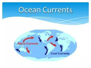
Status of Current Ocean- Colour Missions. Indian Remote Sensing Satellite (IRS) P4 OCM. IRS-P4 OCM features. Launch Date: 26 may 1999 Launcher: PSLV, India Orbit: Sunsynchronous Polar Altitude: 720 Km Equatorial crossing time: 1200 h (Descending node)

E N D
Status of Current Ocean- Colour Missions Indian Remote Sensing Satellite (IRS) P4 OCM
IRS-P4 OCM features Launch Date: 26 may 1999 Launcher: PSLV, India Orbit: Sunsynchronous Polar Altitude: 720 Km Equatorial crossing time: 1200 h (Descending node) Along track tilt: 20o (to avoid sunglint) Ground resolution: 360 x 236 m Swath : 43 (1,420 km) Quantisation : 12 bits
Standard OCM Data Product False Color Composite (FCC) of bands 8,6 & 4
OCM Data Products Level 1: Geo & radiometrically corrected radiances for scenes ofsizes (i) ~ 1420 km x 1420 km (ii) ~ 710 km x 710 km (quadrant products) (iii) ~ 100 km x 100 km Level -2:Standard products over the above scenes of (i) Chlorophyll (ii) Suspended sediments (iii) Yellow substance (iii) Diffuse attenuation coefficient (iv) Aerosol optical depth (v) Normalised water leaving radiance
OCM Data Products Level -3: Weekly and monthly averages on a trial basis being generated for (i) Chlorophyll (ii) Suspended (iii) Diffuse attenuation coefficient (iv) Aerosol optical depth • OCM coverage around India is available for browsing in the NRSA website • Level –1 & 2 can be acquired by users directly from NRSA on payment • The processing s/w developed at SAC is distributed to users for a nominal cost
OCEAN COLOUR VALIDATION EXPERIMENTS • Five cruises onboard ORV Sagarkanya/Sagarkanya were conducted in the Eastern Arabian Sea. • A cruise (45 days) from Chennai to Mauritius & back was undertaken in October-November 2002 (IOGOOS). • Seven cruises in the coastal waters of Bay of Bengal for coastal processes and development of case 2 algorithm. • SeaWiFS protocols For optical measurements and JGOFS protocols for Oceanographic observations were followed.
PARAMETERS MEASURED PARAMETERS INSTRUMENTS ORGANIZATION Chlorophyll Fluorometer, HPLC, CTD NIO, CMFRI, SAC Yellow Substance Spectrophotometer, CTD NIO, Suspended Sediment Balance NIO, CESS, GSI Primary Production Scintillation Counter, CTD NIO Zooplankton Plankton net, Microscope NIO, CMFRI Upwelling Radiance & SPMR, LUR SAC, NIO, NRSA Downwelling Irradiance Abs. & Backsact. Coeff. AC-9 meter NIO, SAC Spectral Optical Depth Sunphotometer SAC, PRL, SPL Total Solar Flux Pyrheliometer PRL Aerosol size distribution QCM PRL Wind direction & Speed Anemometer IMD, GSI, NIO SST Thermometer SAC
Inter Sensor Merging and Comparison of the Ocean Color Data - OCM & Seawifs • OCM and SeaWiFS derived chlorophyll images were produced • And inter-comparison is done. OCM derived chlorophyll SeaWiFS derived chlorophyll
Inter Sensor merging and comparison Atmospheric correction procedure developed at SAC is compared with SeaDAS output. Good match is found between chlorophyll images generated by SeaDAS & SAC developed procedure. The case 2 water mask thresholds are different for SAC developed software and that of SeaDAS. Chlorophyll image generated by SAC Software for SeaWiFS Data Chlorophyll image generated by SeaDAS software For SeaWiFS data
First MODIS-TERRA OCEAN Products generated at SAC/ISRO Gujarat Gujarat Gujarat Water-leaving rad. 490 nm Chlorophyll-a mg/m3 Aerosol optical depth 865 nm MODIS-TERRA data of October 7, 2002 over the Arabian Sea
Remote Sensing of Diffuse attenuation of Light in upper ocean layer (water clarity) using OCM data of 22 March 2000 K(490) image shows Diffuse attenuation of Light in upper layer of Ocean at 490 nm. This is an indicator of Visibility in the upper Oceanic layer Z90 image is inverse of K490 image and shows The depth of light Penetration upto which Surface light field Reduces to 33% This information is Useful for sub-marine Navigation, Divers visibility, Ocean surface heating Gujarat Gujarat Arabian Sea Arabian Sea Z90 image in meters K(490) image in 1/m
Ocean Modelling • Joint studies with IISc: • Time evolution of OCM derived chlorophyll concentration and total suspended matter in the Bay of Bengal for the study of seasonal general circulation features in the southern bay adjoining Sri Lanka • ARMEX Phase II – Analysis of OCM, MODIS and TRMM data on chlorophyll, TSM, SST and in-situ measurements on surface fluxes of heat, momentum, moisture depth profiles of solar short wave radiation penetration to understand the dynamics of Arabian warm pool
Ocean Colour Validation Future Plans A Cal-Val site near Lakshadweep Islands has been approved. Detailed plans are being worked out. A Data buoy/platform to be deployed to collect visible and NIR radiation entering and emanating from the ocean, temperature along with other meteorological and oceanographic parameters about 4-5 times a day.
Marine FisheriesShort Term Forecasts • An approach developed through integration of SST with chlorophyll • Validation experiment carried out for three years (1999-2002) • 70-90 per cent success rate (reliability) • 70-200 per cent increase in catch • Benefit to cost ratio has increased from 1.25 to 1.45 for bottom trawling and 1.3 to 2.25 for gill-netting. • Efforts are ongoing to improve the validity period by incorporating information on surface wind. Oceansat II will provide surface wind along with colour information from same platform. • Approach transferred to INCOIS/DOD. Operationised for the entire country.
Marine Fishery – Short-term forecast • Forecast are generated every third day and are valid for three-four days. • The forecast helps in reducing catch per unit effort. • Forecast contains information about distance, direction and depth of potential fishing zones from nearest fishing harbour in local language. This information is also disseminated through local newspaper, radio, etc. • Forecast is sent all major fishing harbours, fishing cooperatives, free of cost by INCOIS.
Marine Fishery - Feedback from FSI Track No. Depth(m) HR (%) Date species Thunus albacore Thunus albacore, Yellow fin Thunus albacore Thunus albacore, Shark Thunus albacore, Yellow fin Thunus albacore, Yellow fin 2589 3.8 18-02-02 1701 1.9 19-02-02 1876 1.0 20-02-02 2727 1.2 21-02-02 1791 2.1 22-02-02 1860 1.9 23-02-02 1 2 3 4 5 6 Average HR before bloom : 0.2 %
Detection of Algal Bloom Tricodesium bloom observed on the Saurashtra coast, during the month of May.
Coastal Circulation & Plume Dynamics using OCM Sediment images in Krishna-Godavari Delta, Bay of Bengal TSM in mg/L TSM in mg/L Godavari Godavari Krishna Krishna Bay of Bengal Bay of Bengal N 12 Dec 1999 1 Mar 2000 Wind Vectors are plotted using QuickScat data of NASA
PATTERNS OF SUSPENDED SEDIMENTS SHOWING LARGE SCALE SEDIMENT TRANSPORT & CIRCULATION FEATURES ALONG PARTS OF INDIAN COAST DERIVED USING IRS-P4 OCM DATA October 06, 1999 November 10, 2000 January 11, 2000 January 21, 2000 January 02, 2000 January 18, 2000 January 04, 2000