Download
1 / 35
350 likes | 506 Views
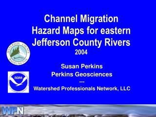
Channel Migration Hazard Maps for eastern Jefferson County Rivers 2004. Susan Perkins Perkins Geosciences --- Watershed Professionals Network, LLC. Intent of Hazard Maps. FEMA Flood Insurance maps have limited application in planning areas safe for development

E N D
Channel Migration Hazard Maps for eastern Jefferson County Rivers2004 Susan Perkins Perkins Geosciences --- Watershed Professionals Network, LLC
Intent of Hazard Maps • FEMA Flood Insurance maps have limited application in planning areas safe for development • CMZ delineations help reduce risks to human communities by guiding development away from areas at risk of channel erosion • Channel migration is not limited to areas below 100-year flood elevation • Channel migration may not be limited to HMZ • CMZ delineation allows planners and managers to weigh the relative risks of human development with habitat preservation over time Slide courtesy of Wash. Dept. of Ecology
Channel Migration Hazard Maps CMZs were reclassified into: • Disconnected Migration Areas (DMA) • High hazard • Moderate hazard • Low hazard
Disconnected Migration Areas • substantial, continuous bank protection structure OR • demonstrated commitment and ability of government agencies to prevent future channel migration • consulted with Jefferson County Public Works Dept. and Natural Resources Division • DMAs may still be subject to flooding
Deltas from Rosgen (1996)
Hazard Level HIGH near river, or low former channel MODERATE LOW farther from river, surface unchannelized Approx. Time Frame < 50 years 50-100 years > 100 years Hazard Delineation
Hazard Delineation • Geomorphic channel type • Type of channel migration • lateral • avulsions • Sediment regime • transport • deposition • Constraints on channel migration
Geomorphic Channel Types • Delta/alluvial fan • Wandering river • Straight and entrenched currently, but formerly meandering • Straight and narrow (always)
Distributary channels Avulsions Depositional Major constraints on channel migration Cross-floodplain roads Extensive levees or revetments Reaches Little Quilcene A Big Quilcene A Duckabush A Duckabush B Dosewallips A Dosewallips B Delta/alluvial fan reaches
Moderate Hazard Zone Remainder of AHZ and EHA Delta/alluvial fan hazard assignment High Hazard Zone HCMZ (+AHZ +EHA where not blocked by constraints)
Wandering river reaches • Meandering with bend cutoffs and avulsions • Straight at times following avulsions • Depositional, or mixed transport and deposition • Low, active floodplain • No or few constraints on channel migration Reaches • Little Quilcene B • Little Quilcene D • Big Quilcene B • Big Quilcene E • Duckabush C • Dosewallips D • Dosewallips G
Wandering river avulsion example -- Duckabush old channel new channel
Wandering River hazard assignment High Hazard Zone HCMZ +AHZ +1/2 of EHA width Moderate Hazard Zone Remainder of EHA
Straight and Entrenched reaches:CMZ now narrower than historic • Minor to no bend growth, or bends occur within a narrower zone than HMZ • Sediment transport, or sediment supply where bed has degraded • Was channelized in past • Entrenched • Discontinuous revetments constrain channel migration Reaches • Big Quilcene C • Big Quilcene D
Straight and Entrenched hazard assignment High Hazard Zone ½ to 2 EHA widths from the year 2000 active channel edge Moderate Hazard Zone Remainder of EHA
Big Quilcene B C D E
Straight and Narrow reaches • Minor to no bank erosion, no bend growth • Few bends, held in place by erosion-resistant geology • Sediment is transported through reach • No man-made constraints on channel migration • Bedrock or glacial bluffs constrain channel Reaches • Little Quilcene C • Big Quilcene F • Dosewallips C • Dosewallips E • Dosewallips F
Straight and Narrow hazard assignment High Hazard Zone HCMZ Moderate Hazard Zone AHZ + EHA
Dosewallips E D
Limitations of CMZ Maps • Maps show relative risk, not a precise prediction of time or location • Not all High and Moderate hazard areas will be occupied in next 100 yrs • Though unlikely, some Low hazard areas could be occupied • Maps do not depict flood risk • Maps do not depict landslide risk • If erosion-resistant bank materials are present, risk would be lower • Transitional zones at downstream ends of straight reaches should be reassessed every 10 years.
Confidence Level • Generally high • 63+ years of historical data • Excellent LIDAR maps • Field work • Migration distance >> map error • Lower in upstream ends • No LIDAR • migration distance < map error