
Efficient Asset Management for City Parks: Accela Software Implementation
Learn how the City of New Braunfels manages its Parks and Recreation assets using Accela software for streamlined operations and maintenance. Follow the GIS methodology, unique asset IDs setup, and asset management automation benefits in this project.

Efficient Asset Management for City Parks: Accela Software Implementation
E N D
Presentation Transcript
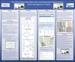
The management of any Government Agencies Department’s assets is crucial in order for things to be organized and run smoothly. For instance, a Municipal Government’s Parks and Recreation Department’s management of assets can become a real hassle for cities with increasing populations or that have unique features, like pristine rivers, that attract visitors from all over. To counter these types of management problems companies like Accela have developed software to assist City and Government agencies. New Braunfels, TX has joined its City Government with Accela and is in the process of implementing it’s software into their various departments including the Parks and Recreation Department. The City’s GIS Analyst and Accela Manager William Flynn has been playing a major role in getting this process going. Accela offers a wide variety of tools for managing assets. Works orders like the trash removal of Landa Park can be assigned when needed or even put on a consistent schedule using preventive maintenance. The work order example at the bottom of the Results section specifies removal of trash from plastic bins only. Accela GIS offers a map of exactly where these specific trash cans are located throughout the park saving time and labor hours of the city employees in the field completing the work order. Below is a map of all of the features we collected through GPS or digitized through our fieldwork at Landa Park. This is an example of different assets that can be maintained through Accela’s asset management automation. Introduction Purpose and Scope There were three major sections for our methodology of which two sections are shown below in Generalized Flow Charts. The first section consists of the GIS portion of obtaining the Park Boundary and Landscape Maintenance data. The second section is similar to the first and consists of the GIS data from five assets associated with the parks: picnic areas, pavilions, spigots, drinking fountains, and trash cans. The third section details the synching of all the aforementioned GIS data with the Accela asset management system. Methodology Unique asset IDs were assigned to each park and the park assets found within.This allowed for parent/child relationships in Accela. For example, asset #15 in the asset type parks is assigned to Landa Park and would be considered the parent to the assets located in the park. Discussion Results Conclusion This project is Presented by: Kevin Scardino: Project Manager and GIS Analyst Nathan Andrews: Assistant Manager, GIS Analyst and Web Master Mukarram Kamran: GIS Analyst and Technical Writer Barkley Jenkins: GIS Analyst and Data SpecialistSpecial Thanks to: Dr. Yongmei Lu, Ryan Schuermann, William Flynn, Kelly Eby, and Kelsey Heiden. The purpose of this project was creating an asset based GIS schema for the City of New Braunfels Parks and Recreation Department. That schema would then be implemented into the City’s existing Accela asset management system, Accela Automation. In order to supply the City of New Braunfels with what they requested The GAMES Conducted various needs assessments with Mr. Flynn and the City’s Parks and Recreation Department personnel Kelly Eby and Kelsey Heiden. Designed 2 GIS Schema’s or geodatabases using ArcMap 10.1/10.0 and ArcCatalog around the assets maintained by the Park and Recreation Department. Conducted field work with a Trimble GeoXT GPS unit as well as moderate digitizing in order to collect necessary data. Helped the City of New Braunfels GIS Analyst/Accela Manager William Flynn synch the GIS schemas/geodatabases with the Accela asset management system, Accela Automation. The scope of this project: Centered on 35 parks and 83 properties for landscape maintenance in the City of New Braunfels. Another 5 assets for the park system: picnic areas, pavilions, trash cans, spigots and drinking fountains. • The collection of sample data for these five assets centered on Landa Park • The GIS schema they used can be implemented by the City for any other park as needed in the future. The City of New Braunfels Parks and Recreation Departments Asset Management Project The GAMES acquired the data for this project by the following procedures: Needs Assessments with Parks and Recreation Department personnel provided an excel spreadsheet with information of park and landscape maintenance properties they maintain. An FTP Site set up by Mr. Flynn supplied our preliminary data used for referencing attribute tables and spatial locations. The City of New Braunfels Websites GIS Data Download/Extract section supplied us with the City’s Parcel and Address data. GPS data were collected using a Trimble GeoXT 6000 GPS unit for the picnic area and pavilion assets. The trash cans, spigots, and water fountains spatial data were collected by physically locating them at Landa Park and using a pen and paper based aerial maps, from Dec 2011, at 1:1,000 & 1:400 scales to mark their locations,which were digitized later. Data The final design of the GIS structure used for the integrated asset management system allows the New Braunfels Parks and Recreation Department the tools to be able to effectively and efficiently maintain numerous assets. The Department’s asset information that contains associated data such as park zones, pavilions, trash cans, barbecue pits, water spigots and drinking fountains can be utilized to provide the community with the best facilities possible. The integration allows the ability for users to not only utilize the power of comprehensively managing diverse asset data types, but to visualize the asset on an interactive map designed specifically to enhance the utility of the asset management system. With this partnership asset information can be managed spatially either with the assets location or topographic relationships; as well as by textual criteria associated with the asset. Automatically generated preventative maintenance reports can be created remotely by users which only need an internet connection and secure access authorization. Assets can be input, located and managed on site thus furthering the detail and utility of the system as well as providing invaluable information exactly when needed. Flow Charts Below: Are the assets which are referred to as child assets and are linked with the parent asset areas, like Landa Park . The pavilions would be another example of a child asset. Above: This is a map of all the different assets we digitized for Landa Park. Below: This is an example of a work order template for trash removal at Landa Park. More Methodology and Flow Charts can be found on our website @ http://geosites.evans.txstate.edu/g4427/F12/index.htm


