Download
1 / 25
250 likes | 500 Views
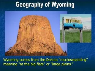
Geography of Wyoming. Wyoming comes from the Dakota "mscheweamiing" meaning "at the big flats" or "large plains.". Nicknames. “The Equality State”. “The Suffrage State”. “The Sagebrush State”. “The Cowboy State”. “Big Wyoming”. “The Wonderland of America”. Physical Regions.

E N D
Geography of Wyoming Wyoming comes from the Dakota "mscheweamiing" meaning "at the big flats" or "large plains."
Nicknames “The Equality State” “The Suffrage State” “The Sagebrush State” “The Cowboy State” “Big Wyoming” “The Wonderland of America”
Physical Regions 1. The Great Plains 2. The Rockies 3. The Intermontane Basins
1. The Great Plains --Flat prairie/rolling hills --Cottonwoods and shrubs grow along rivers
What economic activities take place here? (What is done to make money?) Mining – WY produces 41% of the country’s coal, and ranks #2 in natural gas production. Oil - #7.
Ranching – raising animals. WY is a major producer of sheep and wool, as well as beef cattle. Why is WY not well-suited for farming? Main crops – hay, sugar beets, barley
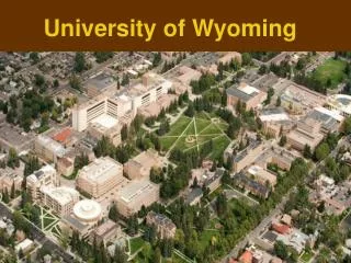
What are the major cities of this region? Cheyenne Casper Laramie Gillette
2. The Rockies --Consist of the Rocky Mountains and Big Horns. --Also the Laramie Range, Wind River Range, and Grand Tetons.
2. The Rockies What economic activities take place here? (What do people do for a living?) What are some animals found here that are not as common on the plains?
Falls of the Yellowstone River, early morning. Yellowstone National Park What are the major cities of this region? Sheridan, Cody, Jackson, Evanston
3. The Intermontane Basins --Means “between mountains” --Short grass and low brush --Few trees and little rain --The Red Desert is located here.
3. The Intermontane Basins Why is it so dry here? What economic activities take place here?
3. The Intermontane Basins What are the biggest cities? Rock Springs Green River Riverton
Highest temp - 114° July 12, 1900 in Basin. Lowest temp - -63° February 9, 1933 in Moran. Wyoming has the second-highest average elevation of any state (6,700 feet). Which state is higher? Why does Wyoming have a relatively cool climate?
Why does the northwest receive the most amount of precipitation?
Major Rivers – Bighorn, Green, Belle Fourche, Powder, North Platte, Snake North Platte River Snake River
Major Lakes – Yellowstone, Bighorn Major Reservoirs – Glendo, Boysen, Flaming Gorge, Seminoe, Alcova, Keyhole What is the difference between a lake and a reservoir? Why does Wyoming have so many reservoirs? Keyhole State Park
Cultural Geography Wyoming has the lowest population of any state (515,000) and the second-lowest density (5 per sq. mile). Why is Wyoming’s density so low? Residents of Wyoming are known as Wyomingites.
Ethnicity White – 86% Hispanic – 8% Native American – 3% African-American – 1.5%
Average lifetime: 74 (rank 25th) Largest Cities: 1. Cheyenne 2. Casper 3. Laramie 4. Gillette 5. Rock Springs
State Symbols Bird Tree Fish Mammal Gemstone Flower