Download
1 / 18
180 likes | 350 Views
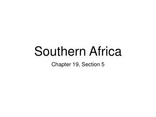
SOUTHERN AFRICA Sub Region IMPLIMENTATION ROAD MAP. A STRAWMAN FOR DISCUSSION Prepared for and on behalf of the southern African EO Community Terry Newby. Content of a Road Map. Sketch the EO Environment of the sub Region Identify Goal and Objectives Develop a Governance structure

E N D
SOUTHERN AFRICASub RegionIMPLIMENTATION ROAD MAP A STRAWMAN FOR DISCUSSION Prepared for and on behalf of the southern African EO Community Terry Newby
Content of a Road Map Sketch the EO Environment of the sub Region Identify Goal and Objectives Develop a Governance structure Confirm a infrastructure (Communications & Data) Public/Private Partnerships Sub Road Maps: Capacity Development Operationalisation and institutionalisation Research and Development Communications & Networking Global involvement and contributions Resourcing strategy
Southern region Angola, Namibia, Botswana, Zimbabwe, Zambia, Malawi, Lesotho, Swaziland, Mozambique, South Africa
Environment described in five parts Capacity Infrastructure Data R&D Operational Use
EO Environment of southern Africa Capacity 29 institutions offer training (Degree) Many short courses Web based training AMESD, GEONETCAST Training facility SAWS / Others? GEOGLAM, GFOI, EOPower. Workshop May 2014
EO Environment of southern Africa • Constraints • Band width • WWW access • Hardware Infrastructure GEONETCAST SANSA (EODC) GEOSS WMO (WWW portals) SAEOSS Google
Challenges • Timeliness • Appropriate resolutions • Temporal • Spatial • Spectral EO Environment of southern Africa DATA Imagery (SANSA, USGS, GEOSS etc) Aerial – mapping agencies (Digital?) Aerial – still costly but aerial obs from VLA’s In-situ (AWS, WMO, Field surveys) – transport/access)
EO Environment of southern Africa R&D Develop operational systems Crop estimation GEOGLAM AMESD/MESA, TIGER, Few R&D institutions outside SA
EO Environment of southern Africa OPERATIONAL APPLICATIONS AFIS (Fire) Drought EWS (AMESD Bulletins) Crop Estimation / condition Rangeland Soil Degradation Water resource management
Authors: AndiswaMlisa/Daniel Matsapola Operational use of EO data
EO Environment of southern Africa Institutional Challenges to operationalisation Limited funding and hence resources for EO‐related work; Lack of data sharing amongst the SADC countries; Gaps : EO research and operation applications; Connectivity inefficiency between providers and users of EO systems; Misalignment between capacity builders’ services and beneficiaries’ needs; Lack of performance indicators, standards for accreditation and certification procedures for education in the field of EO
GOALS & OBJECTIVES EO’s Operationally Used in Sub Region contributing to Development, Sustainability and Stability 1. A critical Mass of Human Capacity 2. A functional Data discovery and access infrastructure 3. Operational Best Practices for the various SBA 4. A R&D Agenda of international competitiveness
Structure Membership (National, Ministries, agencies, NGO’s, Private sector) Communication (regular conferences / meetings/ networking) Secretariat SADC existing structures CoP’s Link to AfriGEOSS/GEO structures
PPP’s Operationalise systems with PPP E.g. Crop Estimation, Land cover GTI Soil Moistue - Joint Project proposals – possibly more successful
Sub Road Maps Capacity Development strategy & Plan Standardise curicula Partnering of institutions Regular CoP workshops R&D Common R&D Agenda Annual networking event (Side event to local Science Conference) Communications WWW, News letters, LinkedIn, Twitter Portal for data Network events
Sub Road Maps Global involvement GEO Work plan, Tasks and Initiatives (GEOGLAM, GFOS) Continental programmes / Projects E.g. Tiger, Land Cover, Afr Water Cycle Operationalisation Standard operating procedures for SBA E.g water, agriculture, disaster Consortiums PPP
RESOURCING Demonstrate local commitment Joint sub-regional country collaboration Show “good stories” Pursue partnership opportunities Horizon 2020 Contributions to GEO Tasks (GEOGLAM & G20 & 8) Exploit SADC structures Ministerial meetings Cross boarder river basin authorities (Limpopo) Others ???????
Conclusion If you cant measure it you cant manage it EO is measurement Collaboration & Coordination is Power Many brains = sound solutions Solutions = Sustainable Development