Download
1 / 17
180 likes | 713 Views
The Development of National Spatial Data Infrastructure in Indonesia. Rudolf W. Matindas Deputy of Spatial Data Infrastructure National Coordinating Agency for Surveys and Mapping (BAKOSURTANAL). OUTLINES. CURRENT NSDI FOCUS AREAS

E N D
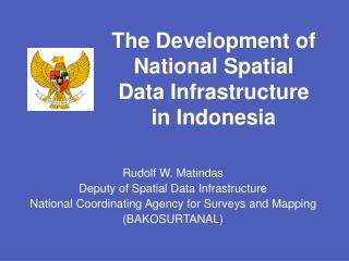
The Development of National Spatial Data Infrastructure in Indonesia Rudolf W. Matindas Deputy of Spatial Data Infrastructure National Coordinating Agency for Surveys and Mapping (BAKOSURTANAL)
OUTLINES • CURRENT NSDI FOCUS AREAS • CONCEPTUAL DEVELOPMENT OF NATIONAL SPATIAL DATA INFRASTRUCTURE IN INDONESIA • CONCLUSIONS
CURRENT NSDI FOCUS AREAS • National Organization “Geodata Alliance” • Significantly expanded multi sector leadership • Plan by year 2005 • NSDI Financing Study • Public / private alternatives for advancing the NSDI • Data Consortia, underwritten by pooled financing • Reduce duplication, increase quality • Expanded International Outreach • International / global collaboration • Regional and Global Spatial Data Infrastructure • Open Geoprocessing
CONCEPTUAL DEVELOPMENT OF NSDI IN INDONESIA SUPPORTING REGULATION PRESENT CONDITION NATIONAL DEVELOPMENT SYSTEM TARGETS OF ARRANGEMENT NSDI DEVELOPMENT PROGRAMS DRIVING FORCES
PRESENT CONDITION • Two contrasting positions further confuse the debate • notion of infrastructure limited to tangible assets like roads, railway networks (and databases) • Infrastructure seen not only in terms of tangible assets but also the individuals and institutions need to make it a functional reality
PRESENT CONDITION (continued) • Many services and data are locational • Devices are becoming location aware • Taxpayers want ease of use and responsive service • “Place” therefore is a core element for e-government
DRIVING FORCES • Commitment of GOI: Establishment of the SDI as part of National Development Program • Spatial data as commodity • Free market/open trade • Advances of technology opens up possibility/opportunity to speed up data collection, processing, analyzing, presentation and disseminating of Spatial Data
SUPPORTING REGULATION • Guidelines of State Policy (Tap. MPR No. IV/99) • National Development Program 2000 - 2004 Act (UU. No. 25/2000) • Human Right Act, Right to Access Information (UU. No. 39/1999) • Autonomy Act (UU. No. 22/1999) • Spatial Planning Arrangement Act (UU. No. 24/1992)
TARGET OF ARRANGEMENT • Partnerships – local/national/regional/global • Standards • Distributed Database and Metadata • Clearinghouse (catalog) • Geodata • Community applications • Outreach, education, assistance
NSDI DEVELOPMENT PROGRAMS • Long Term • Establishment of National Geographic Information Act • Development of Integrated Information Management System • Development of National Metadata • Development of Clearinghouse mechanism system • Short Term • Establishing national committee and working groups for spatial data infrastructure • Development of Indonesian Spatial Data Directory • Promoting IDSN through out websites and seminars • Development of standards • Facilitating on datum migration • Promoting and development of on-line mapping
COMMON FEATURES • Explicitly national • Refer to geographic information, geospatial data or land and marine information • Use terms such infrastructure, systems or framework
ISSUES RAISED BY STUDY Three important questions raised by an evaluation of NSDI experiences: • What is a NSDI? • How national is a NSDI? • Why only national?
ORGANIZATION & PARTNERSHIPS • National Geographic Data Committee Steering Committee, Coordination Group, and Working Groups provide the forum for policy and technical discussion • Some of the major stakeholders & partners – National, Province, District / Municipal, local, and tribal governments; Open GIS Consortium • Expanding Global Outreach to promote compatibility across borders / globally
DEVELOPMENT OF THE NSDI IN INDONESIA DBASE UPDATED DBASE UPDATED Geodetic DB TOPICAL SPATIAL RELATED DATA/ INFO OF AGENCIES TopoMap DB Bathy DB Thematic DB SPATIAL SYSTEM NETWORK SPATIAL SYSTEM NETWORK NATIONAL SYSTEM DEVELOPMENT 2001-2004 YEAR – 1 YEAR – 2 YEAR – 3YEAR - 4 PARTICIPANTS AGENCIES END USERS NSDI AGENCIES & Fundamental Dataset Provinces, Districts / Cities Sectoral Agencies . . . . . . . . I N T E R N E T Research Scientific and Research . . . . . . . . Universities Education . . . . . . . . MD BASE UPDATED MD BASE UPDATED Public Data Developer METADATA . . . . . . . . General Public . . . . . . . Development of Standards • Operational Disseminating data through Internet • Extension of participating parties Spatial Related Data Contributed by Sectoral Agency (Land Agency, Public Work, Forestry, Agriculture, Dept. of Defense, etc) • Data Base Continuous Updating • Management Digital Catalog development • System Host Dev for Data Integrator • Prototype web app. and Internet link Access by all categories of users Inter-Agencies Data Centre
NAT. DEVELOPMENT SYSTEM • Improvement of decision support tools • Improvement of people’s learning through open access to spatial data
CONCLUSION • Diversity of first generation of NSDIs • Not surprising given diversity of geographic and institutional factors involved in the different countries • But also points to considerable confusion regarding the purpose, scope and content of an SDI.
INDONESIA NSDI SECRETARIAT Address: Jl. Raya Jakarta – Bogor Km. 46 Cibinong 16911, INDONESIA Phone: +62 21 8753407 Facsimile: +62 21 875 3366 Email idsn@bakosurtanal.go.id Homepage http://www.bakosurtanal.go.id/