Download
1 / 29
290 likes | 309 Views
Explore the T-PARC NRL-P3 Dropsonde Data Products and learn about the post-processing steps involved in quality control and data analysis for improved predictive skill of high-impact weather events.

E N D
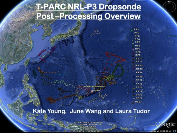
T-PARC NRL-P3 Dropsonde Post –Processing Overview Kate Young, June Wang and Laura Tudor
THORPEX Pacific Asian Regional Campaign (TPARC) 2008 • International project, conducted in the western North Pacific • Aimed at: • Increasing understanding of the mechanisms that lead to improved predictive skill of high impact weather events • Providing data for research to examine typhoon genesis Operations conducted out of Guam, Hawaii and Japan, and included measurements from dropsonde, driftsonde and various Aircraft instruments
TPARC Dropsonde Data Products: Approximately 1600 dropsonde soundings collected between Aug 1 – Sept 30 Aircraft included: NRL-P3 = 475 (Released) Air Force C130 = 630 (In-progress) DLR Falcon = 338 Taiwanese Astra = 162
T-PARC (airborne) Sounding SystemsDriftsonde Temperature versus Altitude (4 drops) from 30km! Nominal Driftsonde Drop altitude Nominal Falcon and DOTSTAR drop altitudes Nominal C-130 Drop altitude Nominal P-3 Drop altitude Courtesy of Terry Hock and Steve Cohn
Quality Control of P3 Dropsonde data Uncovered errors the required investigation In-Flight Data Inspection Raw Profile Examination Batch ASPEN • Configuration Errors • Delayed Launch Detect • Bad Aircraft data measurements Time series of PTU and Wind Histograms of PTU and Wind Visually Examine QC Sounding Release Data with detailed documentation of findings
Problems Detected by Operators • GPS measurement errors (dz/dt, wspd & wdir) related to number of satellites locked • Vertical velocity and horizontal wind errors related to configuration error • Increased frequency of fast fall drops caused by inadequate internal aircraft pressure
Configuration Error Files • Identify sondes manufactured in 2008 • Create profiles of GPS measured dz/dt and ASPEN calculated dz/dt • Separated them into “good agreement” and “not so good”
For those with good agreement….Did comparisons between sondes launched from the same flight. Configuration Error Dropsondes with Good Agreement between Measured and Calculated DZ/DT Based on these comparisons, we determined the winds to be ok. 2008 Sonde
Configuration Error Dropsondes with Poor Agreement between Measured and Calculated DZ/DT
Category #1 Characterized by suspicious GPS dz/dt, but reasonable wind speed when wind errors are low and sats >= 5.
Category #2 • Errors with dz/dt, suspicious winds GPS DZ/DT is affected by the configuration error Winds in excess of 48 m/s Result from low number of satellites
Configuration Error files with questionable wind data when sats = 4
Automotive Modes Affect on Satellite Lock Larger percentages with sats >= 10 ~15% sats< 5
Solution to Address Soundings with a Configuration Error • Additional evaluation included: • Examination of GPS Altitude • Comparison between calculated position and position integrated from winds • Both of which showed questionable results as well. • Final decision was made to remove all GPS data (wind spd, direction, lat, lon and GPS alt) from data files where calculated and measured dz/dt did not agree well.
“Configuration Error” Dropsonde Statistics • 484 dropsondes used • 100 had configuration set to ground based mode (20.6%) (before 10/11/08) • Of those 100 evaluated: • 47 appear to be ok (agreement between GPS vs calc dz/dt) • 22 had no GPS data • 31 were evaluated for large differences between GPS measured and ASPEN calculated dz/dt , and GPS were ultimately set to missing (6.4% of total)
D* vs. D*_P Format GAUS-T01 STA 043937440 050413 225849.25 GAUS-T01 COM GMT GMT Air Air Rel Wind Wind Vert GPS GPS Geopoten GPS Sonde Sonde GPS Wind GPS GAUS-T01 COM Sonde Date Time Press Temp Humid Dir Spd Veloc Longitude Latitude Altitude Wnd RH1 RH2 Snd Error Altitude GAUS-T01 COM ID yymmdd hhmmss.ss (mb) (degC) (%) (deg) (m/s) (m/s) (deg) (deg) (m) Sat (%) (%) Sat (m/s) (m) GAUS-T01 COM --------- ------ --------- ------- ------ ------ ------ ------ ------ ----------- ---------- -------- --- ------ ------ --- ----- -------- GAUS-D01 A11 000000000 050413 230452.00 865.00 10.70 17.00 258.00 7.50 0.00 -119.727805 39.506958 1345.58 0 17.00 17.00 0 0.00 1345.70 GAUS-T01 LAU 043937440 050413 231457.74 GAUS-D01 P00 043937440 050413 230455.74 866.41 10.93 22.60 316.32 0.15 -0.25 -119.727635 39.506965 99999.00 5 21.77 22.60 7 3.60 1344.62 GAUS-D01 P00 043937440 050413 230456.74 866.40 10.84 22.21 166.69 0.27 0.09 -119.727637 39.506963 99999.00 5 21.45 22.21 7 3.60 1345.75 GAUS-D01 P00 043937440 050413 230457.74 866.34 11.06 22.25 58.23 0.35 -0.11 -119.727628 39.506962 99999.00 5 21.83 22.25 7 3.60 1347.85 GAUS-D01 P00 043937440 050413 230458.74 866.27 11.21 22.99 211.66 0.15 -0.17 -119.727642 39.506977 99999.00 5 22.72 22.99 7 3.60 1345.83 GAUS-D01 P00 043937440 050413 230459.74 866.32 10.92 22.28 109.27 0.32 -0.29 -119.727637 39.506971 1332.85 5 21.92 22.28 7 3.60 1345.76 GAUS-D01 P00 043937440 050413 230500.74 866.25 11.01 22.54 264.10 0.36 0.57 -119.727634 39.506964 1333.56 5 22.32 22.54 7 3.60 1345.41 GAUS-D01 P00 043937440 050413 230501.74 866.27 10.62 21.64 16.74 0.20 -0.09 -119.727633 39.506968 1333.41 5 21.44 21.64 7 3.60 1344.86 GAUS-D01 P00 043937440 050413 230502.74 866.28 10.68 21.95 218.68 0.15 0.27 -119.727605 39.506968 1333.30 5 21.74 21.95 7 3.60 1348.02 Header (A11, LAU) Prelaunch (PXX) GAUS-D01 S00 043937440 050413 231457.74 866.14 9.94 20.92 261.48 0.93 0.43 -119.727752 39.506933 1334.55 7 20.92 999.00 8 2.00 1324.82 GAUS-D01 S00 043937440 050413 231458.74 865.88 9.28 19.89 273.46 3.54 2.01 -119.727716 39.506942 1337.07 7 19.89 999.00 8 2.00 1329.11 GAUS-D01 S00 043937440 050413 231459.74 865.47 7.79 18.46 235.54 6.99 3.30 -119.727648 39.506975 1340.95 7 18.46 999.00 8 2.00 1331.99 GAUS-D01 S00 043937440 050413 231500.74 865.09 7.25 18.55 244.98 9.25 4.34 -119.727537 39.506986 1344.56 7 18.55 999.00 8 2.00 1336.08 GAUS-D01 S00 043937440 050413 231501.74 864.73 6.64 17.96 260.64 12.00 4.86 -119.727401 39.507011 1348.04 7 17.96 999.00 8 2.00 1340.59 GAUS-D01 S00 043937440 050413 231502.74 864.26 6.83 18.47 254.05 14.15 3.91 -119.727243 39.507047 1352.48 7 18.47 999.00 8 2.00 1345.49 GAUS-D01 S00 043937440 050413 231503.74 863.70 6.44 18.64 259.49 13.85 5.42 -119.727105 39.507075 1357.77 7 18.64 999.00 8 2.00 1350.32 GAUS-D01 S00 043937440 050413 231504.74 863.27 6.55 19.33 275.82 12.20 4.25 -119.726968 39.507070 1361.91 7 19.33 999.00 8 2.00 1354.19 GAUS-D01 S00 043937440 050413 231505.74 862.64 6.39 19.13 278.09 12.81 6.05 -119.726811 39.507073 1367.81 7 19.13 0.14 8 2.00 1360.71 Sonde (SXX) GAUS-T01 COM Data Type/Data Channel: GAUS SOUNDING DATA, Channel 1 GAUS-T01 COM Project Name/Mission ID: Hallett Obs Met Class, Class #1 GAUS-T01 COM Launch Time (y,m,d,h,m,s): 2005/04/13, 23:04:52.25 GAUS-T01 COM Sounding Name: none GAUS-T01 COM Sonde ID/ID$/Type/Sensors: 043937440, Z3937440, Vaisala RS92-SGP (ccGPS), RS92-SGP (binary coeff) GAUS-T01 COM Sonde Frequency: 405.00 MHz GAUS-T01 COM Sonde Baseline Errors (p,t,h1,h2): 0.0 mb, 0.0 C, 0.0 %, 0.0 % GAUS-T01 COM Sonde Dynamic Errors (p,t,h): 0.0 mb, 0.0 C, 0.0 % GAUS-T01 COM Pre-launch Obs Data System/Time: none, 23:04:52.00 GAUS-T01 COM Pre-launch Obs (p,t,d,h): 865.0 mb, 10.7 C, -13.4 C, 17.0 % GAUS-T01 COM Pre-launch Obs (wd,ws): 258.0 deg, 7.5 m/s GAUS-T01 COM Pre-launch Obs (lon,lat,alt): -119.727805 deg, 39.506958 deg, 1345.6 m, (119 43.6683'W, 39 30.4175'N) GAUS-T01 COM Operator Name/Comments: none, Great Sounding. 1st one with the students. GAUS-T01 COM Standard Comments: none GAUS-T01 COM Software Version 2.2.1 - 17 Feb 2005; Adds: bug fix GAUS-T01 COM Format Version NOAA 1.6 - 04 Mar 2004; Adds: timestamp resolution increased to 0.01 sec; GPS Lon & Lat resolution increased to 6 digits; GPS Altitude data field GAUS-T01 COM Met/Wind Offset: ptu data leads wind data by 0.00 sec GAUS-T01 END 043937440 050414 010331.64 Tail
77 seconds D-Temp+60 DP-Temp+60 D-RH DP-RH Delayed Launch Detect • 20 soundings experienced delay in release of • the launch detect pin • incorrect launch times and filenames • incomplete D_P file • 17 also had delay in release of the parachute • Recommendation is to keep 120 seconds of PXX data in the D_P file.
Failure of Aircraft T/RH sensors T sensor broke during ferry flight on 09/17
Freezing of the sensor occurred RF15 RF16 RF17 RF18 RF19 RF21
NRL P-3 Dropsonde Statistics • 20 delay of the launch detect (corrected) • 6 failure of launch detect (corrected) • 7 fast falls (removed winds) • 6 didn’t transmit to surface (corrected) • 11 soundings interrupted by other sondes on same frequency. (corrected) • 110 contained bad aircraft data (corrected)
Highlights & Conclusions • High quality dataset collected from NRL-P3 • 100% of temperature profiles are included in the final archive • 84% of soundings contain high quality winds • Inclusion of two columns containing (filtered and unfiltered) calculated vertical velocity of the air motion (Wang, J., W.O. Brown, H. Cole, V. Grubisic, and K. Young, 2009: Vertical air motion from T-REX radiosonde and dropsonde data. J. Atmos. Oceanic Technol, Vol 26, pg 928)
Consistent Quality Control of 13-year (1996-2008) High Resolution GPS Dropsonde Data for Hurricane Research NOAA NCAR NASA Air Force Routine Quality Control Placing additional emphasis on improving moisture profiles Supply high resolution, long-term dataset for hurricane research Project Objective Gather dropsonde data from multiple sources, applying consistent QC/QA to produce a high-quality, long-term dropsonde data set for hurricane research.
Goals of this projectProvide researchers with a unique long-term high resolution data set.Facilitate further understanding of hurricane dynamics by providing an opportunity to examine trends and characteristic of environments conducive to hurricanes.Comments and suggestions are always welcome!!