Download
1 / 15
150 likes | 431 Views
Air Force Weather Agency GOES-R Data Exploitation Activities. Mr. Thomas E. Coe Strategic Center Programs Division Air Force Weather Agency. Overview. AFWA Mission Current Architecture Current METSAT Data Exploitation Planned NPOESS Architecture Planned Use of GOES-R Data. Mission.

E N D
Air Force Weather Agency GOES-R Data Exploitation Activities Mr. Thomas E. Coe Strategic Center Programs Division Air Force Weather Agency
Overview • AFWA Mission • Current Architecture • Current METSAT Data Exploitation • Planned NPOESS Architecture • Planned Use of GOES-R Data
Mission • Arming our Nation’s forces with essential air and space environmental intelligence, training, and technical services to ensure battlespace awareness and decision superiority - Anytime, Anywhere. • Operational focus • Priority for resources to support operational applications • Enduring principles: • Worldwide data collection and dissemination • Precise specification of battlespace environment • Real time cloud analyses and forecasts
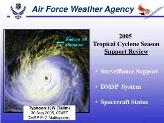
AFWA Civil Support • Back-up for NOAA Operations: • Storm Prediction Center (SPC) • Aviation Weather Center (AWC) • National Volcanic Ash Advisory Center (VAAC) • Environmental Modeling Center (EMC) • Space Environment Center (SEC) 4
Military/Civilian Differences • Focused on combat decision makers, deployed forces • Mission-specific vs. wide-area, general forecasts • Main concern: Mission impacts! • What we do: • Build the world's most comprehensive weather database • Apply and tailor data to specific military needs • Focused on battlespace awareness for worldwide ops • Command and control • Precision engagement • Mission execution
METSAT Data Architecture Input from: - DOMSAT - CDMS-Oracle - WPMDS - NIDS - NOAA - RAPS Output to: - WPMDS - JAAWIN - RAPS - CDFS II - SIDAS Meteorological Satellite Data NIDS WPMDS CDMS-O INPUT Satellite Data Collection and Storage Environmental Product Generation Meteorological Data Receipt and Storage System Operations And Control Environmental Product Distribution Ancillary Functions OUTPUT SCIF Product Generation and Distribution WPMDS CDFS II SIDAS JAAWIN RAPS
AFWA Process Overview ANALYSIS/FORECAST/PRODUCT TAILORING INPUT DISSEMINATION Forecaster-in-the-loop products METSAT Data DMSP POES GOES E/W/P METEOSAT TRMM QuickSCAT EOS (AMSR-E) JAAWIN / JAAWIN-S Automated Products Observations Surface Upper-Air AIREPS/PIREPS Ship Space Military Command and Control Systems Systems, Models, and Applications • Satellite Data Handling System (SDHS) • Cloud Depiction and Forecast System (CDFS II) • Satellite Image Display/Analysis System (SIDAS) • Space WX Analysis & Forecast System (SWAFS) • Mesoscale Model (MM5) • Land/Surface Model (AGRMET) • Joint METOC Broker Language Databases NWP Data GFS NOGAPS
World-Wide Merged Cloud Analysis(Cloud Analysis and Forecast System – CDFS II)
Cloud Analysis/Forecast Data Flow Meteorological Satellite Data • DMSP • POES • GOES • METEOSAT Observations • Surface • Upper Air Specialized Gridded Analyses • Surface Temperature • Snow Depth Cloud Analysis WWMCA FITL Numerical Weather Prediction Temperature, Pressure, Moisture, Wind Fields FITL FITL = Forecaster in the Loop
METSAT Exploitation Initiatives • Weather Research and Forecasting Model (WRF) • Initial operational capability – Jun 06 • Replaces MM5 model • NPOESS, then GOES-R data planned as input • Leveraging JCSDA to support data assimilation • JCSDA Participation • On-site representation • Developing radiative transfer model for WRF 3DVar / 4DVar analysis • Direct radiance assimilation into numerical weather prediction models
Notional NPOESS Architecture Contractor Responsibility AFWA Responsibility AFWA Enterprise Storage Solution (ESS) CentralSAN Enclave Boundary Port Block NPOESS Landing Zone Central Delivery Area AFWA Systems HDF5 Granules HDF5 Granules AFWA-Ready Data Granules firewall firewall Applications Platform (Enable JMBL) Data Product requests / status Data access management traffic Fiber Channel IP-Based
NPOESS EDRs of Interest • AFW Will Use all of the Planned NPOESS EDRs • Cloud Parameters • Atmosphere: Cloud, LIS, NWP • Land: Cloud, LIS • Space Environmental parameters: Ionospheric specification models; auroral products • All 55 NPOESS EDRs have potential uses throughout AFW
NPOESS Exploitation at AFWA Anticipated Benefits of NPOESS Data at AFWA • Enhanced Measurement of Tropospheric Parameters • New applications • Exploitation of higher-resolution and multi-spectral data • Reduced data latency • Improved Space Environment Characterization • Input for new physics-based models (e.g., GAIM) • Specification and forecasting of the ionosphere, magnetosphere and thermosphere • Monitoring of earth’s auroral regions • Other Exploitation Efforts • Point Analysis Reengineering (PAR) • Cloud Analysis (CDFS II)
GOES-R Exploitation at AFWA Anticipated Benefits of GOES-R Data at AFWA • AFWA will use almost all of the planned GOES-R EDRs • Planned use of new capability EDRs: • Hyperspectral Environmental Suite – Vertical temp and moisture profiles, cloud-top temps; cloud tuning • GOES Lightning Mapper • Space Weather: • Space Environment In-Situ Suite • Solar Instrument Suite • Magnetometer • Rapid Scan Winds – Improved tropical storm fixing • Expect significant improvement in NWP accuracy with dramatic increase in available vertical channel data