Download
1 / 56
560 likes | 750 Views
Portland, Oregon. Transportation Sustainability. July 1, 2007 emissions. July 1, 2007 emissions. January Comparison. Oregon Population and Vehicle Miles Traveled.

E N D
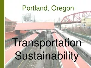
Portland, Oregon Transportation Sustainability
Oregon Population and Vehicle Miles Traveled • Oregon saw an increase in traffic on major roads in urban areas of about 75 percent between 1980 and 2005. However, VMT has declined yearly since 2002. Population and VMT per capita increased by 38% and 28%, respectively, over the same period. VMT per capita has declined recently and in 2005 was at its lowest level since 1989. • Data Sources: VMT - ODOT; Population - Portland State University Population Research Center (Figure 1-1)
Oregon Per Capita VMT Related to Per Capita Income • Statewide personal income and VMT have shown similar trends of growth. Thus it appears that the increase in VMT is tracking with growth in the economy. This constant relationship between VMT and personal income per capita was a conclusion from the Statewide Congestion Overview. • Data Sources: VMT - ODOT; Income – U.S. Bureau of Economic Analysis; CPI – U.S. Bureau of Labor Statistics (Figure 1-5)
Oregon Highway Capital Investment • The ratio of highway capital investment to statewide personal income has declined rapidly over the past 43 years. It peaked in 1968 at about 3 percent, and dropped to about 0.6 percent in 2000. As stated in the Statewide Congestion Overview (2004, p. 13) the decrease in highway capital investment increases the gap between VMT and lane-miles. • Data Sources: Personal Income - US Bureau of Economic Analysis; Capital Expenditures - Highway Statistics Summary to 1995, Table HF-202C, Highway Statistics reports for years 1996-2000, Table HF2 (Figure 1-7)
Oregon Gasoline Prices • This chart shows gasoline prices (including tax) over the past 80 years. Both the nominal and inflation-adjusted prices are presented. Until recently, real gasoline pump prices had been declining steadily since 1920, with several large spikes in the 1970s. Since 1998 the trend has been increasing. • Data Sources: Pump prices – American Petroleum Institute (before 1984) and the Energy Information Administration (from 1984); CPI - Bureau of Labor Statistics (Figure 1-8) Note: The discontinuity in the chart reflects different data sources for gasoline pump prices before and after 1984.
Oregon Gasoline Taxes • Fuel taxes (federal and state) are calculated as a fixed number of cents per gallon purchased. As shown, the nominal Oregon gasoline tax (currently 24¢/gallon) has increased since 1920, but has not kept up with inflation. Similarly, the federal tax (currently 18¢/gallon) has lost purchasing power due to inflationary effects. • Data Sources: Gasoline Tax – American Petroleum Institute and ODOT; CPI - Bureau of Labor Statistics (Figure 1-9)
Oregon Gasoline Tax Rate The gasoline tax rate (federal and state gas taxes as a percentage of the pump price) was around 30% for much of the last century. Because gasoline taxes are a set monetary value, the gas tax rate will fall as pump prices rise. Data Sources: Gasoline Tax – American Petroleum Institute and ODOT; Pump Price – American Petroleum Institute and the U.S. Energy Information Administration 14 (Figure 1-10)
Oregon VMT and Fuel Prices This chart shows the relationship between state travel per capita and gas pump prices since 1970. As can be seen, although the overall VMT has increased, rising fuel prices often correspond with lower VMT. Data Sources: VMT – ODOT; Pump Price – American Petroleum Institute and the U.S. Energy Information Administration 15 (Figure 1-11)
International Fuel Prices For an international perspective, this chart shows that as of 2003 the United States and Canada had significantly lower fuel prices than most other countries. The countries coded blue are part of the G8 (data not available for Russia). Data Source: Organisation for Economic Co-Operation and Development 16 (Figure 1-12)
Bridge Conditions by State This chart shows the percent of bridges rated structurally deficient or functionally obsolete for 11 Western states and the U.S. average. Lower values are better. Oregon rates slightly better than the national average and the other Pacific Coast states. Still, over ¼ of Oregon bridges are deficient or obsolete as of 2005. Data Source: Federal Highway Administration 17 (Figure 1-14)
International Vehicle Travel Per Capita For an international perspective on driving volume, this chart shows annual Vehicle Kilometers Traveled per capita in 2003. VKT includes road travel by both private car and bus. The United States had significantly more travel per person than other countries shown here. The countries coded blue are part of the G8 (without Russia). Data Source: Organisation for Economic Co-Operation and Development 18 (Figure 1-15)
International Vehicle Ownership per Capita This figure shows that as of 2004 the United States had the most motor vehicles per capita of the countries shown here. A high vehicle ownership rate partly explains the high VKT per capita shown on the previous page. The countries coded blue are the G8. Data Source: Organisation for Economic Co-Operation and Development 19 (Figure 1-16)
Portland Area VMT and Transit Trends • This figure shows the proportion change in VMT, VMT per capita, transit boardings and transit boardings per capita in the Portland-Vancouver urbanized area. • Data Sources: VMT, Population, Size, Speed & Travel Time - 2007 Urban Mobility Report; Transit Boardings - TriMet (Figure 2-2)
Portland Area Per Capita VMT and Transit Trends • This figure shows the proportion change in VMT per capita in the Portland-Vancouver urbanized area and Tri-Met transit boardings per capita. • Data Sources: VMT, Population, Size, Speed & Travel Time - 2007 Urban Mobility Report; Transit Boardings - TriMet (Figure 2-3)
Portland Daily Freeway and Arterial VMT and Lane Miles • Daily VMT on freeways increased dramatically between 1982 and 2005. Lane miles on arterials have been added at a rate greater than the increase in VMT. However, lane miles on freeways have increased by only 34 percent since 1982. The gap of VMT and lane miles on freeways may explain the declining speeds on Portland freeways. • Data Sources: DVMT and Lane Miles - 2007 Urban Mobility Report (Figure 2-4)
Portland Growth in Person Travel by Mode • This shows how daily person miles traveled increased between 1990-2000 by mode. • Data Sources: Table B-2 on page B-36 in the Statewide Congestion Overview; U.S. Census; Urban Mobility Report (Figure 2-5)
Population Trends • This is a comparison of population growth among Large urbanized areas with population between 1 and 3 million. The Portland-Vancouver area has a population slightly above the group average. Populations in most cities have increasing trends with about the same rates. San Diego is by far the largest city in this category. • Data Source: 2007 Urban Mobility Report (Figure 3-1)
Travel Distance Trends • This chart shows average daily travel distances per peak period traveler on the major road system (freeway and arterials). Peak period travelers in Portland drive shorter distances than average. • Data Sources: 2007 Urban Mobility Report (Figure 3-2)
Highway VMT Trends • This shows that daily VMT is increasing over time, but that Portland remains below average for the population group. • Data Source: 2007 Urban Mobility Report Note: The drop in DVMT for San Jose in 2000 reflects a significant decrease in the quantity of freeway lane-miles measured for the urban area. (Figure 3-3)
Number of Peak Period Travelers • The number of peak period travelers in the Portland-Vancouver urbanized area is also lower than average, compared to other Large urban areas. • Data Source: 2007 Urban Mobility Report (Figure 3-4)
Annual Congestion Trends • Annual congestion delay for peak period travelers in Portland has been close to the Large area average since 1982. It has exceeded the average since 1992. Shorter-than-average travel distance coupled with lower-than-average travel speed has leveled off the delay actually experienced by travelers. • Data Source: 2007 Urban Mobility Report (Figure 3-5)
Travel Time Trends • Portland annual travel time per peak period traveler has remained below average for Large areas since 1994. Again, shorter-than-average travel distance has eased the impact of congestion on travel time. • Data Source: 2007 Urban Mobility Report (Figure 3-6)
Travel Time and Population • Portland’s population is 11th out of the 25 Large areas (25th overall), and the hours of travel per peak period traveler is well below average for Large areas. • Data Source: 2007 Urban Mobility Report (Figure 3-9)
Congestion During Peak Period This chart shows the amount of congestion during the peak period as a percentage of peak period VMT. The Western cities show the greatest amount of congestion out of the Large urban area group, and the value is increasing for most cities. Data Source: 2007 Urban Mobility Report 31 (Figure 3-12)
Roadway Per Peak Traveler One of the causes of increased congestion is a reduction in the roadway lane-miles per traveler as populations increase faster than new roadway is built. As the Western cities have the greatest congestion, they also have the least roadway per peak traveler. Data Source: 2007 Urban Mobility Report 32 (Figure 3-13)
Transit Trips Per Peak Traveler This figure shows the annual number of public transit trips per peak period traveler. By this measure, Portland has had the most transit use in the Large urban area group for more than five years. Data Source: 2007 Urban Mobility Report 33 (Figure 3-14)
Drive Alone Commuters This figure shows the percent of commuters driving single-occupancy vehicles in 2005. Portland had the lowest percentage in the Large urban area group, showing a large amount of transit use, carpooling, and non-motorized transport. These modes are discussed later in this report. Data Source: American Community Survey, U.S. Census 34 (Figure 3-15)
Air Quality Vehicle exhaust is a known contributor to air pollution in urban areas. This figure shows air quality as measured by the Air Quality Index (AQI) for 2005. More pollution registers higher AQI values. Portland ranks well in relation to other Large urban areas. Data Source: U.S. Environmental Protection Agency 35 (Figure 3-16)
Oregon Motor Vehicle Crash Trends • Despite increasing travel on Oregon highways, both total and fatal crash numbers have declined as a proportion of 1980 values. Improvements in vehicle design, highway design, and social behaviors such as increased seat belt use and less tolerance for impaired driving have contributed to the improvement. Minimum property damage requirements for crash reporting has changed over the time shown Data Source: ODOT (Figure 4-1)
National Motor Vehicle Crash Trends • This figure shows a comparison of motor vehicle fatality rates per 100 million vehicle miles traveled for all 50 US states. Although fatal crashes represent only a portion of the total safety performance they provide a useful benchmark for comparison. Oregon rates have generally been below the national average. Data Source: National Highway Traffic Safety Administration (NHTSA), Fatality Analysis and Reporting System (FARS) (Figure 4-2)
Motor Vehicle Safety • This figure shows an urban area comparison of motor vehicle fatality rates expressed per 100 million VMT. The Portland urban area is below average for the large population group. Data Sources: NHTSA FARS, 2007 Urban Mobility Report (Figure 4-3)
Pedestrian Safety • This figure shows the “Pedestrian Danger Index” for the 25 Large urbanized areas. The index is calculated by dividing the yearly pedestrian fatality rate per 100,000 population by the percentage of commuters walking to work and normalizing that figure to 100. Lower indices are desirable. The index may not reflect the exposure of the total number of people walking since it only includes adjustment for work trips. Data Source: NHTSA FARS, U.S. Census Journey to Work, 2007 Urban Mobility Report (Figure 4-4)
Alcohol-Related Fatality Rates Alcohol-related crashes often account for more than one third of motor vehicle fatalities. This figure shows alcohol-related fatality rates for Large urban areas, as defined by the 2007 Urban Mobility Report. Portland is about average for the large population group. 40 Data Source: NHTSA, FARS (Figure 4-5)
Safety Belt Use By State Safety belts are known to reduce crash fatalities or crash injury severity for front seat occupants. This figure shows a high percentage of seat belt use for the three Pacific Coast states, and usage increasing nationwide. 41 Data Source: USDOT, National Highway Traffic Safety Administration (Figure 4-6)
International Motor Vehicle Safety Comparison For an international safety context, this figure shows a combined motor vehicle injury and fatality rate per billion vehicle kilometers traveled. Along with the U.S., the blue shaded countries are part of the G8 (no data available for Russia). 42 Data Source: Organisation for Economic Co-Operation and Development (Figure 4-7)
National Freight Trends • This figure shows the national trends in ton-miles of freight related to gross domestic product and population. The ton-miles moved per capita has remained relatively flat, while the total ton-miles continues to grow, yet at a lower rate than the overall GDP. • Data Sources: U.S. Bureau of Transportation Statistics, U.S. Bureau of Economic Analysis, and U.S. Census (Figure 5-1)
U.S. Freight Mode Trends • These figures show U.S. Commodity Flow statistics by mode over a ten year period, for both dollar value and weight. As shown, truck movements dominate both value and weight measures. The impact of air freight in high value movements only is also visible. • Data Source: Bureau of Transportation Statistics, Shipments in America (Figure 5-2)
Land Freight by State This chart shows the total weight of land freight to and from 11 Western states in 2007. These shipments were by truck, rail, or a combination of truck and rail. In addition to land freight, California dominated the Western states in freight shipments by all modes combined. Data Source: FHWA Freight Analysis Framework 45 (Figure 5-6)
Land Freight by Urban Area This chart shows the total weight of land freight to and from 25 Large urban areas in 2007. These shipments were by truck, rail, or a combination of truck and rail. The urban area size group is for populations of 1-3 million, as defined in the Urban Mobility Report. When freight by all modes is considered, the primary difference is that New Orleans ranks higher in relation to the other cities. Data Source: FHWA Freight Analysis Framework 46 (Figure 5-7)
Transit Market Share • By transit market share, Portland appears in the top ten large cities in the nation, with more than 5% of work trips by transit. This figure includes Metropolitan Statistical Areas with population over 1 million. Portland ranks first among Large Urban Areas defined in the Urban Mobility Report (population of 1-3 million, shaded darker). • Data Source: 2005 American Community Survey, U.S. Census (Figure 6-1)
Change in Transit Ridership • Portland appears fifth in the top ten CMSAs in terms of the number of work trip transit riders added between 1990-2000. Portland added nearly 25,000 riders. The New York CMSA (which by itself accounted for 36% of all transit work trips in 1990) added approximately the same number. This was a period during which Portland’s capital transit investment in the Westside MAX came online. • Data Source: U.S. Census Journey to Work. (Figure 6-2)
Increase in Transit Share • Portland led the nation in the percent increase in workers using transit, 1990-2000. • Data Source: U.S. Census (Figure 6-3)
Lane Equivalents Saved By Transit Ridership • This figure shows an estimate of the magnitude of the impact of transit ridership into downtown Portland during weekday peak periods. For example, this indicates that an equivalent of 1.5 freeway lanes are “saved” by the presence of transit capacity along the I-5 corridor. • Data Sources: TriMet and C-Tran (Figure 6-4)