Download
1 / 33
330 likes | 519 Views
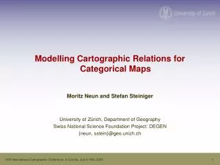
Modelling Cartographic Relations for Categorical Maps Moritz Neun and Stefan Steiniger University of Zürich, Department of Geography Swiss National Science Foundation Project: DEGEN {neun, sstein}@geo.unizh.ch. Outline. Motivation Introducing Relations

E N D
Modelling Cartographic Relations for Categorical Maps • Moritz Neun and Stefan Steiniger • University of Zürich, Department of Geography • Swiss National Science Foundation Project: DEGEN • {neun, sstein}@geo.unizh.ch XXII International Cartographic Conference, A Coruña, July 9-16th, 2005
Outline • Motivation • Introducing Relations • Modelling Horizontal & Vertical Relations • Outlook XXII International Cartographic Conference, A Coruña, July 9-16th, 2005
1. Motivation XXII International Cartographic Conference, A Coruña, July 9-16th, 2005
Thematic (Categorical) Maps • Most research in generalization on topographic maps • • majority of maps are of thematic nature (categorical, GIS, facilities, networks, POI ...) • • focus on thematic mapswith polygons ina generic approach • Examples: geology, land-use, statistics, administration XXII International Cartographic Conference, A Coruña, July 9-16th, 2005
Motivation • Generalization should preserve the typical and emphasise specifics. XXII International Cartographic Conference, A Coruña, July 9-16th, 2005
Motivation • Generalization should preserve the typical and emphasise specifics. XXII International Cartographic Conference, A Coruña, July 9-16th, 2005
2. Introducing Relations XXII International Cartographic Conference, A Coruña, July 9-16th, 2005
What is considered as a relation? XXII International Cartographic Conference, A Coruña, July 9-16th, 2005
What is considered as a relation? XXII International Cartographic Conference, A Coruña, July 9-16th, 2005
What is considered as a relation? XXII International Cartographic Conference, A Coruña, July 9-16th, 2005
What is considered as a relation? XXII International Cartographic Conference, A Coruña, July 9-16th, 2005
What is considered as a relation? XXII International Cartographic Conference, A Coruña, July 9-16th, 2005
3. Horizontal & Vertical Relations XXII International Cartographic Conference, A Coruña, July 9-16th, 2005
Horizontal & Vertical Relations • Horizontal relations • of map objects exist within one specific scale or level of detail (LOD) and represent common structural properties. horizontal relations XXII International Cartographic Conference, A Coruña, July 9-16th, 2005
compactness, area size, distance Geometry frequency, area statistics Topology Structure Statistics and Density Semantics Inter-thematic structure for aggregation (are blue soil classes of same familly?) => Semantic similarity orientation => meso structure? Relation Types topologic neighbour XXII International Cartographic Conference, A Coruña, July 9-16th, 2005
Horizontal Relations XXII International Cartographic Conference, A Coruña, July 9-16th, 2005
Topological Properties 2 • Topologic structure: • - Island (in other polygon or background) • - Island cluster • - Landscape (complete tesselation) neigbourhood 3 landscape A 1 2 • Ring model relation island • Topologic neighbourhood island cluster • Nine-Intersection Model (9IM) : e.g. overlap, touch, contain, ... l1 l2 l3 ring modelwith three levels XXII International Cartographic Conference, A Coruña, July 9-16th, 2005
Structural Properties visible patterns gestalt theory meso structures A proximity groupings B similarity (size, shape, orientation) C grouping by type D parallelism XXII International Cartographic Conference, A Coruña, July 9-16th, 2005
Horizontal & Vertical Relations • Horizontal relations • of map objects exist within one specific scale or level of detail (LOD) and represent common structural properties. horizontal relations XXII International Cartographic Conference, A Coruña, July 9-16th, 2005
1:200k 1:25k Horizontal & Vertical Relations Vertical relations are links between single map objects or groups of map objects between different map scales and LODs. • Horizontal relations • of map objects exist within one specific scale or level of detail (LOD) and represent common structural properties. horizontal relations vertical relations XXII International Cartographic Conference, A Coruña, July 9-16th, 2005
relations between propertiesof whole LODs e.g. semantic similarity or type prioritiesfor aggregation XXII International Cartographic Conference, A Coruña, July 9-16th, 2005
relations between single map objects or groups • matching and formalisation of thegeometrical, topological and semantical outcomewith abstract generalization operators abstract procedural knowledge XXII International Cartographic Conference, A Coruña, July 9-16th, 2005
Vertical Identity Relations 1:1 x XXII International Cartographic Conference, A Coruña, July 9-16th, 2005
Vertical Identity Relations 1:1 x A Coruña XXII International Cartographic Conference, A Coruña, July 9-16th, 2005
Vertical Group Relations n:m XXII International Cartographic Conference, A Coruña, July 9-16th, 2005
Enrichment of Relations XXII International Cartographic Conference, A Coruña, July 9-16th, 2005
Vertical Relation Properties • enrich relations with additional information XXII International Cartographic Conference, A Coruña, July 9-16th, 2005
4. Outlook XXII International Cartographic Conference, A Coruña, July 9-16th, 2005
Using Relations • Improve automated generalisation (horizontal relations)• choice of appropriate algorithms• more information about parameters for algorithms• better evaluation of results • Interpolation of intermediate scale levels (Cecconi 2003) e.g. in combination with morphing • Incremental updating of lower detailed LODs (Kilpeläinen and Sarjakoski 1995) • Training and use of learning algorithms (inductive, neuronal) by analyzing relations and properties (Weibel et al. 1995 XXII International Cartographic Conference, A Coruña, July 9-16th, 2005
Thanks for your attention! • Any questions, suggestions or comments? • maps: • Flood hazard map: www.nlfb.de, • China –language region map: www.hphein.de/, • snow depth map: http://www.slf.ch/swiss-snow/hstopodc.html, • soil map „Littau“: IKA, ETHZ, Switzerland XXII International Cartographic Conference, A Coruña, July 9-16th, 2005
Matching 1:25‘000 1:200‘000 XXII International Cartographic Conference, A Coruña, July 9-16th, 2005
Project DEGEN • Purpose: • data enrichment with relations • • modeling of enriched data • • exploitation of enriched data • Focus: • thematic vector maps • Goals/Questions: • types of “vertical” relations between map objects on different LODs? • • modelling and representing in a MRDB? • • matching of map objects in two LODs and acquisition relations and their attributes? • • management and deployment of relations? • • usefulness of vertical relations for the creation of intermediate LODs? • • usefulness of the same relations for incremental generalization? XXII International Cartographic Conference, A Coruña, July 9-16th, 2005
Vertical Relations XXII International Cartographic Conference, A Coruña, July 9-16th, 2005