Download
1 / 21
210 likes | 348 Views
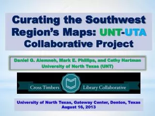
Curating the Southwest Region’s Maps: UNT - UTA Collaborative Project. Daniel G. Alemneh, Mark E. Phillips, and Cathy Hartman University of North Texas (UNT ). Outline Project Background Description of the project Project Aims: Six major areas of activities Project Impact:

E N D
Curating the Southwest Region’s Maps: UNT-UTA Collaborative Project Daniel G. Alemneh, Mark E. Phillips, and Cathy Hartman University of North Texas (UNT)
Outline Project Background • Description of the project Project Aims: • Six major areas of activities Project Impact: • Quality control Lessons Learned: • Summary
Background Project Description: • Mapping the Southwest was a 3-year project (2010 to 2013) funded by a National Endowment for the Humanities (NEH) We the People grant. Project Objective: • The University of North Texas (UNT) Libraries partnered with the University of Texas at Arlington (UTA) Library’s Special Collections to digitize 5,000 historically-significant and mostly rare maps. • The project just completed and the newly curated collection is now available online for free public access through The Portal to Texas History gateway.
Major Work Areas Catalog maps without existing MARC records Prepare the maps for transport Capture and process digital images of the maps Create software to automate import of MARC data to populate the metadata template Create or enhance metadata Assess quality of the digital images, cataloging, and metadata
Work Area 1: Catalog maps without existing MARC records One of the major areas of UTA’s involvement was cataloging maps that lacked prior cataloging records. To facilitate the digitization process, we modified our workflow. • Maps came to UNT for scanning and then were returned to UTA for cataloging. • UTA cataloged maps from all batches retrospectively, in time to complete the metadata descriptions.
Work Area 2: Prepare the maps for transport Another major area of UTA’s involvement was packing the maps for transportation to the UNT digitization lab. In the early phase of the project: • We purchased the needed packaging materials, • The UTA staff trained the UNT team on handling the maps • We created and tested packing procedures Over the duration of the project, we revised packing procedures • We revised the schedule from 15 to 14 trips (saved on costs) • Arranged and packed by size (facilitated scanning workflow)
Work Area 3: Capture and process digital images of the maps UNT employed the Better Light Scan Back System to digitize the majority of the items: • A ruler and a color chart were captured (for 1:1 image comparison) • The Digital Imaging Technician typically set up and recalibrated equipment and lighting several times (for varying dimensions, etc.) Scanning workflows were modified based on experience gained early in the project. To improve overall production speed, we added: • Flatbed scanner, the Epson 10000XL, (for items > 8” x 10”) • ZeutschelOmniscan 10000TT planetary scanner(for extremely delicate items) • A half-time student worker
Capturing Digital Images of the Maps with the Better Light Scan Back System
Work Area 4: Create software to automate import of MARC data to populate the metadata template Delays in hiring cataloging staff at UTA resulted in a change of workflow: • Maps came first to UNT for scanning and then were returned to UTA for cataloging. Since MARC records were not ready for the batch ingest, the project did not need to create software to automate MARC importation to UNT's metadata template.
Work Area 5: Create or enhance metadata We made changes in the work plan: • Since the project lacked MARC records, (instead of auto-MARC import), UNT populated the metadata template with “short records” that provided basic retrieval information. • The UTA metadata team then added additional information to complete the records. All of the 5000+ digitized maps now have complete metadata and are visible to the public with all digital library functionalities. • Despite a late start, we were able caught up most of the hours we fell behind in the project.
The UTA Map Collections in the Portal to Texas History: http://texashistory.unt.edu/explore/collections/UTAM/
Work Area 6: Assess quality of the digital images, cataloging, and metadata The quality control process is systematically reviewed during the digitization process in order to address and correct any problems that show up in a given workflow. • Imaging quality control: • Pixel anomalies caused by vibrations in the camera system • Color profiles in images were not being rendered correctly • Metadata quality assurance • Crosswalks between MARC and the UNTL metadata format, • Other corrections (using post ingest quality assurance tools)
All of the maps digitized for this grant project are available online for free public access • Digital objects displayed on the Portal have already been optimized for indexing by various search engines. • The newly created Mapping the Southwest collection has already been used (more than 115,000 times) by scholars and researchers around the world • We compile usage statistics for digital resources we manage, which can be viewed by any user at any time. • It is interesting to analyze the users behavior, including: • Where they come from (location) • How do they land to our page (searching mechanisms) • What devices they use (including mobile) Project Impact
Building such a large digital map collection requires a well-developed infrastructure and dedicated support from all stakeholders. • Inter-institutional resource sharing • The close working relationship, team spirit, and active engagement by both institutions contributed to a successful completion of the project. • Regular project status meetings helped to communicate and evaluate accomplishments in comparison with planned work to ensure targets were met. • Both teams have remained flexible, accommodated some unforeseen situations, and allowed for changes as needed to improve workflows and complete the project on-time and on-budget. Lessons Learned
The scanning of large-format items presents many challenges. But the UNT-UTA collaborative project was able to meet these challenges and share the rich cartography collections of the region widely. • In addition to showcasing the maps of the region, the partnership provides a mechanism through the collaboration to ensure long-term access and preservation of these valuable resources by sharing the long-term responsibility for the management of these digital maps. • We very much appreciate the funding from NEH that made this work possible and enabled us to make this important collection available to current and future users around the globe. Summary
Project Contacts Principal Investigator: Cathy HartmanCathy.Hartman@unt.edu Co-Principal Investigator: Mark Phillips Mark.Phillips@unt.edu Project Manager: Daniel Alemneh Daniel.Alemneh@unt.edu Project Coordinator at UTA: Ann Hodges Ann.Hodges@uta.edu