Download
1 / 20
200 likes | 322 Views
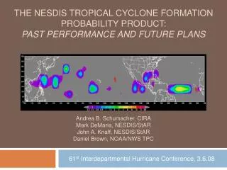
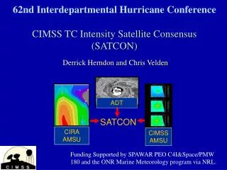
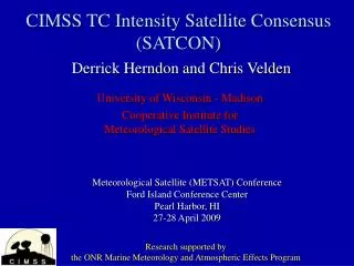
61st Interdepartmental Hurricane Conference CIMSS TC Intensity Satellite Consensus (SATCON). Derrick Herndon and Chris Velden. Funding Supported by SPAWAR PEO C4I&Space/PMW 180 and the ONR Marine Meteorology program via NRL. Motivation.

E N D
61st Interdepartmental Hurricane ConferenceCIMSS TC Intensity Satellite Consensus (SATCON) Derrick Herndon and Chris Velden Funding Supported by SPAWAR PEO C4I&Space/PMW 180 and the ONR Marine Meteorology program via NRL.
Motivation • Remove some of the ambiguity associated with objective intensity estimates • Hurricane Lili 2002 current intensity estimates 5 hours prior to landfall varied from 83 - 125 kts • Hurricane Isabel 2003 intensity estimates varied from 77 -105 kts 17 hours prior to landfall. • Hurricane Charley 2004 rapid intensification • Goal is to assist forecasters in determining current TC intensity by combining the best aspects of individual objective estimates into a single weighted consensus estimate
The Problem: 2006 04W IR image from NRL TC Page IR image from NRL TC Page 09JUL 2100 UTC 09JUL 0030 UTC Estimated intensity at 00Z on 09JUL is 75 kts. System is moving swiftly toward Korea with apparent weakening.
Dvorak = 45 kts CIMSS AMSU = 79 kts ADT = 45 kts CIRA AMSU = 76 kts Which COR to set ? The Problem: 2006 04W IR image from NRL TC Page 09JUL 2100 UTC
How It Works • Each member is weighted based on the members statistical performance in a given situation: • ADT is weighted according to scene type (Eye scenes get the most weight while shear scenes get the least) • CIMSS AMSU is weighted according to instrument resolution (well resolved storms get more weight than poorly resolved storms as determined by IR/ATCF RMW) • CIRA AMSU is weighted according to CLW. Estimates with CLW values < 1.4 mm get more weight.
2005-2006 Stats (Pressure) Values in millibars. Validation is aircraft recon pressure +/- 3 hours from estimate time - bias = method was too weak.
DVK Simple AVG SATCON BIAS -2.4 -3.1 -3.2 AVG ERROR 7.0 6.8 6.3 RMSE 9.9 10.4 9.7 N 128 128 128 2005-2006 Stats (Pressure) Values in millibars. Validation is aircraft recon pressure +/- 3 hours from estimate time - bias = method was too weak. Simple AVG is average of CIMSS AMSU/ADT and CIRA
1999-2006 Stats (Pressure) Values in millibars. Validation is aircraft recon (bouys) pressure +/- 3 hours from estimate time - bias = method was too weak.
1999-2006 Stats (MSW) Values in knots. Validation is best track msw coincident with aircraft recon +/- 3 hours from estimate time. A - bias = method was too weak.
1999-2006 Stats (MSW) MSW validation in knots. MSLP validation in millibars. - bias = method was too weak.
ADT MSLP Error Compared to AMSU Max Tb Anomaly ADT MSLP Error (mb) AMSU Tmax (k)
CIRA MSLP Error vs AMSU 89 Ghz CIRA MSLP Error (mb) AMSU 89 Ghz Average (k) for AMSU-A FOV
Future Work • Re-derive weights for wind component using Best Track winds • Address MW latency • Add error bars for estimate confidence • Continue cross-platform information sharing • Add additional TC intensity methods (SSMI / TRMM ?)
SATCON HOMEPAGE http://cimss.ssec.wisc.edu/tropic/satcon/satcon.html