Download
1 / 28
280 likes | 498 Views
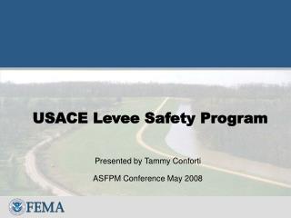
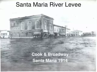
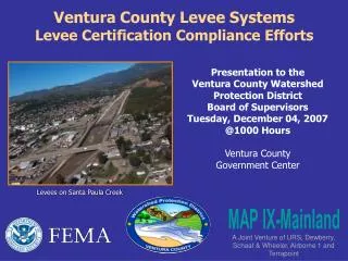
Presentation to the Ventura County Watershed Protection District Board of Supervisors Tuesday, December 04, 2007 @1000 Hours Ventura County Government Center. Ventura County Levee Systems Levee Certification Compliance Efforts. Levees on Santa Paula Creek. MAP IX-Mainland.

E N D
Presentation to the Ventura County Watershed Protection District Board of Supervisors Tuesday, December 04, 2007 @1000 Hours Ventura County Government Center Ventura County Levee SystemsLevee Certification Compliance Efforts Levees on Santa Paula Creek MAP IX-Mainland A Joint Venture of URS, Dewberry, Schaaf & Wheeler, Airborne 1 and Terrapoint
Introductions of District Project Team Present National Flood Insurance Program (NFIP) FEMA Levee Certification Requirements 44 CFR Part 65.10 Federal Regulatory Standards Process Guidance FEMA Procedural Memorandum 34 Process Guidance FEMA Procedural Memorandum 43 Overview of District Levee Certification Efforts Confirmation of FEMA’s Receipt of PAL Agreement Letters on November 28, 2007 District Levee Certification Action Items during the Next 90-120 Days Agenda
A levee IS aman-made structure, usually an earthen embankment, designed and constructed in accordance with sound engineering practices to contain, control or divert the flow of water so as to provide protection from temporary flooding. Levees also include floodwalls. A levee is NOTa dam, a detention basin, or a road or railroad embankment Source: FEMA Publication: “PM 43 – Guidelines for Identifying Provisionally Accredited Levees” What is a Levee ?
Why Update Flood Maps? • Federal Requirements - National Flood Insurance Program: • National Flood Insurance Act of 1968 • Flood Disaster Protection Act of 1973 • Flood Insurance Reform Act of 1994 • Current accurate flood maps are critical to: • Reduce potential loss of life & property through sound floodplain management • Reduce NFIP & disaster costs • Protect natural & beneficial values of floodplains • Accurate and up to date flood maps are vital for the successful implementation of all floodplain management strategies.
Flood Mapping Inventory Ages:Ventura County vs. National Trends
FEMA has long been concerned with levee certifications Initiated Levee Policy Committee to develop recommendations to NFIP before Katrina in 2005 “Accreditation” vs. “Certification” FEMA does not certify levees. Levee owners do. FEMA accredits certified levees on effective DFIRMs. FEMA Levee Certification Requirements
For the purpose of NFIP maps, FEMA will only recognize levee systems thatmeetandcontinue to meetdesign, operational and maintenance criteria of the Code of Federal Regulations, Title 44, Section 65.10(44 CFR 65.10), which was adopted on August 25, 1986 Code of Federal Regulations (44 CFR 65.10) • Certification Criteria broken down into 6 key components: • Operations and Maintenance Plan • Freeboard • Closures • Embankment and foundation stability • Interior Drainage • Other Design Criteria
PM 34issued on August 22, 2005 (before Katrina) Nationwide there are thousands of levee structures with inadequate, missing, or outdated certification documentation PM 34 was issued as part of the larger Map Modernization effort PM 34 Provides flowchart for identifying and mapping levees depending on certification FEMA Procedural Memorandum 34 “Interim Guidance for Studies Including Levees”
FEMA’s bottom line: If a levee is shown on a FIRM map as providing protection from the base flood, then itneedsto be certified. Original FEMA time table required local levee owners to submit certification documentation - 30 days.Unrealistic! Local Communities and levee owners objected strenuously. In response, FEMA issued Procedural Memorandum 43 on September 26, 2006 FEMA PM 34 – Interim Guidance for Studies Including Levees
PM 43 was issued September 25, 2006 and revised March 16, 2007 Those levees that require additional time for owners to compile the certification documentation will be designated by FEMA as “Provisionally Accredited” Two Year PAL Letter FEMA provided the District with a 90 day window to sign and return PAL agreements indicating the full 44 CFR 65.10 documentation will be provided within 24 months of the signed agreement FEMA Procedural Memorandum 43“Guidelines for Identifying Provisionally Accredited Levees (PAL)”
FIRM Levee Note:The following note must be applied at several locations, point to the levee, and be placed landward of the levee in or near the Zone X (shaded) area: WARNING: Provisionally Accredited Levee. For explanation, see the Notes to Users. FIRM Notes to Users: WARNING: This levee, dike, or other structure has been provisionally accredited and mapped as providing protection from the 1-percent-annual-chance flood. To maintain accreditation, the levee owner or community is required to submit documentation necessary to comply with 44 CFR Section 65.10 by (September 01, 2009). Because of the risk of overtopping or failure of the structure, communities should take proper precautions to protect lives and minimize damages n these areas, such as issuing an evacuation plan and encouraging property owners to purchase flood insurance. Notes for PAL Levees Shown on FIRMs
Flood Insurance Mapping Consequences of failure to meet the certification standards of 44 CFR 65.10: If a levee fails to meet the criteria in 44 CFR 65.10, or a levee owner fails to meet the PAL requirements, then the levee and the area landward of it will no longer be eligible for the PAL designation or accreditation. FEMA will remove the PAL designation from the levee, and will remap the area landward of the levee as being a Special Flood Hazard Area (Zone A in most cases). FEMA PM 43 – Guidelines for Identifying Provisionally Accredited Levees (PAL)
Provisionally Accredited Levee (Scenario A) Process Scenario A applies to levees that are not in the US Army Corps of Engineers Rehabilitation and Inspection Program.
FEMA Letter datedAugust 31, 2007 PAL Letters to FEMA Nov. 27, 2007 Certification completion date for Scenario A1 levees is September 01, 2009 PAL Agreement Letter (Scenario A1)
Letters to FEMA Nov. 27, 2007 FEMA Letter datedAugust 31, 2007 PAL Letter to FEMANLT Nov. 29, 2008 Certification completion date for Scenario A2 levees is November 29, 2010. Maintenance Correction Period (Scenario A2)
FEMA Originally Identified 60 Levees and/or Levee-Like Situations Data from FEMA letter dated August 31, 2007
FEMA’s Consultant Issued Revised List (11-08-07)Nine “Blue” Levee Like Situations Removed
Map of Seventeen District Levees: PAL Agreements or Maintenance Correction Period Request to FEMA on 11-27-07
List of Seventeen District Levees: PAL Agreements or Maintenance Correction Period Request to FEMA on 11-27-07
Estimated Fiscal Impacts of Levee Certification Efforts on District’s Budgets by Watershed Zone
Completed Action Items PAL Agreement Letter signatures All PAL letters were signed by District and local reps by 26 November 2007 Maintenance Issue Correction Period Request signatures Maintenance Correction period requests signed by District on 20 November 2007 PAL package preparation & compilation PAL packages were completed by and submitted to FEMA Region IX’s Office in Oakland on 27 November 2007 via FedEX Priority Overnight FEMA Region IX’s Acknowledgement of Receipt of District’s Agreement Packages FEMA acknowledged receipt of District PAL packages forwarded on 28 November 2007 Certification Action Items in Next 90-120 Days RFQ scope preparation and issue Estimated within next 45 calendar days Consultant selection Estimated within next 90 calendar days Board Approval of Professional Services Contract Estimated within next 120 Days District’s Levee Certification Action Items
Contact Information: Gerard Kapuscik Special Projects Manager (805) 648-9284 Gerard.Kapuscik@ventura.org Joseph Lampara, Engineer III Advanced Planning Section Watershed Protection District (805) 654-2458 Joseph.Lampara@ventura.org Questions Calleguas Creek