Climate
Climate. Standard 6b. Standard 6b. 6b: Students know the effects on climate of latitude, elevation, topography, and proximity to large bodies of water and cold or warm ocean currents. . Review.

Climate
E N D
Presentation Transcript
Climate Standard 6b
Standard 6b • 6b: Students know the effects on climate of latitude, elevation, topography, and proximity to large bodies of water and cold or warm ocean currents.
Review • Remember that the amount of sunlight (temperature) and precipitation establishes a specific climate. • For example, hot temperature and lots of rainfall caused a tropical rainforest. • Climate is also affected by other factors…
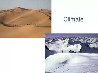
Latitude • This one we know already… • The closer you are to the equator, the warmer the temperature.
Elevation • Elevation: height of a given area relative to the sea level • Ex: Los Angeles is at sea level vs. Mt. Everest which is 29,035 ft above sea level. • Generally, the higher the height, the cooler the temperature.
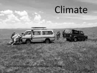
Topography • Topography: the different land features in a given area • In other words, topography refers to the shape of the land. • Mountains? • Valleys? • Flat?
Rainshadow Effect • Mountains act like barriers, changing wind movement. • Rainshadow Effect: Warm, moist air condenses as it flows up a mountain. Condensing causes rainfall in the upward slope and dry air in the downward slope.
Warm, moist air moves toward the mountain On the other side, dry air blows down and warms up As air moves up, it cools off and condenses, causing rainfall. Leeward Windward
Quick Think • How does latitude affect the temperature? • Finish the sentence, the higher you are in elevation, the ________ the temperature. • Death Valley is the lowest point in the US (282 ft below sl). Why do you think it is called “Death Valley”? • If moist wind is flowing from the ocean, which point, A or B, would you expect to find rain?
A B
Oceans • The proximity (closeness) to an ocean or other large body of water causes moderate climate. • Ex: California is near the ocean. Because the ocean is relatively warm all year long, it heats up the coast, causing pleasant temperatures all year long.
Koppen Climate Classification • Because of the many factors that affect climate, there are a total of thirteen different types of climate. • The Koppen Classification system organizes climates mainly based on precipitation and temperature • Letter system used with five major climates
Tropical Climates (A) • Tropical Rainforest (Af) • Tropical Monsoon (Am) • Tropical Savannah (Aw)
Deserts (B) • Dry Desert (Bw) • Steppe Climate (Bs)
Temperate (C) • Mediterranean (Cs) • Humid Subtropical (Cfa) • Marine West Coast (Cfb)
Severe (D) • Humid Continental – Hot Summer (Dfa) • Humid Continental – Mild Summer (Dfb) • Subartic (Dfc, Dfd, Dwc, Dwd)
Polar (E) & Highlands (H) • Polar (E) • Highlands (H)