Download
1 / 75
750 likes | 850 Views
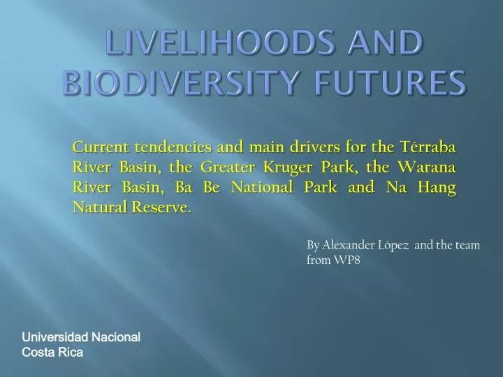
Livelihoods and Biodiversity Futures. Current tendencies and main drivers for the Térraba River Basin, the Greater Kruger Park, the Warana River Basin, Ba Be National Park and Na Hang Natural Reserve. . By Alexander López and the team from WP8. Universidad Nacional Costa Rica.

E N D
Livelihoods and Biodiversity Futures Current tendencies and main drivers for the Térraba River Basin, the Greater Kruger Park, the Warana River Basin, Ba Be National Park and Na Hang Natural Reserve. By Alexander López and the team from WP8 Universidad Nacional Costa Rica
What is an scenario? A scenario is a description of how the future may unfold based on if-then proposition and typically consists of a representation of an initial situation and a description of the key driving forces and changes that lead to a particular future state. Universidad Nacional, Escuela de Relaciones Internacionales
Types of scenarios Business as usual are constructed based on future expectations of continuing present trends Fast development is constructed base on the improvement of current tendencies The crisis scenario is constructed on how condition might expect to deteriorate from the present state Policy scenario refers to the future effects of one given policy on drivers
Thestory line A storyline is a narrative description of a scenario, which highlights its main features and the relationships between the scenarios driving forces and its main features.
Scenario Outline – [Case study] Improved livelihoods Policy Fast development High biodiversity Low biodiversity Crisis Business as usual Reduced livelihoods What are the (cultural-spiritual, socio-economic, and environmental) drivers that influence the relationship between biodiversity conservation and sustainable livelihoods?
Main elements explaining current tendencies • Foreign oriented market economy. • Development of infrastructure. • Environmental change. • Low level of human development.
Main biophysical drivers • Protected areas (terrestrial reserves) • Land change cover (vegetation cover) • Population growth.
Main socio-economic drivers • Infrastructure development. • Unemployment . • Agriculture production. • Tourism and real state development.
Main cultural drivers • External exposure ( handicraft). • Dependency on natural resources. • Syncretism in cultural practices.
Land use and land change • A main concern is the trend of ownership passing to foreign investors through the purchase of lands by developers or international real estate firms looking to build large-scale residential complexes or hotels which constitute an abrupt and extreme change in land-use and demand on natural resources.
Protected areas • A total of 18 protected areas are located within the Grande de Térraba River basin, making up 37.4% of the catchment´s territory . • The International Friendship Park located within the upper and middle sections of the basin, is the largest protected area stretching from the limits of Chirripo National Park (Costa Rica) to the Panamanian border.
Protected areas • The Térraba-Sierpe National Wetlands has a great biological variety that supports the subsistence of surrounding communities. The wetland contains the largest and most significant quantity and variety of mangroves in Costa Rica. • The wetlands are also important to the non-indigenous communities living in and around the park area who depend on raising livestock and the extraction of shellfish species like piangua, (Anadaratuberculosa).
Population growth • Census data from 1973, 1985 and 2000 shows that the Basin has experienced population growth of approximately 50.6% over the past 35 years . • Population density in the year 2000 was around 31.9 inhabitants per square kilometer, a relatively low density when compared to the national average of 87 inhabitants per square kilometer .
Agriculture development: Pineapple Production as a driver • The area has been historically used for agriculture, especially extensive farming with a foreign oriented model, which, over the years, has altered the natural landscape of the zone. • Pineapple is the recent example. PINDECO produced around 65% of the pineapple. Starting in 1990 the company transformed from simple production and began purchasing portions of the export crops from local independent growers.
Agriculture development: Pineapple and oil palm • The pineapple industry in the Brunca Region currently accounts for about 21% of national production, with a total of 10,815 hectares of plantations and has gone from its place as the number one zone for pineapple production to the fourth largest producer in today’s national market. • The introduction of African Oil Palms as cultivars (Elaeis guineensis) has had a positive impact on the area’s economy, absorbing labor that would have otherwise been unoccupied after the disappearance of the large banana and cacao companies
Infrastructure and the Diquís Hydroelectric Project • The Diquís Hydroelectric Plant, PHED, will be the largest dam in Central America, with a reservoir measuring about 6,815 hectares, of which 800 hectares are currently classified as indigenous territories. • Approximately 1,100 people must be relocated to higher ground within the basin in order for the project to go forward • The Diquís Project has budgeted financial compensation for those displaced, but the cultural and social attachment of these inhabitants to their lands remains a significant factor of opposition to the project, with many claiming that their identity would be lost if they were forced to be relocated.
Infrastructure and the Diquís Hydroelectric Project • Consequences for agriculture in the Basin with the construction of the Diquís Hydroelectric Project would be concentrated mainly in modifications of land-use. • Agricultural and livestock production would be most affected by the flooding of certain areas used for permanent and seasonal crops, as well as grazing zones for cattle.
Tourism and real Estate Development(Immovable Property Development, Fixed Capital Development) • The case study area has been greatly impacted by real estate development along the Costeña Ridge. • From January 2007 to September 2008 the amount of construction permits granted has grown 202%, from around 100 per year to over 735 construction projects in a span of approximately 20 months. • This real estate “boom” is indicative of a lack of control and regulation on the part of Osa’s municipal government (Redondo y Villalobos, 2008).
Poverty and unemployment • Socioeconomic indicators for the Brunca Region indicate very low levels of development, due to socioeconomic problems that have impacted the area over the past 25 years, including the closure of the banana company. • The Brunca Region today is the poorest area of Costa Rica, with 40.4% of the population living below the poverty line.
Poverty and unemployment • Wages within the Grande de Térraba Basin are among the lowest in the country, with an average monthly income of around USD $150. The national average for monthly income is USD $554 (MIDEPLAN 2008). • This disparity reflects the quality of employment available within the area of study, where benefits and job stability are volatile or nonexistent.
Cultural-spiritual drivers • Cultural and spiritual value systems are very closely related to the way of life with a community, that is to say forms of subsistence and adaptation to uncertainty and vulnerability. • Value systems are subject to change over time.
Cultural drivers • A first element is exposure that in cultural terms refers to external elements that have a direct impact in the way of life and natural resource base for the subsistence of this population. • The external exposure can be seen in the fact that Costa Rican indigenous communities are quite integrated in national and international markets for livestock production and the service sector, especially those related to tourism.
Cultural drivers • A second element is syncretism can be seen in the belief systems. Thus, Sibü (Translation of God in Boroca language) Cúastram who is a solar deity who can only be seen by the chiefs. • But ,when the question was asked about Who or what create nature…they say God, he is the only one that can make everything. • Autonomous communities with traditional belief systems have found themselves integrating market processes, and a new susceptibility to values based on the accumulation of wealth and consumption
Cultural drivers • A third element is dependency on natural resources which can be seen in the production of handicraft. • Handicraft is one of the principal productive activities in the Boruca community, employing the majority of the working population. • The “overproduction” of craft items also has a negative impact on the environment, contributing to the scarcity of natural resources used in their fabrication, such as dyes extracted from mangrove trees as well as from mollusks native to the littoral zone.
Cultural drivers • The production of Boruca textiles is an economic activity maintained by many artisans who use pigments extracted from plants and trees as well as from shellfish and sea snails in order to create their own home-made dyes. • The traditional cultural practice of extraction of natural pigments and dye-making take place in two areas: gardens or cultivated areas where plants and flowers were extracted within indigenous settlements, and the seashore, outside of settlement areas.
Main elements explaining current tendencies • Poverty and socio economic stagnation mainly in the Vhembe District. • Agriculture development . • Water shortage and water competition. • Health problems related to HIV-Aids.
Biophysical driving forces • Water shortage and water competition. • Land use change • Eco-tourism potential
Socio-economic driving forces • Poverty and unemployment. • HIV-Aids. • Poor local governance.
Cultural driving forces • Role of religion and traditions • Dependency on natural resources • Old ways of life versus new one (tradition vrs modernity)
Land use as biophysical driver • The Luvhuvhu Catchment can be divided into the following four main areas based on land tenure and type of land use practice 1) Agriculture; 2) Forestry; 3) Rural settlements; and 4) the natural reserve
Land use as biophysical driver • The upper catchment is characterized by its large scale commercial farming (e.g., irrigated crops, dry land crops, and rangeland cattle production), and forestry (mostly state-owned plantations in the upper catchment). • Conservation areas (including the Kruger National Park) are found in the lower reaches of the river and the middle and lower reaches of the catchment is so-called communal areas.
Land use as biophysical driver • Intensive irrigation farming is practiced in the upper Luvuvhu River catchment. Thirteen percent (13%) of the catchment are privately owned commercial farms while the majority of plantations, with the exception of a few small ones, are state-owned. • Approximately 2.8% of the catchment area is covered with commercial forestry estates and indigenousforests. • Approximately 35% of the land area in the lower portion of the area falls within the Kruger National Park
Water competition and shortage in the Limpopo river basin • There are two main issues: • The quantity of water which relates to the imbalance between the supply and demand for water which in turn also speaks to the effect of floods and droughts • The water quality which speaks to the inappropriate land uses in the river valleys, the impact of fertilizers and pesticides as well as the high concentrations of pit latrines in certain areas
Water competition and shortage in the Limpopo river basin • The competition dynamics of water resources in the catchment is not solely due to transboundarycompetition between the neighboring countries. • Large-scale commercial farming and small-scale farming, uneven rainfall patterns, agriculture and urban demand, as well as over-utilization and pollution by various sectors are part and parcel of the predicament • Over utilization of water resources and pollution arising from high-density urban settlements, mining and other industrial development are seen to have an impact on the social, economic, political and natural environments downstream.
Tourism • The Kruger National park is one of the largest tourist attractions in South Africa and forms the eastern border of the study area. • Makuya National park is another conservation area where tourists can do game driving and until recently hosted hunting.
Poverty and unemployment as driver • The population of Vhembe is 98.74% black. Given the history of South Africa (Apartheid), 99% of the people living in Vhembe can be classified as Previously Disadvantaged People. • About 813,467 people are classified as poor, which amounts to 65.2% of the total population of Vhembe
Poverty and unemployment as driver • The main sectors that employ people from the Vhembe District are government and agriculture. In addition, mining and tourism are two of the most important economic sectors. • The unemployment rate for Vhembe District stood at 49% in 2006. It rose to this level from 47.7% in 1996. At the provincial level the rate of unemployment rose from 44.4% in 1996 to 45.1% in 2006.
HIV/ Aids • While the situation in the Mutale River valley is not well known, HIV/AIDS is known to severely affect subsistence agriculture, adding significantly to the problems of agriculture and food security. • For subsistence agriculture, production depends very heavily on labour and in poor rural households, AIDS causes severe labour and economic constraints that disrupt agricultural activities and aggravate food insecurity.
Agriculture development of smallholders and large scale commercial farmers • Limpopo is one of the country’s prime agricultural regions recognized for the production of a large variety of products and can be said that is very likely that continue playing an important role for agriculture development in the near future. • Of the total land area in Limpopo of 11 960 600 ha, farmland constitutes about 88.2%, while arable land comprises 14% estimated that there were about 5000 commercial farming units in the Province.
Governance conflicts • One area to see the governance problem is the management of the Makuya park because the government and the community representatives had very different views in terms of management of the park. The main objective of the tribal authorities was (is) to obtain payment of rents. • The aim of the provincial government on the other hand was quite the opposite. To hand responsibility of the Park over to the local communities and with that end the government’s responsibility for rent, wages and other costs associated with running it.
Governance conflicts • Land tenure is a example of governance problems. In thetribal areas, chiefs and headmen are responsible for the allocation of land to individuals as well as the demarcation of land. However, in areas under the jurisdiction of the municipality (such as Thohoyandou), individuals can purchase land and obtain private ownership. • The demise of the Apartheid state and the abolition of the homeland government led to the re-assertion of the autonomy of individual chiefdoms in the Venda region. Renewed emphasis was placed on the independence of each Venda chiefdom. • Today, Venda is still made up of 25 traditional authorities, each constituting a separate Chiefdom.
Cultural-spiritual drivers • The role of beliefs involving natural resources. Fors instance the legend of the python god who lives in the Lake who cares for their crops. • The Phiphidi Waterfalls is also a well known sacred site of the Vhavenda as well as the Big Tree which is the world’s oldest and biggest Baobab tree.
Cultural-spiritual drivers • Dependency on natural resources. Many local chiefs make a point to support older traditions which make provision for the control and monitoring of the use of natural resources, particularly the use of wood for firewood, the use of roots and plants for medicinal purposes. • For instance: • Some tree species may not be brought home • Some trees are planted to protect the homestead • Important trees that may not be cut (fruit trees, trees that attract rain)
Main elements explaining current tendencies • Expansion of market economy. • Increasing conflicts and contestation • Non-inclusive policy • Increasing identity politics.
Biophysical driving forces • Land use changes. • Population density. • Changing rainfall patterns.