Download
1 / 18
200 likes | 381 Views
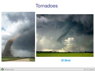
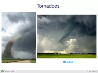
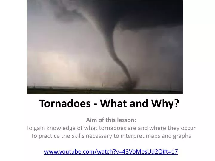
Tornadoes - What and Why?. Aim of this lesson: To gain knowledge of what tornadoes are and where they occur To practice the skills necessary to interpret maps and graphs www.youtube.com/watch?v=43VoMesUd2Q#t=17. Task One.

E N D
Tornadoes - What and Why? Aim of this lesson: To gain knowledge of what tornadoes are and where they occur To practice the skills necessary to interpret maps and graphs www.youtube.com/watch?v=43VoMesUd2Q#t=17
Task One • Watch the following video clip. What conditions are necessary for the formation of a tornado? http://www.youtube.com/watch?v=6qOTPmpfnUI
Task 2 • Cut out the nine images that represent the different stages of tornado development. Glue them into your exercise book in the correct order leaving enough space to write the correct statement from below by the image. • http://news.bbc.co.uk/2/hi/5328524.stm
Task 2 continued… • Match the correct statement with the correct image
Task Three Cut out the following map out from the resource sheet, stick it into your exercise book and then answer these questions: • List 8 countries that have an increased likelihood of experiencing tornadoes • Describe the global distribution of areas with an increased likelihood of experiencing tornadoes
Tornado hits Birmingham, UK! • http://www.bing.com/videos/search?q=birmingham+UK+tornado&FORM=HDRSC3#view=detail&mid=CB3CD28F3F672230EE10CB3CD28F3F672230EE10
Task Four Cut out the following map out from the resource sheet, stick it into your exercise book and then answer these questions: • Describe the link between tornadoes and agricultural areas. • What problems do you think may be caused by the link between tornadoes and agricultural areas.
Task Five Cut out the following graph out from the resource sheet, stick it into your exercise book and then answer these questions, in full sentences: • In which year was there the greatest number of tornado deaths? How many deaths were there that year? • In which year was there the lowest number of tornado deaths? How many deaths were there that year? • Are the number of deaths caused by tornadoes increasing or decreasing? Explain why you think that is.
Tornado threat USA • On to a base map, produce a map that shows the areas of the United States of America where there is a significant risk of death caused by a tornado. You should have three categories of area: High Risk, Medium Risk and Low Risk.
Tornado Alley is a nickname given to the plains region of the U.S. that experiences a high frequency of tornadoes, many of which are violent tornadoes (EF-3 or greater). With the Rocky Mountains to its west, and the warm waters of the Gulf of Mexico to its south, this region is in a ripe location to produce supercell thunderstorms.
Detecting a tornado Today, most developed countries have a network of weather radars, which remains the main method of detecting tornadoes. In the United States and a few other countries, Doppler weather radar stations are used. These devices measure the velocity and radial direction (towards or away from the radar) of the winds in a storm, and so can spot evidence of rotation in storms from more than a hundred miles (160 km) away.