Download
1 / 7
70 likes | 93 Views
We use AirMap as an airspace mapping software that provides us with a nice interactive map of the sky within the flying radius of our UAV that we can use to create checklists, set up geospace, communicate with drone flight enthusiasts. To learn about flying rules and get authorized as a flyer.

E N D
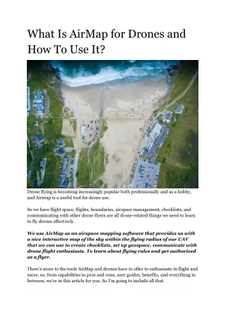
What Is AirMap for Drones and How To Use It? Drone flying is becoming increasingly popular both professionally and as a hobby, and Airmap is a useful tool for drone use. So we have flight space, flights, boundaries, airspace management, checklists, and communicating with other drone flyers are all drone-related things we need to learn to fly drones effectively. We use AirMap as an airspace mapping software that provides us with a nice interactive map of the sky within the flying radius of our UAV that we can use to create checklists, set up geospace, communicate with drone flight enthusiasts. To learn about flying rules and get authorized as a flyer. There's more to the tools AirMap and drones have to offer to enthusiasts in flight and more, so, from capabilities to pros and cons, user guides, benefits, and everything in between, we're in this article for you. So I'm going to include all that.
So without wasting much time let's start now. Please continue reading the article to know more about AirMap. What is AirMap, and How does it work? AirMap is a drone digital software tool that we use to obtain a geographic map of the airspace surrounding our drone device. Using this app, we can easily manage our airspace, as well as get information about other people's geo-locations and we can fly our drone without any hassle. An ever-increasing crowd of drone companies and professionals has greatly supported the AirMap digital software in driving the best airspace management, drone flight safety measures, and enterprise line-of-sight expansion over the past few years. The AirMap Drone application is working wonders for both professional drone travellers and hobbyist users. The way AirMap works for us is by allowing operators to geo-location for UAV flights, plan flights, and request flight approval from LAANC for our safe flights in restricted airspaces. This is why without wasting money on any drone flight planning, flight scheduling, checklist creation, we can increase the productivity of our drones and also ensure that the people around us as well as those flying Drones are not safe. snaptain s5c wifi fpv drone How is AirMap Beneficial? Airmap is incredibly beneficial for many areas when it comes to drone apps and the benefits are immense. Let's take a look at some of the major benefits of Airmap that Airmap brings to us in the modern world. For Operators: When it comes to the public flying drones, with the help of communication with other pilots, restricted airspace, request capabilities for safe flights, and high-quality flying experiences, AirMap offers drone operators all that.
For Enterprises: All enterprises that want to inspect their remote assets, manage geo-location, affordably and easily manage drone fleets, and keep sensitive locations safe can use the AirMap app to its full potential. You should use it and can get very good results from it. For Airports: If we talk about how we can benefit airports with Airmap, then it is really quite simple to go. By minimizing unplanned and untimely UAS flight paths colliding with time-bound aeroplane traffic flying in the sky, airports are very helpful in conducting their transactions safely without any interruptions. For ANS Providers: With its communication of defined rules as well as managing the integration of unmanned and unmanned aircraft systems, AirMap is a very important application for all ANS providers. How to Use AirMap? If we are a good drone operator and have been flying a drone for a long time, then knowing the uses of AirMap to our flying advantage will not be too difficult. There are three main steps to using the AirMap for drones application. Let's take a look at these three steps recommended by trained professionals. Discovery: If we have not used Airmap yet and you want to use it then first of all we have to learn what is airspace and how to get the benefit of airspace in AirMap. At the top of AirMap, there is a search bar where we can add an address or even a landmark to reproduce our point of interest and interact with the map to find information about other airspaces. Planning:
Our next step after airspace is planning is very important. When we know the airspace very well, we take into account all the advisories in our area as well as the airspace restrictions to ensure that there is no disturbance in our flight path. Not there. During this particular phase of planning, we will give our reason for flying, then thoroughly check Airmap recommendations, contact airport operations, rules for flying in the area and perform other similar pre-flight planning activities. We like to have contact requirements specific to our rules, and then take a flight. Here we can adjust the altitude, type of aircraft, area of flight, and all other important elements to ensure that the plan is carried out. Flight: Once we have submitted the pre-flight checklist of our flight and filled all the required elements on it, we can easily safely and safely steer our drone in our desired flight path without any hassle. Can ready to fly. The AirMap app helps us make sure we're flying our drone ethically and that we're not invading other flyers' geo-locations, as well as all of us and our own. Very good at keeping drones safe in the sky. Pros and Cons of AirMap: So, are you looking to get the Airmap to use for your drone flights? So this is going to be a good decision for you. But before we do, make sure we take a look at some of the major pros and cons of Airmap for all Drone Operators. Pros: Airmap drone app is completely free software that we can easily download on our mobile devices and with its help ensure drone flight safety with its complete control in our hands. With its help, we can easily communicate with many other drone pilots as well as get complete information about various drone enthusiasts near our area of interest and with the help of this, we can also create a proper community of drone lovers. Huh.
The device requirements of Airmap software are very simple and the app works smoothly on most modern mobile devices. Whether we are using an iOS device or an Android one, we are good to go. Cons: The only drawback in the Airmap drone app is its interface which is a bit tricky to understand and some of the complex elements present in this app can prove a bit difficult for a novice to understand. Where and How to Download AirMap? Airmap is virtually free for all and since Aipmap is a mobile application, we cannot download Aipmap to our PC anyway. On a mobile device, we can download it by visiting our device's app store. If we use an Android device, we will find it on the first rank by going to the Google Play Store searching the Airmap and clicking on the download button on it, we will easily get it on our phone. If we are using an iPhone device, then we will go to that App Store and from that, we will easily download the app on our phone. The experience is quite smooth and simple. One way we can use Airmap on our pc is that we can download any one mobile emulator on our pc then we can download the Airmap application easily. In this way, we will be able to use the Aipmap application from our PC effectively. Best Apps for Drones Frequently Asked Questions: Is the AirMap app free? Red Wing Regional Airport tells us that each drone operator can log in to www.airmap.com or download the free "Airmap for Drones" app for both devices whether Android or iOS. Registration for the Airmap app is free and upon signing in, Airmap will provide us with: a map of the 5-mile area for the drone operator Red Wing Airport,
Is there an app for spotting drones? A DroneWatcher mobile app easily turns our Android™ smartphone or tablet device into a drone and tiny UAV detector using advanced signal intelligence technology to capture all the information about 95% of drone users about their drone, and Tracks, records and alerts. How does the AirMap app work? The Drone Airmap app displays to us the areas where Class E airspace begins to surface. We have displayed airport location buffers for situational awareness. And we are hereby encouraged to fly in the designated areas. And in some areas, Temporary Flight Restrictions (TFR) are used to temporarily restrict flights How do I use AirMap for Laanc? LAANC authorization using the web app Step 1: Verify that LAANC is available: All facilities of the participating LAANC. Step 2: Choose Mission Type: "FAA Part 107" Step 3: We need to add a flight plan. Step 4: We need to adjust the range of the flight plan area correctly. Step 5: We need to enter the pre-flight checklist details and select "Brief Flight Plan" How do I get FAA authorization for my drone? Day and Night Time Authorization via the FAA Drone Zones for Us: 1 We log in to the FAA Drone Zone. 2 We select "Part 107 Waiver/Create Authority". 3 We select the second option in the pop up titled "Part 107 Exemption/Authorization": Airspace Authorization and start the application. 4 We fill in the required fields:... 5 Hum Operation Parameters ( drone x pro scam )
Conclusion: The AirMap drone app is proving to be quite revolutionary for all types of drone flying enthusiasts, even establishments and corporate entities requiring airspace. The Aipmap app helps us a lot in ensuring a safe and healthy environment for any drone flight as well as a good channel of communication between different types of passengers. Therefore, having AirMap on our mobile devices is essential for our next flight. I hope that you have learned a lot from this article of ours, whatever information you want through this article, you will get it. And you're going to ensure the safety of your flight from now on with Airmap, this amazing airspace-mapping tool. Thanks have a nice day ahead of you. Source link - https://www.dronesnuture.com/2022/01/What-Is-AirMap-for- Drones.html