Download
1 / 16
160 likes | 175 Views
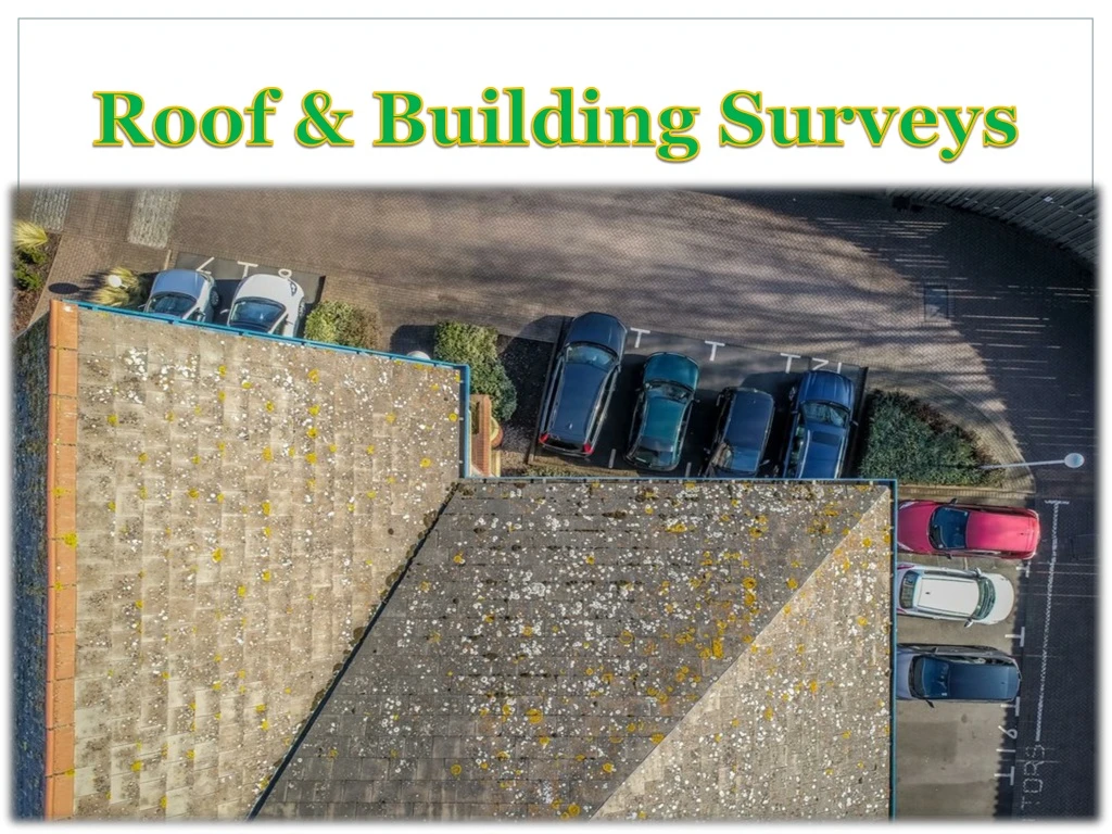
However, traditional inspection methods such as scaffolding erection or hiring elevated platforms can seem to incur more expense and disruption than the benefit that they provide. Luckily, drone roof inspections can provide a faster, cheaper and simpler solution to your roof inspection needs.

E N D
No more ladders, no more climbing, all you need is a drone and our dedicated software for roof surveys! In just minutes with a drone and special software, you can get a highly detailed images, pinpoint elements, measure distances, calculate areas (including dimension walls or roofs), and share your drone data with your team and clients.
Roof inspections can be a crucial measure in saving you money in the long term by spotting potential problems early, whether you are inspecting a property you are planning on purchasing or one that you already own.
However, traditional inspection methods such as scaffolding erection or hiring elevated platforms can seem to incur more expense and disruption than the benefit that they provide. Luckily, drone roof inspections can provide a faster, cheaper and simpler solution to your roof inspection needs.
Our newly-added Photomap function helps us efficiently create aerial photograph-based maps. After we complete an aerial photography mission in the desired area and import the photos into GS Pro, the software will automatically create a composite photo of the area that we can adjust as needed.
For more update , visit us https://dronemotion.io