La Mosquitia
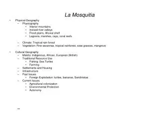
La Mosquitia. Physical Geography Physiography Interior mountains Incised river valleys Flood plains, Alluvial shelf Lagoons, marshes, cays, coral reefs Climate: Tropical rain forest Vegetation: Pine savannas, tropical rainforest, seas grasses, mangrove Cultural Geography

La Mosquitia
E N D
Presentation Transcript
La Mosquitia • Physical Geography • Physiography • Interior mountains • Incised river valleys • Flood plains, Alluvial shelf • Lagoons, marshes, cays, coral reefs • Climate: Tropical rain forest • Vegetation: Pine savannas, tropical rainforest, seas grasses, mangrove • Cultural Geography • Miskito: Indigenous, African, European (British) • Traditional Resource Use • Fishing: Sea Turtles • Farming • Settlements and Housing • Infrastructure • Past Issues • Foreign Exploitation: turtles, bananas, Sandinistas • Current Issues • Agricultural colonization • Environmental Protection • Autonomy
Tica Bus provides wonderful service for long distance travel in Central America. Its routes do not include La Mosquitia, because that region has no paved roads. You can think of La Mosquitia as Honduras’ and Nicaragua’s “Wild, Wild, East”. This sparsely populated region is remote from infrastructure. Therefore it’s remote from other government services. Historically the peoples of La Mosquitia have felt apart from Central America. One reason is this isolation.
The blue area is La Mosquitia. http://www.palmerministry.com/miskitoinfo.htm
The region includes, tropical rainforest (AKA broadleaf evergreen forest), pine forest, lots of swamp or marsh and, in Honduras, wet savanna.
Red lines represent roads. The Honduran part of the region has none. The road shown in the Nicaraguan Mosquitia is open only during the dry season.
This geological map shows what you learned in the reading about the landscapes of Central America. Yellow = recent alluvium. That means the land is comprised of recent, in geological terms, deposits from stream flooding.
Restrooms Wampusirpi International Airport Most travel in the region is by watercraft on the many streams. More rapid transportation is provided by Cessnas that land at airports like this one. See the wet savanna in the background.
Savannas are tropical grasslands where precipitation is insufficient to support forest growth. Think Lion King. In La Mosquitia there is sufficient precipitation for forests, but the hard-packed alluvium prevents forest growth except along streams where erosion has cut through the hard-packed layer to a soil layer in which trees can germinate and take root. Wet savanna
Rain in coastal Miskito settlement Miskito settlements can be found in the different physical environments that they inhabit: coastal estuaries, old beach ridges, along streams.
Mangrove Mangrove environments along coastal estuaries are important fishing grounds for the people of La Mosquitia.
All of the houses in this fishing village are made out of the trunk and fronds of one species of palmetto. The thatch roofs effectively keep water out of the interior. The plastic buckets that line the house are for catching rainwater. Miskito fishing village
From local Wal-Mart Just kidding. Blue tarps are a useful introduced consumer good.
A split bamboo walled home raised above the ground on posts with a suita thatch roof and gallery in Pinales, 1996.
A board wall and zinc roof home in Brus Lagoon, 1996. Note how the house has been built to the same basic plan at the one in the previous slide which was built with only local materials.
Miskito school. See what I mean by remote from government services? This community had no teachers.
Rio Wampu Balsa wood pipante. This is common transport in the region.
Parts of La Mosquitia experienced the banana boom, but it was brief. What’s left behind are canals that the fruit companies dredged for transporting bananas or some old and abandoned railroad grades. Mosquitia canal
These dugout canoes, pipantes, are made out of the trunks of mahogany trees, aspecies to the tropical rainforest regions of La Mosquitia.
The owner of this large pipante earns his living by providing a sort floating general store and post office on the Patuca River. His customers are agricultural migrants who have come from the west to cut down tropical rainforest and establish farms. Are we almost there yet? La Rata’s Gringo Taxi Professor Brady
Mahogany pipante Miskito children grow up on the water. For them, a pipante is like a bicycle.
Pipantes bring all consumer goods (Cokes) into interior settlements in La Mosquitia. Inland port, Mosquitia
This map shows some of what Nietschmann described. Lobster boats ply the waters off the Mosquito Coast. They hire Miskito divers. The lobsters are bound for restaurants in the US.
Lobster diving is one of the few opportunities to earn cash in Miskito settlements, where traditional exchange was a form of bartering.
The men in the cowboy hats are not Miskito. They are Mestizo/Ladino farmers who are moving into western Mosquitia to practice slash and burn agriculture. That truck won’t be able to penetrate very far into La Mosquitia. Miskito ferry
Frontier boom-town in Mosquitia This is a young settlement on the western edge of La Mosquitia where landless campesinos from the west come to buy supplies (cigarettes, gas for chainsaws, beans, salt, rice) before they head into the tropical rainforest looking for a place to farm.
Mestizo pioneer family that had moved into La Mosquitia to homestead.
This slide shows the process of frontier agricultural colonization. First a campesino moves move in to stake his claim. He cuts a patch of rainforest, farms the land, builds a small house. Eventually, he is close to a new road which gives him access to cinder blocks which he uses to build a larger more permanent homestead.This process occurred in the US as we moved westward. Similar to the US case, these campesinos are occupying the ancestral lands and resources of another group, the Miskito. Frontier boom-town in Mosquitia