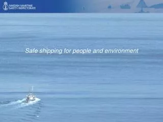
Efficient AIS Data Processing for Environmentally Safe Shipping
Efficient AIS Data Processing for Environmentally Safe Shipping. Marios Vodas 1 , Nikos Pelekis 1 , Yannis Theodoridis 1 , Cyril Ray 2 , Vangelis Karkaletsis 3 , Sergios Petridis 3 , Anastasia Miliou 4

Efficient AIS Data Processing for Environmentally Safe Shipping
E N D
Presentation Transcript
Efficient AIS Data Processing for Environmentally Safe Shipping Marios Vodas1, Nikos Pelekis1, YannisTheodoridis1, Cyril Ray2, Vangelis Karkaletsis3, SergiosPetridis3, Anastasia Miliou4 1 University of Piraeus2 Naval Academy, France3 NCSR “Demokritos”4 Archipelago – Inst. of Marine Conservation
Outline • Part I: Marine Transportation • Part II: Automatic Identification System (AIS) • Part III: Objectives • Part IV: Methodology • Part V: Conclusion
Safety (and Environmental) Issues • Ships, control centers and marine officers have to face many security and safety problems due to: • Staff reduction, cognitive overload, human errors • Traffic increase (ports, maritime routes), dangerous contents • Terrorism, pirates • Technical faults (bad design, equipment breakdowns) • Bad weather • Etc. IRENav (NATO) MarineTraffic.com HELCOME AIS
The Most Prominent Cause of Accidents • About 75-96% of marine casualties are caused, at least in part, by some form of human error * : • 88% of tanker accidents • 79% of towing vessel groundings • 96% of collisions • 75% of fires and explosions • Solution to such issues requires different levels of responses taking into account : • People (activities) • Technology • Environment • Organisational factors *RothblumA.M. (2006) “Human Error and Marine Safety”, U.S. Coast Guard Research & Development Center
Ways to Minimize Accidents • Level of education and practice for mariners • Work safety regulations (behaviour guidelines, normalised onboardequipments) • Navigation and decision support systems providing real-time information, predictions, alerts... • Integrate and use properly multiple and heterogeneous positioning systems : AIS, ARPA, Long Range Identification System (LRIT), Global Maritime Distress and Safety System (GMDSS), synthetic aperture radar, airborne radar, satellite based sensors • Generalisation of vessel traffic monitoring, port control, search and rescue systems, automatic communications
Traffic Monitoring Air-based support Human and semi-automatic monitoring On-demandand on a regular basis Remote Sensing support Semi-automatic monitoring Every 2 to 6 hours Sensor-based support Almost automatic analysis and monitoring Real-time
AIS Device • The Automatic Identification System identifies and locates vessels at distance • It includes an antenna, a transponder, a GPS receiver and additional sensors (e.g., loch and gyrocompass) • It is a broadcast system based on VHF communications • It is able to operate in autonomous and continuous mode • Ships fitted with AIS send navigation data to surrounding receivers (range is about 50 km) • Ships or maritime control centres on shore fitted with AIS receives navigation data sent by surrounding ships →AIS is mandatory (IMO) for big ships and passengers’ boats
AIS Transmission Rate and Accuracy • AIS accuracy is defined as the largest distance the ship can cover between two updates • The AIS broadcasts information with different rates of updates depending on the ship’s current speed and manoeuvre • The IMO assumes that accuracy of embedded GPS is 10m General update rules have been compared to reality: it appears that update rates are lower
AIS Data • The AIS provide location-based information on 2D routes, this defining point-based 3D trajectories • Transmitted data include ship’s position and textual meta-information • Static: ID number (MMSI), IMO code, ship name and type, dimensions • Dynamic: Position (Long, Lat), speed, heading, course over ground (COG), rate of turn (ROT) • Route-based: Destination, danger, estimated time of arrival (ETA) and draught That is, an ordered series of locations (X,Y,T) of a given mobile object O with T indicating the timestamp of the location (X,Y) → Time does not exist in AIS frames : to be add by receivers !AIVDM,1,1,,A,1Bwj:v0P1=1f75REQg>rPwv:0000,0*3B
Big AIS Data Processing for Environmentally Safe Shipping • Objectives, based on Archipelagos Institute of Marine Conservationrequests, was to • Investigate factors which contribute most to the risk of a shipping accident • Identify dangerous areas • How : traffic database processing in order to address some requirements / queries set by Archipelagos towards semi-quantitative risk analysis of shipping traffic → Data coming from AIS → Application to the Aegean Sea
Typical Questions From Domain Experts • Calculate average and minimum distances from shore or between two ships • Calculate the maximum number of ships in the vicinity of another ship • Find whether (and how many times) a ship goes through specified areas (e.g. narrow passages, biodiversity boxes) • Calculate the number of sharp changes in ship’s direction • Find typical routes vs. outliers • etc. etc.
Mediterranean Sea • European Maritime Safety Agency (EMSA) centralizes data from EU states and provides them through a Web service • We worked on a dataset on Mediterraneanseaprovided By IMIS Hellas(a Greek IT company related to IMIS Global, collecting AIS data, mariweb.gr) → Data Volume is 100 million positions per month, that is about 2300 positions per minutes • Focus on Aegean sea : 3 days, 3 million position records (933 distinct ships) • Full dataset is more than 2000 SQL tables for a total of 2 TB covering 2,5 years of vessel activity Two datasets are available at Chorochronos.org interface (IMIS 3 days and AIS Brest)
Populating a Database • Relational database (postgres and postgis) • Data model based on AIS messages : positions, ships and trips • Parsing, Integration, error checking filtering • Reconstructing trajectories from raw data and feeding a trajectory DB • Apply “simple” queries to answer experts needs “What is the (sub)trajectory of a ship during its presence in an area” ?
MOD Engine and Rule-Based Analysis Mixed top-down / bottom-up approach involving an expert monitoring real-time traffic on a touch table • An integrated approach for maritime situation awareness based on an inference engine (drools) • The expert defines his rules according its needs and objectives • The engine executes rules using the AIS database • Hermes is a MOD engine providing extensible DBMS support for trajectory data • Defines trajectory data type • SQL extensions at the logical level • Efficient indexing techniques at the physical level • Includes trajectory clustering support http://infolab.cs.unipi.gr/hermes
Take the Maritime Environment Into Account • The maritime domain is peculiar as there is no underlying network but some maritime rules define predefined paths and anchorage areas (polylines and polygons) that might constrain a given trajectory S-57 ENC (Electronic Nautical Chart) • We added official vector chart and expert-defined areas of interest in the database • Coastlines • Starting, ending, passing, restricted areas, waiting zones • Regulations and dangers (rocs, buoys, seabed) • …
Exploring the Data • Calculating trajectory aggregations and feeding a trajectory data warehouse • Performing OLAP analysis over aggregations (eg. O/D analysis) • Running KDD techniques : frequent pattern analysis, clustering, outlier detection, etc. Association of points coming from the same source-destination set Definition of a route and qualifying of positions at each time Qualifying of a new trajectory compared to the identified route Cloud of locations
Visualizing Trajectories and Patterns → Web-basedvisualisationusingGoogle Maps / Earth applications, Openlayers (OSM) frequent patterns speed behaviour space-time cube: trajectory too far on the right → ← space-time cube: ship is late
Some Open Questions Q1. What kind of storageis appropriate for BIG volumes of vessel traffic data? • Serial vs. parallel/distributed processing (e.g. Hadoop) • (batch vs. streaming) MOD engines? • What about indexing BIG mobility data? Q2. What kind of analysison vessel traffic data makes sense? • Analysis on current (location, speed, heading, …) vs. historical information (trajectories) • Clusters (+ outliers), frequent patterns, next location prediction, etc. • Exploit on previous knowledge to improve real-time analysis Q3. What kind of visualizationis appropriate for vessel traffic data / patterns • Current location vs. trajectory-based visual analytics Trajectory clustering Frequent patternmining
Research Challenges on Data – Just a Few Examples • Trajectory compression / simplification: how to compress / simplify trajectories keeping quality as high as possible? • Semantic trajectory reconstruction: how to extract semantics from raw (GPS-based) trajectory data? • Trajectory sampling: how to find a representative sample among a trajectory dataset? • Generating trajectories by example: how to build large synthetic datasets that simulate the ‘behavior’ of a small real one? • Etc.