Download
1 / 11
110 likes | 231 Views
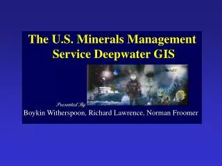
The U.S. Minerals Management Service Deepwater GIS. Presented By. Boykin Witherspoon, Richard Lawrence, Norman Froomer . Where there is no vision, the people perish. King Solomon. U.S. Minerals Management Service. Manages minerals development in US Coastal and Territorial Waters

E N D
The U.S. Minerals Management Service Deepwater GIS Presented By Boykin Witherspoon, Richard Lawrence, Norman Froomer
Where there is no vision, the people perish... King Solomon
U.S. Minerals Management Service • Manages minerals development in US Coastal and Territorial Waters • Documents scientific investigation within US Coastal and Territorial Waters • Generalizes GIS information from raw data collections • Responsible for resources in Arctic, Pacific, Gulf of Mexico, Atlantic
MMS Information Challenges • Collect/generalize deepwater environmental data • Conceptualize coastal and marine data standards • Manage and document offshore development impacts • Leverage/interpret/visualize environmental data
Physical Oceanography Gulf of Mexico Cetaceans Deepwater Shelf Pinnacle Trend Habitat Benthic Habitats Pipelines Dives Sonar Imagery Chemosynthetic Communities Socioeconomic Parameters Bathymetry ESI Species Platforms Wells Transects Transmissometer Drifter Examples of Environmental Data Generated/Employed by MMS
MMS Deepwater Project Goals • Manage Environmental Studies Information • Integrate Environmental Studies Data into Existing Data Structures • Search and Query Environmental Studies Data • Develop Plan Review Applications
MMS Deepwater Project Goals • Manage Environmental Studies Information • Develop a digital standard for studies data • Models studies as hierarchical features • Study Area Extents = Single SDE Layer of “Footprints” that contain and are defined by: • Study Features = Multiple SDE Layers of “Toeprints” defined by: • Attribute tables maintained within the Coastal and Offshore Resource Information System (CORIS) data structure
MMS Deepwater Project Goals • Integrate Environmental Studies Data into Existing Data Structures • Gulf of Mexico: Physical Oceanography Program Final Report • Distribution and Abundance of Cetaceans in the North-Central and Western Gulf of Mexico • Lousiana/Texas Shelf Physical Oceanography Program: Eddy Circulation Study • Mississippi-Alabama Shelf Pinnacle Trend Habitat Mapping Study • Northeastern Gulf of Mexico Coastal and Marine Ecosystem Program: Ecosystem Monitoring, Mississippi/Alabama Shelf CORIS
MMS Deepwater Project Goals • Search and Query Environmental Studies Data • Attribute Query • Spatial Query • Relational Data/SDE Layers • Tabular/Spatial Display
MMS Deepwater Project Goals • Develop Plan Review Applications • Provide a “directed” interface environment • Provide basic GIS tools • Automate assessment process • Provide configuration files • SDE-layer-based processing • Extendable and Scalable
MMS Deepwater Tools: • A first step towards achieving Ocean GIS • Extensible tools for Marine Managers • Data searching capabilities for Managers • Backbone for future development • Incorporates advantages of Open GIS • Can be updated with web-enabled data access capabilities available at ArcGIS 8.1 • Clear development path