Download
1 / 20
200 likes | 385 Views
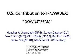
U.S. Contribution to T-NAWDEX: “DOWNSTREAM”. Heather Archambault (NPS), Steven Cavallo (OU), Dan Cziczo (MIT), Chris Davis (NCAR), Pat Harr (NPS), Laura Pan (NCAR), Mark Zondlo (Princeton). T-NAWDEX Workshop Karlsruhe, Germany 20 March 2013. “DOWNSTREAM”.

E N D
U.S. Contribution to T-NAWDEX:“DOWNSTREAM” Heather Archambault (NPS), Steven Cavallo (OU), Dan Cziczo (MIT), Chris Davis (NCAR), Pat Harr (NPS), Laura Pan (NCAR), Mark Zondlo (Princeton) T-NAWDEX Workshop Karlsruhe, Germany 20 March 2013
“DOWNSTREAM” Dynamics and Observations of the Waveguide: North–South Transport and Rossbywave Excitation over Atlantic Midlatitudes
Synergy with T-NAWDEX • Focused over eastern North America and the western North Atlantic • Scientific foci: • Stratospheric–tropospheric exchange • Tropical, midlatitude, and polar forcing of waveguide perturbations • Predictability • Multiscale interactions
“DOWNSTREAM” Science Themes Microscale Clouds, aerosols, trace constituents, radiation, turbulence PV distribution Impacts on medium-range predictability Meso-to-sub-synoptic scale Tropopause polar vortices, transitioning tropical cyclones, warm conveyor belts, diabatic Rossby vortices, predecessor rain events Waveguide forcing Synoptic-to-hemispheric scale Rossby wave amplification, dispersion, breaking along North Atlantic waveguide, tropospheric–stratospheric exchange (water vapor)
1. Science Questions Related to Extratropical Transition • How do sub-synoptic-scale phenomena generate waveguide perturbations? • What is relative contribution of diabatic heating in frontal zones versus tropical cyclone (TC) core? Midlatitude impact region TC–midlatitude interface region Decaying tropical cyclone core region
1. Science Questions Related to Extratropical Transition Grams et al., 2013: QJRMS • Is TC outflow the primary means of perturbing the waveguide? • What is the detailed vertical structure of: • TC outflow? • merger of TC outflow and midlatitude jet?
2. Science Questions Related to Polar Vortices Cavallo and Hakim, 2012: MWR • Formation and extrusion of tropopause polar vortices (TPV) and sensitivities to diabatic (e.g., radiation) variations: • How well are these represented? • How do clouds influence process? • How do these coherent structures evolve as they approach the jet? • What happens to the jet itself? “No radiation” minus “with radiation” In composite numerical simulated vortices, a weaker TPV occurs without radiation
Potential temperature on 2-PVU surface (0000 UTC) (ET of Leslie) 8 Sep 2012 9 Sep 2012 10 Sep 2012 11 Sep 2012
3. Science Questions Related to Predictability NASAOUTFLOW DOWNSTREAM T-NAWDEX 30 30 OC T 31 31 How do multiple sources of waveguide perturbations influence predictability on synoptic to hemispheric scales? 01 01 02 02 03 03 NOV 04 04 05 05 X 06 06 Flooding rain 07 07 08 08 09 09 0° 120°E 60°W 180° 120°W -2.5 -2.0 -1.5 -1.0 +1.0 +1.5 +2.0 +2.5 250-hPa v’
4. Science Questions Related to UTLS Transport of Water and Other Constituents • How are water vapor and other constituents transported into the lower stratosphere in outflow (WCB) regions associated with extratropical and tropical cyclones? • What are the source regions? Figure 1 from Pan et al., 2008: BAMS (adapted from Stohl et al. 2003 : (BAMS)
5. Science Questions Related to Cirrus Clouds • What drives the spatial variability of ice, H2O, T, and w on scales of 0.2–20 km? • How do water and temperature define the spatial distribution of relative humidity? • How can tracer correlations be used to understand larger-scale dynamics?
5. Science Questions Related to Cirrus Clouds • What are the mechanisms yielding ice supersaturated regions for cirrus formation? • How does cirrus formation differ as aerosol characteristics change? • How do cirrus clouds affect the overall budget of water vapor in the upper troposphere/lower stratosphere region?
A Candidate DOWNSTREAM Case G-V Flight Range 6 9 Cirrus shield extends far downstream of TC Potential temperature on dynamic tropopause IR satellite Extratropical transition of TC Leslie 0000 UTC 10 Sep 2012
A Candidate DOWNSTREAM Case TC Outflow Layer Potential temperature on dynamic tropopause Extratropical transition of TC Leslie 0000 UTC 10 Sep 2012
Instrumentation and Uses • W-band cloud radar (Doppler) • Ka Band radar(?) • VCSEL – water vapor • Microwave Temperature Profiler (MTP) • Dropsondes • CVI (Counterflow Virtual Impactor) • Fast Ozone • CO • Various trace species GV Cloud Radar: 15°–20° scan MTP? HCR?
PV Estimation from MTP Data • If variation in ‘x’ is slow compared to variation in ‘y’: • MTP can obtain gradients of potential temperature within “curtain” along flight track • Cloud radar can obtain velocities below aircraft • PV estimates with a resolution of <10 km horizontal, roughly 200 m vertical Jet Stream z y x Approximate form, if slowly varying along the jet relative to across jet
NRC (Canadian) Convair-580 • The National Research Council (NRC) of Canada operates a twin-turboprop Convair-580 research aircraft. • Operation is on a full cost-recovery basis, so full funding is required even for government-backed projects. Service ceiling: 7200 m (23,500 ft) Cruising speed at altitude: ~215 kt Range Out-and-back: 1000 km One-way: 2000 km Aircrew: 2 people Research crew: ~12 people Home page: www.nawx.nrc.gc.ca • The Convair-580 is used heavily for microphysical measurements, particularly for projects related aircraft icing and air quality • Can carry a range of remote sensing equipment: W- and X-band radars (up, down, side views) and a G-band water vapour radiometer
NRC (Canadian) Convair-580 • The Convair-580 flew into hurricanes Michael (2000), Karen (2000) and Isabel (2003) during extratropical transition (ET). • The Isabel mission was the first to sample an ET with flight level sensors and dropsondes over land. (Above) Equipment installed during flight into Hurricane Michael (2000). (Right) Storm track and near-surface winds from dropsondes, and radar cross-section wind dropsonde winds. All panels from adapted from Abraham et al. (BAMS, 2004).
NRC (Canadian) Convair-580 • The Convair-580 could be booked for a 2-month period (i.e. Sept-Oct 2016), but deployed only when a feature of interest is predicted. • If based in St. John's, Newfoundland, the Convair could be ready for operation (i.e. ferried from Ottawa) with 3-days notice: may be more consistent with more predictable features. • All previous flights into storms undergoing ET have been round-trip • To extend coverage to 40oN, 40oW (or slightly further south) the Convair could land to refuel in the Azores; however, crew rest requirements probably mean an overnight before the return flight Azores Range rings for Convair-580 based in St. John's, Newfoundland. Red ring is for a round-trip flight, magenta ring is for a one-way flight. 40oW
Summary • DOWNSTREAM: Sept-Oct. 2016 • Eastern U.S., Canada and Northwest Atlantic • Dynamics-driven study of origin of waveguide perturbations • Transport and small-scale cloud processes • Effects on PV distribution • Predictability associated with mesoscale features • NSF-NCAR GV aircraft: unique collaborative opportunity with two G-Vs.