Download
1 / 7
0 likes | 3 Views
Discover why precise land and drone surveys are essential before starting any infrastructure project. Dolphin Engineers in Jaipur offers cutting-edge survey solutions for roads, mines, and industrial sites. Boost project accuracy and reduce costs with certified experts.<br>

E N D
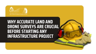
WHY ACCURATE LAND AND DRONE SURVEYS ARE CRUCIAL BEFORE STARTING ANY INFRASTRUCTURE PROJECT
BUILDING STARTS WITH THE GROUND — LITERALLY Every successful infrastructure project starts from the ground up — and the foundation of that process is accurate land surveying. Whether it’s a road, a mine, a dam, or an industrial site, proper survey data prevents design flaws, cost overruns, and legal complications. Here at Dolphin Engineers, our team of Jaipur land surveyors utilizes cutting-edge technology such as drones and GPS- based systems to provide accurate, real-time ground data to provide a firm foundation for each project.
HOW DRONE SURVEYS ARE CHANGING THE GAME Old-fashioned surveys may be slow and restrictive in difficult terrain. Enter Drone Surveys in Jaipur: Quicker and more secure data capture Aerial mapping with high-resolution 3D topographic modeling Real-time site progress monitoring for big sites From mineral site mapping to road construction, drones provide project managers with a bird's-eye perspective they can really build on.
ROAD CONSTRUCTION: WHY SURVEY ACCURACY MATTERS Accuracy matters in road construction surveys, where every centimeter makes a difference. Slope, elevation, or alignment errors can cost significant rework. Dolphin Engineers offers: Contour mapping and longitudinal section surveys Pavement condition and route alignment studies Post-construction monitoring with drones Our seasoned surveyors ensure roads are built to last — with safety, cost, and time efficiency aligned.
MINES SURVEY: CHARTING WHAT'S UNDERGROUND In mining, it is essential to understand underground layers. Our Mines Survey services in Jaipur offer: Overburden and mineral volume calculations Pit design validation and safety layout analysis Drone-based monitoring for remote or hazardous areas We assist mining operations in making better, safer decisions — while maximizing resource extraction.
WHY TRUST DOLPHIN ENGINEERS? With years of experience and a multidisciplinary team, Dolphin Engineers combines: Certified land & mines surveyors Drone pilots with DGCA-compliant technology GIS & CAD integration for detailed reporting Strong on-ground execution for Rajasthan's varied terrain
FINAL THOUGHTS: EVERY GREAT PROJECT BEGINS WITH GREAT DATA Prior to the laying of the first stone, precise surveys decide the way ahead. At Dolphin Engineers, we don't merely survey land — we survey certainty. If you're embarking on a new project in Rajasthan, allow us to assist you in starting it right. CONTACT US: +91-9680026609 www.dolphinengineers.com B-3, C-49, VIDYA APARTMENTS, PARAS MARG, BAPU NAGAR JAIPUR, RAJASTHAN-302020