Download
1 / 21
210 likes | 219 Views
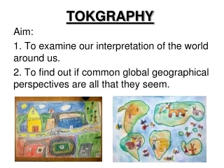
TOKGRAPHY. Aim: 1. To examine our interpretation of the world around us. 2. To find out if common global geographical perspectives are all that they seem. Perceptions ……. How does our perception shape our supposed knowledge of place and spatial awareness? Get ready for some examples….

E N D
TOKGRAPHY Aim: 1. To examine our interpretation of the world around us. 2. To find out if common global geographical perspectives are all that they seem.
Perceptions …….. • How does our perception shape our supposed knowledge of place and spatial awareness? • Get ready for some examples….
One of London’s many disgruntled tube users, Luke Lewis, took to Twitter to post his take on a ‘more honest’ underground map explaining what Londoners can expect from each station.
You and your partner have 15 minutes to draw a map of the world and place the following items on your map… • 5 Political Items (Cities, Countries, etc.) • 5 Geographic Features (Mountains, Rivers, Oceans) • 5 Inventions • 5 Cultural Items (Art, Music, Religion) • 5 Historical Items (People, Events, etc.) • 5 Arrows Showing Movement across Space (such as the Mongols invading Europe or Smallpox coming to the Americas)
The Peters Projection Map from Two Perspectives In 1974, as an effort to reduce the political bias of conventional maps, Arno Peters created the 'Peters Projection' of the world so that one square inch anywhere on the map represents an equal number of square miles of the earth's surface.